 |
On-line Digital Images |
SC 843047 |
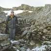
Mr Matthew Ritchie in the stone-walled hut (possible mess hut) at the OS Colby Camp on Ben Lawers. View from S. |
11/2001 |
Item Level |
 |
On-line Digital Images |
SC 843049 |
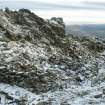
Stone-walled hut (possible mess hut) at OS Colby Camp on Ben Lawers. View from NW. |
11/2001 |
Item Level |
 |
On-line Digital Images |
SC 843052 |
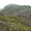
Alan Leith (RCAHMS) and Gavin MacGregor (GUARD) surveying the OS Colby Camp on Ben Lawers, September 2003. |
9/2003 |
Item Level |
 |
On-line Digital Images |
SC 843084 |
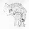
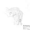
Plan (pencil on film) of the Ordnance Survey Colby Camp near the summit of Ben Lawers. |
9/2003 |
Item Level |
 |
On-line Digital Images |
SC 887146 |
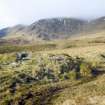
View from E of large shieling-hut (BL00 65) with smaller hut (BL00 66, possibly a dairy) behind. |
2001 |
Item Level |
 |
On-line Digital Images |
SC 887149 |
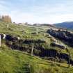
S farmstead. Early building platforms (BL00 2009-10) N of byre dwelling (BL00 105). View from WSW. |
2001 |
Item Level |
 |
On-line Digital Images |
SC 887155 |
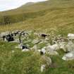
View of shieling-hut (BL00 98) from E. |
5/2003 |
Item Level |
 |
On-line Digital Images |
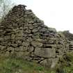
SC 923672 |
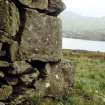
Detail of S corner of building (BL00 733) within township, showing cupmarks on quoin. View from W. |
c. 2001 |
Item Level |
 |
On-line Digital Images |
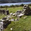
SC 923673 |
SW gable of building (BL00 733) within township. There are cupmarks on the two lower quoins in the S corner (in foreground). |
c. 2001 |
Item Level |
 |
On-line Digital Images |
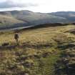
SC 926220 |
S farmstead. N end of barn (BL00 104) showing remains of loft doorway. View from N. |
6/2003 |
Item Level |
 |
On-line Digital Images |
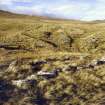
SC 926222 |
Mr Matthew Ritchie at a peat stand (BL00 1801) adjacent to a trackway NE of Meal Odhar. View from N. |
15/11/2001 |
Item Level |
 |
On-line Digital Images |
SC 926223 |
Peat stand (BL00 1620) NE of Meall Odhar. View from SE, with further stands (BL00 1614-1616 &c) in background. |
15/11/2001 |
Item Level |
 |
On-line Digital Images |
SC 926229 |
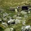
Interior of hut (BL00 98) showing (in foreground) edge-set backstone of hearth beside doorway and (in background) aumbry in NW wall. View from SE. |
5/2003 |
Item Level |
 |
On-line Digital Images |
SC 926230 |
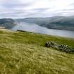
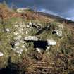
General view of stone hut BL00 1293 and turf huts BL00 1297-99. View from W. |
2001 |
Item Level |
 |
On-line Digital Images |
SC 926231 |
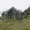
View of corn-drying kiln (BL00 23) from SW. |
10/2001 |
Item Level |
 |
On-line Digital Images |
SC 926232 |
Ruined byre dwelling (BL00 738), showing fragment of possible laird's house incorporated into the NE gable. View from NNE. |
4/2002 |
Item Level |
 |
On-line Digital Images |
SC 1330263 |
RCAHMS survey drawing; plan of the Colby Camp on Ben Lawers. |
9/2003 |
Item Level |
 |
On-line Digital Images |
SC 1330264 |
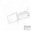
RCAHMS survey drawing; plan of the farmstead at Wester Kiltyrie. |
30/8/2004 |
Item Level |
 |
On-line Digital Images |
SC 2114740 |
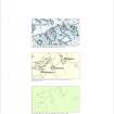
Illustration comparing the depiction of the farmsteads at Margdow, Margnaha and Margcraggan on John Farquharson's survey of North Lochtayside (1760), Plan 7, and the Ordnance Survey 6-inch map Perthshire 1867 Sheet LXXXI with the remains as surveyed by RCAHMS in 2000 |
2008 |
Item Level |
 |
On-line Digital Images |
SC 2173508 |
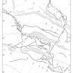
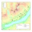
Ben Lawers: Peat-stack stances and trackways north-east of Meall Odhar |
2003 |
Item Level |
 |
On-line Digital Images |
SC 2173630 |
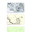
Distribution of cup-markings and cup-and-ring markings: RCAHMS Ben Lawers survey area |
2003 |
Item Level |
 |
On-line Digital Images |
SC 2171465 |
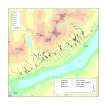
Tombreck - Illustration comparing the buildings surveyed as part of the RCAHMS field survey of Ben Lawers with those shown on the John Farquharson Survey of North Lochtayside, 1769, Plan 9 and the Ordnance Survey 6-inch map Perthshire 1867, Sheet LXXXI. |
2010 |
Item Level |
 |
On-line Digital Images |
SC 2173628 |
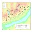
Distribution of peat-stack stances with trackways and head dykes: RCAHMS Ben Lawers survey area |
2003 |
Item Level |
 |
On-line Digital Images |
SC 2173634 |
Distribution of turf and stone walled huts, 1772 hill grazing boundaries and head dykes: RCAHMS Ben Lawers survey area |
2003 |
Item Level |


