|
All Other |
DC 62473 |
Rynachulig carved stone; pencil survey drawing showing carved stone inscribed with 'Lord of Braddl' |
9/2002 |
Item Level |
|
Digital Files (Non-image) |
TM 000544 |
Zip file containing all Field Survey linework collected during the RCAHMS archaeological field survey of Ben Lawers 2000 |
2017 |
Item Level |
|
Digital Files (Non-image) |
GV 008347 |
Ink drawing of Margdow farmstead |
2008 |
Item Level |
|
Digital Files (Non-image) |
DX 001452 |
RCAHMS Field Survey - structures database (Ben Lawers survey) |
2009 |
Item Level |
|
Digital Files (Non-image) |
DX 001458 |
Database containing details of cup marked rocks in the Ben Lawers Survey area. |
2009 |
Item Level |
|
Digital Files (Non-image) |
DX 001457 |
Database of farmsteads and some individual buildings identified on Survey of Lochtayside maps (John Farquharson, 1769), early Ordnance Survey maps and during RCAHMS Ben Lawers fieldwork. |
2009 |
Item Level |
|
Digital Files (Non-image) |
GV 008585 |
Ben Lawers: Hill grazings in 1772 and distribution of sheiling-huts. |
2003 |
Item Level |
|
Digital Files (Non-image) |
GV 008589 |
Distribution of cup-markings and cup-and-ring markings: RCAHMS Ben Lawers survey area |
2003 |
Item Level |
|
Digital Files (Non-image) |
GV 008537 |
Publication plan of Wester Kiltyrie farmstead |
2010 |
Item Level |
|
Digital Files (Non-image) |
GV 008591 |
Ben Lawers, North Lochtayside - DXF file containing Farquharson 1772 farm boundaries and head dykes and OS 1st edition improved ground and forested areas |
2003 |
Item Level |
|
Digital Files (Non-image) |
GV 008587 |
Ben Lawers: Peat-stack stances and trackways north-east of Meall Odhar |
2003 |
Item Level |
|
Digital Files (Non-image) |
GV 008588 |
Distribution of peat-stack stances with trackways and head dykes: RCAHMS Ben Lawers survey area |
2003 |
Item Level |
|
Digital Files (Non-image) |
GV 008590 |
Distribution of turf and stone walled huts, 1772 hill grazing boundaries and head dykes: RCAHMS Ben Lawers survey area |
2003 |
Item Level |
|
Digital Files (Non-image) |
GV 008586 |
Ben Lawers: Distribution of Peat-stack stances and trackways |
2003 |
Item Level |
|
Digital Files (Non-image) |
TM 002342 |
Zip file containing all Field Survey linework collected during the RCAHMS archaeological field survey of Ben Lawers 2000, Geojson and shapefile formats |
2000 |
Item Level |
 |
On-line Digital Images |
SC 696120 |
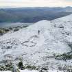
General view of OS Colby Camp on Ben Lawers. View from N. |
11/2001 |
Item Level |
 |
On-line Digital Images |
SC 774905 |
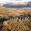
Peat stand (BL00 1787) W of Allt a' Choire Chireinich. View from NW. |
15/11/2001 |
Item Level |
 |
On-line Digital Images |
SC 774907 |
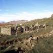
S farmstead. View of barn (BL00 104) from SE. |
2001 |
Item Level |
 |
On-line Digital Images |
SC 774921 |
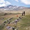
RCAHMS surveyors at a peat stand (BL00 239) beside a trackway on the W shoulder of Meall Odhar. View from SE. |
2000 |
Item Level |
 |
On-line Digital Images |
SC 774926 |
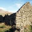
N farmstead. View of barn (BL00 101) from S. |
2001 |
Item Level |
 |
On-line Digital Images |
SC 774929 |
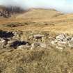
General view of shieling-hut (BL00 33) from SE. |
15/11/2001 |
Item Level |
 |
On-line Digital Images |
SC 843022 |
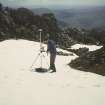
Mr Rob Shaw with GPS survey equipment at the Ordnance survey Colby Camp , Ben Lawers summit. |
22/6/2000 |
Item Level |
 |
On-line Digital Images |
SC 843037 |
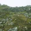
The windbreak at the W end of the OS Colby Camp on Ben Lawers. View from E. |
9/2003 |
Item Level |
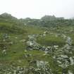 |
On-line Digital Images |
SC 843045 |
Enclosure and possible tent pitch at OS Colby Camp on Ben Lawers,with windbreak in the background. View from E. |
9/2003 |
Item Level |


