Accessibility

Font Size

100% 150% 200%

Background Colour

Default Contrast
Close Reset

Pricing Change

New pricing for orders of material from this site will come into place shortly. Charges for supply of digital images, digitisation on demand, prints and licensing will be altered. 


Upcoming Maintenance

Please be advised that this website will undergo scheduled maintenance on the following dates:

Thursday, 9 January: 11:00 AM - 3:00 PM

Thursday, 23 January: 11:00 AM - 3:00 PM

Thursday, 30 January: 11:00 AM - 3:00 PM

During these times, some functionality such as image purchasing may be temporarily unavailable. We apologise for any inconvenience this may cause.


Drawings

551 1/4/3/4/1

Description Drawings

Collection Records of the Royal Commission on the Ancient and Historical Monuments of Scotland (RCAHMS), Edinbu

Catalogue Number 551 1/4/3/4/1

Category All Other

Permalink http://canmore.org.uk/collection/2249885

Collection Hierarchy - Sub-Group Level

Preview Category Catalogue Number Title Date Level
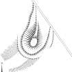
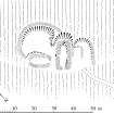
Photographs and Off-line Digital Images E 10304 Publication drawing; Plan of Downey Hill farmstead. 1996 Item Level
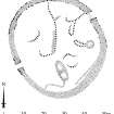
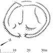
Photographs and Off-line Digital Images E 10306 Publication drawing; Plan of the Girdlestanes stone circle, indicating edge of river bank. 19/10/1995 Item Level
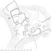
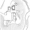
Photographs and Off-line Digital Images E 10303 Plan of Tanlawhill tower-house, buildings and enclosures, redrawn for publication from DC 32428. 1996 Item Level
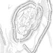
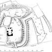
Photographs and Off-line Digital Images E 10305 Publication drawing; Plan of fort and other structures on Camp Hill, Bailiehill. 1996 Item Level
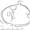
Photographs and Off-line Digital Images E 10307 Publication drawing; Plan of the Loupin' Stanes stone circle. 1996 Item Level
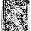
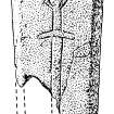
Photographs and Off-line Digital Images E 10444/1 Photographic copy of tracing of cross-shaft. 22/5/1991 Item Level
Photographs and Off-line Digital Images E 10444/2 Photographic copy of rubbing of carved stone. 28/9/1990 Item Level
Prints and Drawings DC 44711 Plan 1990 Item Level
On-line Digital Images On-line Digital Images DP 053135 Publication drawing; Plan of Urchin Knowe buildings and field-system. Photographic copy. 14/8/1996 Item Level
On-line Digital Images On-line Digital Images DP 051908 Survey drawing; Plan of Gillesbie Cottages enclosure, indicating vegetation. Photographic copy. 18/10/1991 Item Level
On-line Digital Images On-line Digital Images DP 077624 Publication illustration; Plan of Burnswark Roman fortlet. 28/8/1996 Item Level
On-line Digital Images On-line Digital Images SC 1243796 Publication drawing; Craigieburn fort and settlement. 13/12/1995 Item Level
On-line Digital Images On-line Digital Images SC 381981 Plan of Castle O'er fort and adjacent lengths of linear earthwork, redrawn for publication from DC 32458. 8/9/1995 Item Level
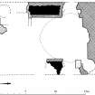
On-line Digital Images On-line Digital Images SC 382032 Publication drawing; First floor plan of Torthorwald tower (indicating phases of construction). 1996 Item Level
On-line Digital Images On-line Digital Images SC 381965 Publication drawing; Plan of Stanshiel Rig (A) settlement. 1996 Item Level
On-line Digital Images On-line Digital Images SC 382760 Publication drawing; Details of Wamphray incised cross. Item Level
On-line Digital Images On-line Digital Images SC 381997 Publication drawing; Plan of (S end of) Neolithic bank barrow at Tom's Knowe (Raeburnfoot). 1996 Item Level
On-line Digital Images On-line Digital Images SC 381977 Publication drawing; Plan of Mollin scooped settlement and building. 4/1994 Item Level
On-line Digital Images On-line Digital Images SC 382042 Publication drawing; Plan of Tanlawhill tower-house, buildings and enclosures. 6/8/1996 Item Level
On-line Digital Images On-line Digital Images SC 381975 Publication drawing; Plan of Stidriggs settlement. 1996 Item Level
On-line Digital Images On-line Digital Images SC 382028 Publication drawing; Plan of Torthorwald motte and tower-house: publication drawing for Inventory of Eastern Dumfriesshire. 1996 Item Level
On-line Digital Images On-line Digital Images SC 382756 Publication drawing; Detail of Wauchope 5 incised cross. 1996 Item Level
On-line Digital Images On-line Digital Images SC 381987 Publication drawing; Plan of Downey Hill farmstead. 1996 Item Level
On-line Digital Images On-line Digital Images SC 382038 Publication drawing; Plan of Wamphray Place motte and earthworks. Item Level

People and Organisations

Events