 |
On-line Digital Images |
SC 2212918 |
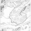
Publication drawing; distribution map of arable land c.1750, South-east Perth |
1993 |
Item Level |
 |
On-line Digital Images |
SC 2213623 |
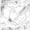
Publication drawing; map showing study area, South-east Perth. |
1993 |
Item Level |
 |
On-line Digital Images |
SC 2213624 |
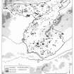
Publication drawing; distribution map of recorded archaeological monuments, South-east Perth |
1993 |
Item Level |
 |
On-line Digital Images |
SC 2213625 |
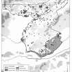
Publication drawing; distribution map of cropmarkings and selected soil-types, South-east Perth |
1993 |
Item Level |
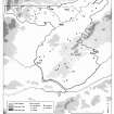 |
On-line Digital Images |
SC 2213626 |
Publication drawing; distribution map of barrows and cairns, South-east Perth |
1993 |
Item Level |
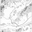 |
On-line Digital Images |
SC 2213632 |
Publication drawing; distribution map of cist- and urn-burials, South-east Perth |
1993 |
Item Level |
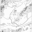 |
On-line Digital Images |
SC 2213633 |
Publication drawing; distribution map of ritual and ceremonial monuments, South-east Perth |
1993 |
Item Level |
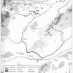 |
On-line Digital Images |
SC 2213634 |
Publication drawing; distribution map of ritual and ceremonial enclosures, and pit-defined features, South-east Perth |
1993 |
Item Level |
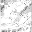 |
On-line Digital Images |
SC 2213638 |
Publication drawing; distribution map of standing stones and stone circles, South-east Perth |
1993 |
Item Level |
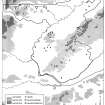 |
On-line Digital Images |
SC 2213640 |
Publication drawing; distribution map of cup-and-ring-marked stones, South-east Perth |
1993 |
Item Level |
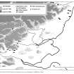 |
On-line Digital Images |
SC 2213641 |
Publication drawing; distribution map of Neolithic funerary monuments in eastern Scotland |
1993 |
Item Level |
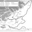 |
On-line Digital Images |
SC 2213642 |
Publication drawing; distribution map of henges, ring-cairns, pit-circles and recumbent stone circles in eastern Scotland |
1993 |
Item Level |
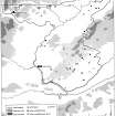 |
On-line Digital Images |
SC 2213737 |
Publication drawing; distribution map of fortified and domestic architecture dating from before 1700 |
22/3/1993 |
Item Level |
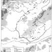 |
On-line Digital Images |
SC 2240099 |
Publication drawing; distribution map of souterrains and interrupted ring-ditches. |
28/10/1992 |
Item Level |
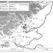 |
On-line Digital Images |
SC 2213578 |
Publication drawing; distribution map of stone settings in eastern Scotland |
1993 |
Item Level |
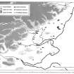 |
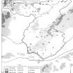
On-line Digital Images |
SC 2213644 |
Publication drawing; distribution map of cursus monuments, rectilinear enclosures (possible mortuary enclosures) and pit-defined enclosures in eastern Scotland. |
c. 1993 |
Item Level |
 |
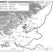
On-line Digital Images |
SC 2213645 |
Publication drawing; distribution map of stone tools, South-east Perth |
9/11/1992 |
Item Level |
 |
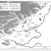
On-line Digital Images |
SC 2213673 |
Publication drawing; distribution map of stone settings in eastern Scotland |
1993 |
Item Level |
 |
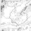
On-line Digital Images |
SC 2213679 |
Publication drawing; distribution map of cursus monuments, rectilinear enclosures (possible mortuary enclosures) and pit-defined enclosures in eastern Scotland. |
c. 1993 |
Item Level |
 |
On-line Digital Images |
SC 2213680 |
Publication drawing; distribution map of stone tools, South-east Perth |
9/11/1992 |
Item Level |
 |
On-line Digital Images |
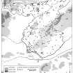
SC 2213681 |
Publication drawing; distribution map of early prehistoric funerary and ceremonial monuments, and stone and bronze tools, South-east Perth |
29/10/1992 |
Item Level |
 |
On-line Digital Images |
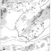
SC 2213682 |
Publication drawing; distribution map of unenclosed settlements, South-east Perth |
1992 |
Item Level |
 |
On-line Digital Images |
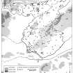
SC 2213646 |
Publication drawing; distribution map of early prehistoric funerary and ceremonial monuments, and stone and bronze tools, South-east Perth |
29/10/1992 |
Item Level |
 |
On-line Digital Images |
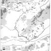
SC 2213647 |
Publication drawing; distribution map of unenclosed settlements, South-east Perth |
1992 |
Item Level |


