Accessibility

Font Size

100% 150% 200%

Background Colour

Default Contrast
Close Reset

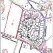
Graphics from archaeological evaluation, Grantown Road, R2, Forres

551 5/16/21/1/3

Description Graphics from archaeological evaluation, Grantown Road, R2, Forres

Date c. 8/2007 to 6/2008

Collection Records of AOC Archaeology Group, archaeologists, Loanhead, Midlothian, Scotland

Catalogue Number 551 5/16/21/1/3

Category All Other

Accession Number 2017/90

External Reference AOC 20713

Permalink http://canmore.org.uk/collection/2157096

Collection Hierarchy - Batch Level

Preview Category Catalogue Number Title Date Level
Digital Files (Non-image) GV 008435 Vector graphic written scheme of investigation figure 1: 'Location of proposed evaluation trenches', Archaeological evalution, Grantown Road, R2, Forres c. 9/2007 Item Level
Digital Files (Non-image) GV 008437 Vector graphic data structure report figure 1: 'Site location', Archaeological evaluation, Grantown Road, R2, Forres c. 10/2007 Item Level
Digital Files (Non-image) GV 008438 Vector graphic data structure report figure 2: 'Location of evaluation trenches', Archaeological evaluation, Grantown Road, R2, Forres c. 6/2008 Item Level
Digital Files (Non-image) GV 008439 Vector graphic data structure report figure 3-7: Plan of structures and features, Archaeological evaluation, Grantown Road, R2, Forres c. 10/2007 Item Level
Digital Files (Non-image) GV 008440 Vector graphic site plan, Archaeological evaluation, Grantown Road, R2, Forres c. 10/2007 Item Level
Digital Files (Non-image) Digital Files (Non-image) WP 007408 Archaeological evaluation, Location plan, Grantown Road, R2, Forres c. 8/2007 Item Level
Digital Files (Non-image) GV 008436 Vector graphic trench survey data, Archaeological evaluation, Grantown Road, R2, Forres c. 10/2007 Item Level

People and Organisations

Events