|
All Other |
551 500/1/9/15/1 |
Digital photographs taken during the Whiteadder Archaeological Survey |
2020 |
Batch Level |
|
Digital Files (Non-image) |
DX 001487 |
Index to J G Callander (RCAHMS) notebooks MS 36/51 and MS 36/52, listing sites and dates of visit |
2020 |
Item Level |
 |
Digital Files (Non-image) |
WP 007453 |
Whiteadder Project, Technical Guidance for Polygon Creation |
2015 |
Item Level |
|
Digital Files (Non-image) |
WP 007447 |
Whiteadder Archaeological Survey, Lidar processing metadata |
3/2021 |
Item Level |
|
Digital Files (Non-image) |
TM 000846 |
Whiteadder Archaeological Survey, Handheld GPS Track Logs |
3/2020 |
Item Level |
|
Digital Files (Non-image) |
GV 008523 |
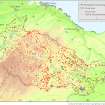
Map showing the HES Whiteadder Survey Area with known and newly discovered sites |
4/2021 |
Item Level |
|
Digital Files (Non-image) |
TM 000809 |
Whiteadder Archaeological Survey, Study Area |
3/2021 |
Item Level |
|
Digital Files (Non-image) |
TM 000839 |
Whiteadder Archaeological Survey, Stage 1 project data; shapefile of known sites that were not visited |
3/2021 |
Item Level |
|
Digital Files (Non-image) |
TM 000840 |
Whiteadder Archaeological Survey, Stage 2 project data; shapefile of sites discovered in desktop phase that were not visited |
3/2021 |
Item Level |
|
Digital Files (Non-image) |
TM 000841 |
Whiteadder Archaeological Survey, Stage 3 project data; shapefile of sites discovered in desktop phase that were visited in Spring 2020 |
3/2021 |
Item Level |
|
Digital Files (Non-image) |
TM 000842 |
Whiteadder Archaeological Survey, Stage 4 project data; shapefile of sites discovered during fieldwork in Spring 2020 |
3/2021 |
Item Level |
|
Digital Files (Non-image) |
TM 000843 |
Whiteadder Archaeological Survey, Stage 5 project data; shapefile of sites discovered in desktop phase that were visited in Autumn 2020 |
3/2021 |
Item Level |
|
Digital Files (Non-image) |
TM 000844 |
Whiteadder Archaeological Survey, Stage 6 project data; shapefile of sites discovered during fieldwork in Autumn 2020 |
3/2021 |
Item Level |
 |
On-line Digital Images |
SC 1956495 |
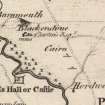
Extract from Armstrong's Map of Berwickshire (1771) showing two cairns southeast of Blakerstone. |
1771 |
Item Level |
 |
On-line Digital Images |
SC 2171060 |
Map showing the HES Whiteadder Survey Area with known and newly discovered sites |
4/2021 |
Item Level |


