|
Digital Files (Non-image) |
GV 004520 |
Archaeological landscape map of Foulshiels, Greenshiels area of Liddesdale. Grayscale. Created for Scottish Life and Society publication. |
8/10/2008 |
Item Level |
|
Digital Files (Non-image) |
GV 005086 |
Digital map (colour) of archaeological landscape around Hartsgarth, Liddesdale in Adobe Illustrator format |
2001 |
Item Level |
|
Digital Files (Non-image) |
GV 005082 |
Digital map (colour) of archaeological landscape around Hermitage Castle and Tofts Knowes, Liddesdale in Adobe Illustrator format |
2001 |
Item Level |
|
Digital Files (Non-image) |
GV 005083 |
Digital map (colour) of archaeological landscape around Foulshiels and Greenshiels, Liddesdale in Adobe Illustrator format |
2002 |
Item Level |
|
Digital Files (Non-image) |
GV 005084 |
Digital map (colour) of archaeological landscape around Kirkhill, Liddesdale in Adobe Illustrator format |
2001 |
Item Level |
|
Digital Files (Non-image) |
GV 005085 |
Digital map (colour) of archaeological landscape around Woolhope, Liddesdale in Adobe Illustrator format |
2001 |
Item Level |
|
Digital Files (Non-image) |
TM 000559 |
Zip file containing all the survey linework collected during the RCAHMS Afforestable Land Survey of Liddesdale |
1996 |
Item Level |
|
Digital Files (Non-image) |
DX 001442 |
RCAHMS Structures Database - Liddesdale survey |
1996 |
Item Level |
|
Digital Files (Non-image) |
TM 002203 |
Zip file containing all the survey linework collected during the RCAHMS Afforestable Land Survey of Liddesdale. SHP and Geojson file formats with extra attribution added to the linework. |
1996 |
Item Level |
 |
On-line Digital Images |
SC 1123249 |
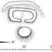
Scanned version of DC49411 - plan of Hazelyside Hill shileing |
2000 |
Item Level |
 |
On-line Digital Images |
SC 1122966 |
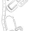
Scanned version of DC49403 - plan of Greenshiels Sike farmstead - with added scale bar |
11/4/2001 |
Item Level |
 |
On-line Digital Images |
SC 1122969 |
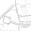
Scanned version of DC49405 - plan of Ettleton Sike township - with added scale bar |
11/4/2001 |
Item Level |
 |
On-line Digital Images |
SC 1122980 |
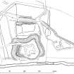
Scanned version of DC49409 - plan of Hermitage Castle and earthworks - with added annotation and scale bar |
11/4/2001 |
Item Level |
 |
On-line Digital Images |
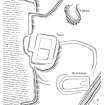
SC 1122858 |
Scanned version of ink drawing DC49401 - Plan of Foulshiels - farmstead/ tower
|
2001 |
Item Level |
 |
On-line Digital Images |
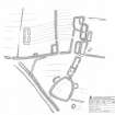
SC 1300855 |
Scanned version of DC49404 - pencil drawing depicting Ettleton Sike township |
1998 |
Item Level |
 |
On-line Digital Images |
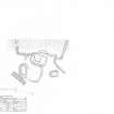
SC 1300856 |
Scanned version of DC49400 - pencil drawing depicting Foulshiels - farmstead/ tower |
1998 |
Item Level |
 |
On-line Digital Images |
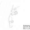
SC 1300857 |
Scanned version of DC49402 - pencil drawing depicting Greenshiels Sike farmstead |
3/1998 |
Item Level |
 |
On-line Digital Images |
SC 1300873 |
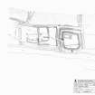
Scanned version of DC49406 - pencil drawing depicting Hermitage Chapel |
3/1998 |
Item Level |
 |
On-line Digital Images |
SC 1300874 |
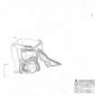
Scanned version of DC49408 - pencil drawing depicting Hermitage Castle and Earthworks |
3/1998 |
Item Level |
 |
On-line Digital Images |
SC 1300875 |
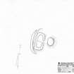
Scanned version of DC49410 - pencil drawing depicting Hazelyside Hill shieling Hermitage Castle and Earthworks |
1998 |
Item Level |
 |
On-line Digital Images |
SC 1472651 |
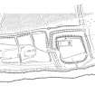
Ink drawing - plan of Hermitage Chapel/ moated site. 400dpi copy of DC49407. |
1998 |
Item Level |
 |
On-line Digital Images |
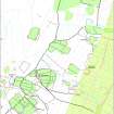
SC 1671555 |
Digital map (colour) of archaeological landscape around Kirkhill, Liddesdale |
|
Item Level |
 |
On-line Digital Images |
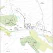
SC 2086545 |
Map showing archaeological landscape around Hermitage Castle and Tofts Knowes, Liddesdale |
1996 |
Item Level |
 |
On-line Digital Images |
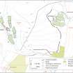
SC 2086549 |
Map showing the archaeological landscape around Hartsgarth, Liddesdale |
2001 |
Item Level |


