|
All Other |
551 500/1/20/1 |
Architecture Survey digitisation |
|
Sub-Group Level |
|
All Other |
551 500/1/20/2 |
Maps of Scotland |
|
Sub-Group Level |
|
All Other |
551 500/1/20/3 |
Regional and local maps |
|
Sub-Group Level |
|
Digital Files (Non-image) |
GV 006964 |
The combined magnetic survey of the fort at Bankhead, including the north, south and east annexes. Fig 11 - prepared for Britannia paper - The Roman military presence at Dalswinton, Dumfriesshire: a re-assessment of the evidence from aerial, geophysical and LiDAR survey.
By W.S. HANSON, R.E. JONES AND R.H. JONES
|
8/5/2018 |
Item Level |
|
Digital Files (Non-image) |
GV 007023 |
DES publication illustration. Measured drawing of Govan no. 18 |
11/2/2019 |
Item Level |
|
Digital Files (Non-image) |
GV 006788 |
Map of Scotland showing the distribution of buildings with cruck construction recorded in Canmore, showing those classified as cruck buildings and those referred to only in site descriptions and photographic captionsdistribution of cruck framed buildings |
8/5/2018 |
Item Level |
|
Digital Files (Non-image) |
GV 006784 |
Aerial photographic transcription of Roman and other sites at Dalswinton (after Jones 2011, Illus 112 with amendments/additions) prepared for Britannia paper - The Roman military presence at Dalswinton, Dumfriesshire: a re-assessment of the evidence from aerial, geophysical and LiDAR survey.
By W.S. HANSON, R.E. JONES AND R.H. JONES
|
8/5/2018 |
Item Level |
|
Digital Files (Non-image) |
GV 006785 |
Grey-scale graphic of the magnetic survey by SENSYS at Bankfoot superimposed over the aerial photographic plot of the camps and postulated two-phase fort. Black white palette: +/- 3nT. Fig 7 - prepared for Britannia paper - The Roman military presence at Dalswinton, Dumfriesshire: a re-assessment of the evidence from aerial, geophysical and LiDAR survey.
By W.S. HANSON, R.E. JONES AND R.H. JONES
|
8/5/2018 |
Item Level |
|
Digital Files (Non-image) |
GV 006786 |
The combined magnetic survey of the fort at Bankhead, including the north, south and east annexes. Fig 8 - prepared for Britannia paper - The Roman military presence at Dalswinton, Dumfriesshire: a re-assessment of the evidence from aerial, geophysical and LiDAR survey.
By W.S. HANSON, R.E. JONES AND R.H. JONES
|
8/5/2018 |
Item Level |
 |
On-line Digital Images |
SC 1765675 |
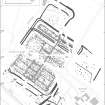
The combined magnetic survey of the fort at Bankhead, including the north, south and east annexes. Fig 11 - prepared for Britannia paper - The Roman military presence at Dalswinton, Dumfriesshire: a re-assessment of the evidence from aerial, geophysical and LiDAR survey.
By W.S. HANSON, R.E. JONES AND R.H. JONES
|
29/10/2018 |
Item Level |
 |
On-line Digital Images |
SC 1661380 |
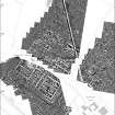
The combined magnetic survey of the fort at Bankhead, including the north, south and east annexes. Fig 8 - prepared for Britannia paper - The Roman military presence at Dalswinton, Dumfriesshire: a re-assessment of the evidence from aerial, geophysical and LiDAR survey.
By W.S. HANSON, R.E. JONES AND R.H. JONES
|
8/5/2018 |
Item Level |
 |
On-line Digital Images |
SC 1661383 |
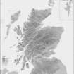
Map of Scotland showing the distribution of buildings with cruck construction recorded in Canmore, showing those classified as cruck buildings and those referred to only in site descriptions and photographic captionsdistribution of cruck framed buildings |
8/5/2018 |
Item Level |
 |
On-line Digital Images |
SC 1661378 |
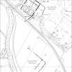
Aerial photographic transcription of Roman and other sites at Dalswinton (after Jones 2011, Illus 112 with amendments/additions) prepared for Britannia paper - The Roman military presence at Dalswinton, Dumfriesshire: a re-assessment of the evidence from aerial, geophysical and LiDAR survey.
By W.S. HANSON, R.E. JONES AND R.H. JONES
|
8/5/2018 |
Item Level |
 |
On-line Digital Images |
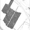
SC 1661379 |
Grey-scale graphic of the magnetic survey by SENSYS at Bankfoot superimposed over the aerial photographic plot of the camps and postulated two-phase fort. Black white palette: +/- 3nT. Fig 7 - prepared for Britannia paper - The Roman military presence at Dalswinton, Dumfriesshire: a re-assessment of the evidence from aerial, geophysical and LiDAR survey.
By W.S. HANSON, R.E. JONES AND R.H. JONES
|
8/5/2018 |
Item Level |
 |
On-line Digital Images |
SC 2099843 |
Plan of Tyninghame Road Block |
19/1/2016 |
Item Level |


