| Preview |
Category |
Catalogue Number |
Title |
Date |
Level |
|
All Other |
551 500/1/17/1 |
Milestones, Mile Plates and Mile Posts. |
|
Sub-Group Level |
|
All Other |
551 500/1/17/2 |
Boundary stones and markers |
|
Sub-Group Level |
|
All Other |
551 500/1/17/3 |
Images of sites and monuments around Perth |
|
Sub-Group Level |
|
All Other |
551 500/1/17/22 |
Arran, Catacol bridge |
|
Sub-Group Level |
|
All Other |
551 500/1/17/20 |
Images of sites and monuments in East Lothian and Berwickshire. |
|
Sub-Group Level |
|
All Other |
551 500/1/17/19 |
Police boxes |
|
Sub-Group Level |
|
All Other |
551 500/1/17/23 |
Miscellaneous digital photography in Aberdeenshire. |
8/4/2019 |
Sub-Group Level |
|
All Other |
551 500/1/17/28 |
Haddington |
|
Sub-Group Level |
|
All Other |
551 500/1/17/29 |
Whitesands Beach, Dunbar |
|
Sub-Group Level |
|
All Other |
551 500/1/17/26 |
Port Seton Harbour |
|
Sub-Group Level |
|
All Other |
551 500/1/17/27 |
Port Seton. |
|
Sub-Group Level |
|
All Other |
551 500/1/17/30 |
Non-project specific photography, Fife |
|
Sub-Group Level |
|
All Other |
551 500/1/17/31 |
Rock art recording post Scotland's Rock Art Project |
23/5/2023 |
Sub-Group Level |
|
All Other |
551 500/1/17/32 |
A photographic record of Ruthven Barracks during extensive flooding, on the 9th of October 2023 |
|
Sub-Group Level |
|
All Other |
551 500/1/17/21 |
Knock Steading, Strathavon |
|
Batch Level |
|
All Other |
551 500/1/17/24 |
Survey of buildings and sites on the Bass Rock |
16/7/2019 |
Batch Level |
|
All Other |
551 500/1/17/33 |
Fieldwork in support of the Legacy Project |
2022 |
Batch Level |
 |
On-line Digital Images |
DP 268657 |
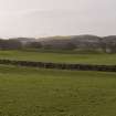
General view of the deposits to the SE of the Bush Burn, taken from the NE |
8/2/2018 |
Item Level |
 |
On-line Digital Images |
DP 268658 |
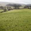
General view of the deposits to the NW of the Bush Burn, taken from the NE. The area in the centre of the image has been plough flattened. |
8/2/2018 |
Item Level |
 |
On-line Digital Images |
DP 268659 |
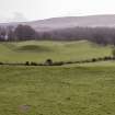
General view of the deposits to the SE of the Bush Burn, taken from the NW. |
8/2/2018 |
Item Level |
 |
On-line Digital Images |
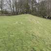
DP 268660 |
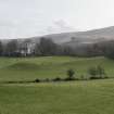
General view of the deposits to the SE of the Bush Burn, taken from the NW. |
8/2/2018 |
Item Level |
 |
On-line Digital Images |
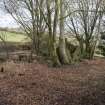
DP 268661 |
General view of the deposits to the NW of the Bush Burn, as they enter the woodland. Taken from the SW. |
8/2/2018 |
Item Level |
 |
On-line Digital Images |
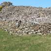
DP 268662 |
General view of the farmstead, overlying the natural terrace. |
8/2/2018 |
Item Level |
 |
On-line Digital Images |
DP 381147 |
Detail of SW corner of the cairn. |
23/3/2022 |
Item Level |
