|
Digital Files (Non-image) |
GV 006099 |
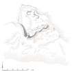
Map of Eigg showing locations mentioned in chapter |
5/2016 |
Item Level |
|
Digital Files (Non-image) |
GV 006100 |
Galmisdale, plan of possible house. HES publication illustration |
5/2016 |
Item Level |
|
Digital Files (Non-image) |
GV 006101 |
Cnoc Smeordail, plan of hut circles. HES publication illustration. |
5/2016 |
Item Level |
|
Digital Files (Non-image) |
GV 006102 |
Plan of hut circles at Howlin. HES publication illustration |
5/2016 |
Item Level |
|
Digital Files (Non-image) |
GV 006103 |
Plan of Poll Duchaill fort. HES publication illustration |
5/2016 |
Item Level |
|
Digital Files (Non-image) |
GV 006104 |
Plan of dun at Grulin. HES publication illustration |
5/2016 |
Item Level |
|
Digital Files (Non-image) |
GV 006105 |
Plan of Corrogan Mor fort. HES publication illustration |
5/2016 |
Item Level |
|
Digital Files (Non-image) |
GV 006106 |
Plan and sections of the possible ritual site of Sron na h-Iolaire. HES publication illustration |
5/2016 |
Item Level |
|
Digital Files (Non-image) |
GV 006107 |
Plan of 'beehive' huts at Glen Charadail. HES publication illustration |
5/2016 |
Item Level |
|
Digital Files (Non-image) |
GV 006108 |
Plan of square burial cairns, Bay of Laig. HES publication illustration |
5/2016 |
Item Level |
|
Digital Files (Non-image) |
GV 006109 |
Plan of Grulin township. HES publication illustration |
5/2016 |
Item Level |
|
Digital Files (Non-image) |
GV 006110 |
Plan of shieling group at Bidein An Tighearna. HES publication illustration |
5/2016 |
Item Level |
|
Digital Files (Non-image) |
GV 006111 |
Plan and elevation of shieling hut at Bidein An Tighearna. HES publication illustration |
5/2016 |
Item Level |
|
Digital Files (Non-image) |
GV 006112 |
Plan of Clanranald pier. HES publication illustration |
5/2016 |
Item Level |
|
Digital Files (Non-image) |
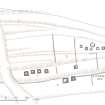
GV 006076 |
HES Publication Illustration. Plan of shieling group at Bidean An Tighearna, Eigg. |
3/2016 |
Item Level |
 |
On-line Digital Images |
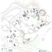
SC 1526905 |
Plan of square burial cairns, Bay of Laig. HES publication illustration. |
5/2016 |
Item Level |
 |
On-line Digital Images |
SC 1526909 |
Plan of Grulin township. HES publication illustration. |
5/2016 |
Item Level |
 |
On-line Digital Images |
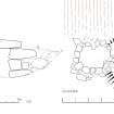
SC 1526914 |
Plan and elevation of shieling hut at Bidein An Tighearna. HES publication illustration. |
5/2016 |
Item Level |
 |
On-line Digital Images |
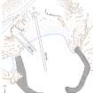
SC 1526915 |
Plan of Clanranald pier. HES publication illustration, 400dpi copy of GV006112 |
5/2016 |
Item Level |
 |
On-line Digital Images |
SC 1526878 |
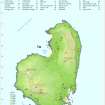
Map of Eigg showing locations mentioned in chapter. HES publication map, 400dpi copy of GV006099 |
5/2016 |
Item Level |
 |
On-line Digital Images |
SC 1526880 |
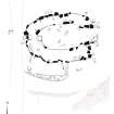
Galmisdale, plan of possible house. HES publication illustration. |
5/2016 |
Item Level |
 |
On-line Digital Images |
SC 1526881 |
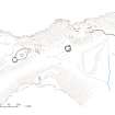
Cnoc Smeordail, plan of hut circles. HES publication illustration. |
5/2016 |
Item Level |
 |
On-line Digital Images |
SC 1526882 |
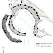
Plan of hut circles at Howlin. HES publication illustration. |
5/2016 |
Item Level |
 |
On-line Digital Images |
SC 1526883 |
Plan of Poll Duchaill fort. HES publication illustration. |
5/2016 |
Item Level |


