|
All Other |
551 1/4/2/7/1 |
Lochend Colliery |
1992 |
Batch Level |
|
Digital Files (Non-image) |
GV 005081 |
1:5000 Site plan of Wilsontown Ironworks in Adobe Illustrator format. Created in1997 for the RCAHMS publication Forts, Farms and Furnaces. p36 |
6/1997 |
Item Level |
|
Digital Files (Non-image) |
TM 000316 |
ZIP file containing dxf data sets used to create illustrations for Forts, Farms and Furnaces, Archaeology in the Central Scotland Forest, RCAHMS 1998 (WP003896.pdf) along with dxf files of survey overlays. |
1992 |
Item Level |
|
Digital Files (Non-image) |
DX 001418 |
RCAHMS Structures Database, Central Scotland Woodland |
1992 |
Item Level |
|
Digital Files (Non-image) |
GV 007642 |
Publication Drawing: Plan of Mid Bracco farmstead . Created for FORTS, FARMS AND FURNACES Archaeology in the Central Scotland Forest, RCAHMS 1998, WP003896.pdf |
1998 |
Item Level |
|
Digital Files (Non-image) |
GV 007643 |
Publication Drawing: Industrial sites on the first edition OS maps, 1852-60. Created for FORTS, FARMS AND FURNACES Archaeology in the Central Scotland Forest, RCAHMS 1998, WP003896.pdf, Fig. 19 |
1998 |
Item Level |
|
Digital Files (Non-image) |
GV 007645 |
Publication Drawing: Industrial sites on the third edition OS maps, 1905-14. Created for FORTS, FARMS AND FURNACES Archaeology in the Central Scotland Forest, RCAHMS 1998, WP003896.pdf, Fig. 21 |
1998 |
Item Level |
|
Digital Files (Non-image) |
GV 007646 |
Publication Drawing: The Central Scotland Forest: location map, Created for Forts, Farms and Furnaces, Archaeology in the Central Scotland Forest, RCAHMS 1998, WP003896.pdf, Fig. 3 |
1998 |
Item Level |
|
Digital Files (Non-image) |
GV 007647 |
Publication Drawing: Land use in the Central Scotland Forest (based on data supplied by the Macaulay Land Use Research Institute). |
1998 |
Item Level |
|
Digital Files (Non-image) |
GV 007650 |
Publication Drawing: Area of Central Scottish Woodland 1992 field survey, showing distribution of farmsteads and rig-and-furrow cultivation. |
1998 |
Item Level |
|
Digital Files (Non-image) |
GV 007648 |
Publication Drawing: Distribution of prehistoric and Roman monuments, Created for Forts, Farms and Furnaces, Archaeology in the Central Scotland Forest, RCAHMS 1998, WP003896.pdf, Fig. 6 |
1998 |
Item Level |
|
Digital Files (Non-image) |
GV 007649 |
Publication Drawing: Distribution of medieval castles and churches, Created for Forts, Farms and Furnaces, Archaeology in the Central Scotland Forest, RCAHMS 1998, WP003896.pdf, Fig. 13 |
1998 |
Item Level |
|
Digital Files (Non-image) |
GV 007644 |
Publication Drawing: Industrial sites on the second edition OS maps, 1893-97. Created for FORTS, FARMS AND FURNACES Archaeology in the Central Scotland Forest, RCAHMS 1998, WP003896.pdf, Fig. 20 |
1998 |
Item Level |
|
Digital Files (Non-image) |
TM 002211 |
ZIP file containing all survey linework collected as part of the RCAHMS survey of Central Scotland Woodland area. SHP and Geojson file formats with extra attribution added to the linework. |
1992 |
Item Level |
 |
On-line Digital Images |
SC 1518321 |
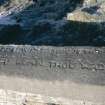
Haywood village, Greebank, detail of poem on window-sill of former hotel. |
20/8/1994 |
Item Level |
 |
On-line Digital Images |
SC 1519278 |
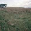
Dunsiston Colliery, view of miners row |
1/10/1993 |
Item Level |
 |
On-line Digital Images |
SC 1519279 |
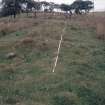
Dunsiston Colliery, view of miners row. |
1/10/1993 |
Item Level |
 |
On-line Digital Images |
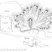
SC 2032214 |
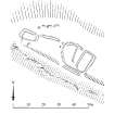
Publication Drawing: Plan of Drumfin farmstead. Central Scotland Woodland Survey. |
14/7/1992 |
Item Level |
 |
On-line Digital Images |
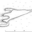
SC 2031350 |
Publication Drawing: Plan of buildings and bing at Lochend pit No 5. Central Scottish Woodlands Survey. |
1993 |
Item Level |
 |
On-line Digital Images |
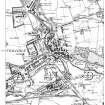
SC 2032404 |
Publication Drawing: Plan of Sergeant's Law lime kiln. |
26/7/1994 |
Item Level |
 |
On-line Digital Images |
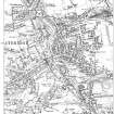
SC 2031780 |
Extract of OS first edition 6-inch map of Coatbridge (Lanarkshire 1864, sheets vii and viii. surveyed 1858-9 |
2004 |
Item Level |
 |
On-line Digital Images |
SC 2031797 |
Extract of OS second edition 6-inch map of Coatbridge (Lanarkshire 1899, sheets vii and viii, surveyed 1896-7) |
2004 |
Item Level |
 |
On-line Digital Images |
SC 2031901 |
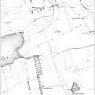
Publication illustration: 'Extract from the first edition of the OS 6-inch map, showing the area to the west of Mountcow Farmsteading, Shotts (Lanarkshire 1864, sheet viii, surveyed 1859). |
1998 |
Item Level |
 |
On-line Digital Images |
SC 2032575 |
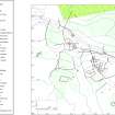
Publication Drawing: 'Plan of Mid Bracco farmstead, compiled from ground survey, aerial photographs and OS map detail'. |
1998 |
Item Level |


