|
Digital Files (Non-image) |
GV 005956 |
Map of East Renfrewshire Council showing the farms that were inhabited in 2007 |
20/12/2007 |
Item Level |
|
Digital Files (Non-image) |
GV 005957 |
Map of East Renfrewshire Council showing the farms that were unroofed on the OS 1st edition maps, unroofed on the OS 2nd edition maps and roofed on the OS 2nd edition maps. |
20/12/2007 |
Item Level |
|
Digital Files (Non-image) |
GV 005958 |
Map of East Renfrewshire Council showing the farms named on John Ainsley's 1796 Map of the County of Renfrew. |
20/12/2007 |
Item Level |
|
Digital Files (Non-image) |
GV 005959 |
Map of East Renfrewshire Council showing the prehistoric sites within the council area. |
20/12/2007 |
Item Level |
|
Digital Files (Non-image) |
TM 000116 |
DXF file contaiing all GPS/EDM survey data collected during the RCAHMS East Renfrewshire field project carried out in 2007 |
30/11/2015 |
Item Level |
|
Digital Files (Non-image) |
TM 001153 |
GNSS data relating to the 2007 RCAHMS survey of East Renfrewshire. Includes primary data, combined linework file (.dxf) and survey linework metadata form. |
2007 |
Item Level |
 |
On-line Digital Images |
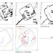
DP 099546 |
Comparative plans of map and survey depictions of the remains of Eaglesham mill. |
12/2/2008 |
Item Level |
 |
On-line Digital Images |
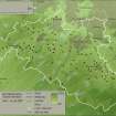
SC 1498758 |
Map of East Renfrewshire Council showing the farms that were inhabited in 2007 - Tif copy |
20/12/2007 |
Item Level |
 |
On-line Digital Images |
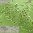
SC 1498759 |
Map of East Renfrewshire Council showing the farms that were unroofed on the OS 1st edition maps, unroofed on the OS 2nd edition maps and roofed on the OS 2nd edition maps - with urban areas from OS 2nd edition maps - Tif copy |
20/12/2007 |
Item Level |
 |
On-line Digital Images |
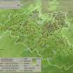
SC 1498760 |
Map of East Renfrewshire Council showing the farms that were unroofed on the OS 1st edition maps, unroofed on the OS 2nd edition maps and roofed on the OS 2nd edition maps - with urban areas from modern maps - Tif copy |
20/12/2007 |
Item Level |
 |
On-line Digital Images |
SC 1498761 |
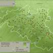
Map of East Renfrewshire Council showing the farms named on John Ainsley's 1796 Map of the County of Renfrew with urban areas from Roy map - Tif copy |
20/12/2007 |
Item Level |
 |
On-line Digital Images |
SC 1498762 |
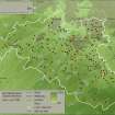
Map of East Renfrewshire Council showing the farms named on John Ainsley's 1796 Map of the County of Renfrew with urban areas from the modern map - Tif copy |
20/12/2007 |
Item Level |
 |
On-line Digital Images |
SC 1498767 |
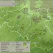
Map of East Renfrewshire Council showing prehistoric sites with urban areas from the modern map - Tif copy |
20/12/2007 |
Item Level |
 |
On-line Digital Images |
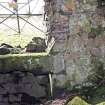
DP 242454 |
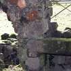
Detail of fireplace lintel. |
6/6/2007 |
Item Level |
 |
On-line Digital Images |
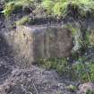
DP 242455 |
Detail of fireplace lintel. |
6/6/2007 |
Item Level |
 |
On-line Digital Images |
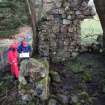
DP 242456 |
Detail of roll-moulded door jamb. |
6/6/2007 |
Item Level |
 |
On-line Digital Images |
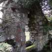
DP 242457 |
View of outshot, taken from north-west. |
6/6/2007 |
Item Level |
 |
On-line Digital Images |
DP 242458 |
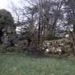
View of gable taken from the east. |
6/6/2007 |
Item Level |
 |
On-line Digital Images |
DP 242459 |
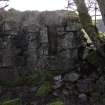
General view of Cowden Hall, taken from the south-west. |
6/6/2007 |
Item Level |
 |
On-line Digital Images |
DP 242460 |
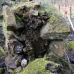
Detail of cruck slot in south-west wall. |
6/6/2007 |
Item Level |
 |
On-line Digital Images |
DP 242462 |
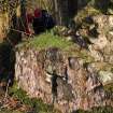
Cruck slot in north-east side wall. |
6/6/2007 |
Item Level |
 |
On-line Digital Images |
DP 242463 |
Detail of pink harl on exterior of the north-west wall. |
6/6/2007 |
Item Level |
 |
On-line Digital Images |
DP 242466 |
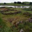
General view of excavated building, taken from the west. |
20/6/2007 |
Item Level |
 |
On-line Digital Images |
DP 242467 |
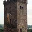
View of tower from north. |
4/6/2007 |
Item Level |


