|
Digital Files (Non-image) |
TM 000318 |
Zip file containing the final survey linework dxf file for the RCAHMS Afforestable Land Survey of Mar Lodge 1993, the individual 1:10000 map sheet overlay dxf files, OS Antiquity model dxf files and a document detailing the files and the survey methodology. |
1993 |
Item Level |
|
Digital Files (Non-image) |
DX 001423 |
RCAHMS Structures Database - Mar Lodge Estate |
1994 |
Item Level |
|
Digital Files (Non-image) |
TM 002208 |
Zip file containing the final survey linework for the RCAHMS Afforestable Land Survey of Mar Lodge 1993. SHP and Geojson file formats with extra attribution added to the linework. |
1993 |
Item Level |
 |
On-line Digital Images |
SC 621669 |
Lui Water, Township. |
1993 |
Item Level |
 |
On-line Digital Images |
SC 621603 |
View of Glen Lui, Mar Lodge: C02122/CN |
|
Item Level |
 |
On-line Digital Images |
SC 750091 |
View of corn-drying kiln at Lui Water. |
1993 |
Item Level |
 |
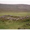
On-line Digital Images |
SC 436193 |
View of township from NW. |
|
Item Level |
 |
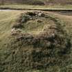
On-line Digital Images |
SC 436109 |
View of township building from SE. |
1993 |
Item Level |
 |
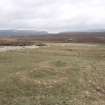
On-line Digital Images |
SC 436106 |
View of kiln barn. |
1993 |
Item Level |
 |
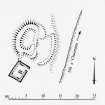
On-line Digital Images |
SC 436114 |
View from S |
1993 |
Item Level |
 |
On-line Digital Images |
SC 436112 |
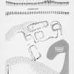
Publication drawing; plan of shieling hut, Black Bothy (MAR93 154) |
29/11/1994 |
Item Level |
 |
On-line Digital Images |
SC 436171 |
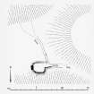
Publication drawing; farmstead at Little Allanaquoich |
19/12/1994 |
Item Level |
 |
On-line Digital Images |
SC 436113 |
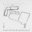
Publication drawing; ground plan of whisky still, Allt Connie
|
29/11/1994 |
Item Level |
 |
On-line Digital Images |
SC 436110 |
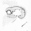
Publication drawing; plan of farmstead, Croislish |
20/12/1994 |
Item Level |
 |
On-line Digital Images |
SC 436107 |
Publication drawing; ground plan of kiln barn, Glen Lui (NO 0614 9170) |
29/11/1994 |
Item Level |
 |
On-line Digital Images |
SC 438584 |
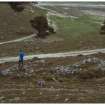
Also known as Little Allanaquoich, this township lies on a terrace above the River Dee. This view shows two associated shieling huts at NO 1143 9101. |
c. 1993 |
Item Level |
 |
On-line Digital Images |
SC 436199 |
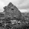
Detail of W gable (interior) showing double fireplaces in ground floor. |
1993 |
Item Level |
 |
On-line Digital Images |
SC 436196 |
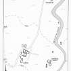
Publication drawing; Geldie Lodge, location plan |
c. 1993 |
Item Level |
 |
On-line Digital Images |
SC 436567 |
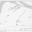
Publication drawing; Plan of Dalvorar township. |
|
Item Level |
 |
On-line Digital Images |
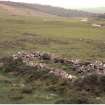
SC 436119 |
Detail of township buildings from NW. |
1993 |
Item Level |
 |
On-line Digital Images |
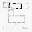
SC 436201 |
Publication drawing; Bynack Lodge, ground plan with phasing |
c. 1993 |
Item Level |
 |
On-line Digital Images |
SC 1571486 |
Tomnamoine. General view of hut with partial turn-off and extension |
1996 |
Item Level |
 |
On-line Digital Images |
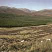
SC 436167 |
Shieling-huts from SE. |
|
Item Level |
 |
On-line Digital Images |
DP 343738 |
Publication drawing; farmstead at Little Allanaquoich |
19/12/1994 |
Item Level |


