|
Digital Files (Non-image) |
GV 006543 |
Map showing location of Mine Howe on Orkney |
5/2000 |
Item Level |
|
Digital Files (Non-image) |
GV 006544 |
Plan of subterranean structures at Mine Howe |
5/2000 |
Item Level |
|
Digital Files (Non-image) |
GV 006545 |
Section through subterranean structures at Mine Howe |
5/2000 |
Item Level |
|
Digital Files (Non-image) |
GV 006546 |
Profile through subterranean structures at Mine Howe |
5/2000 |
Item Level |
|
Digital Files (Non-image) |
TM 000543 |
Zip file containing the survey linework collected during the 1999 RCAHMS survey of Mine Howe |
11/1999 |
Item Level |
 |
On-line Digital Images |
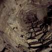
SC 539384 |
View up into corbelled roof of lower chamber. |
|
Item Level |
 |
On-line Digital Images |
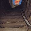
SC 539387 |
View up upper flight of ladder steps. |
11/1999 |
Item Level |
 |
On-line Digital Images |
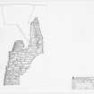
DP 039722 |
Section through the subterranean chamber. |
2000 |
Item Level |
 |
On-line Digital Images |
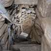
SC 1392342 |
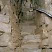
View down lower flight of steps to cistern, after installation of handrail. |
27/7/2000 |
Item Level |
 |
On-line Digital Images |
SC 1392343 |
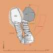
View up lower flight of steps from cistern to half-landing, after installation of handrail. |
27/7/2000 |
Item Level |
 |
On-line Digital Images |
SC 1594486 |
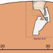
Plan of subterranean structures at Mine Howe |
5/2000 |
Item Level |
 |
On-line Digital Images |
SC 1594487 |
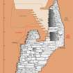
Profile through subterranean structures at Mine Howe |
5/2000 |
Item Level |
 |
On-line Digital Images |
SC 1594488 |
Section through subterranean structures at Mine Howe |
5/2000 |
Item Level |
 |
On-line Digital Images |
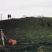
SC 1852522 |
View of the natural mound of Mine Howe, with Mr I Parker and Mr R Shaw with Douglas Patterson, farmer. |
11/1999 |
Item Level |
 |
On-line Digital Images |
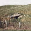
SC 1852523 |
View of horizontally bedded, natural sandstone blocks on the S flank of Long Knowe, to the W of Mine Howe. |
11/1999 |
Item Level |
 |
On-line Digital Images |
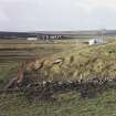
SC 1852524 |
View of sandstone blocks on the S flank of Long Knowe. |
11/1999 |
Item Level |
 |
On-line Digital Images |
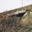
SC 1852525 |
View of sandstone blocks on the S flank of Long Knowe. |
11/1999 |
Item Level |
 |
On-line Digital Images |
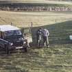
SC 1852526 |
Mr D Cowley (RCAHMS) with Mr Douglas Patterson |
11/1999 |
Item Level |
 |
On-line Digital Images |
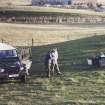
SC 1852527 |
Mr D Cowley (RCAHMS) with Mr Douglas Patterson |
11/1999 |
Item Level |
 |
On-line Digital Images |
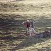
SC 1852528 |
Commission at work: Mr I Parker and Mr R Shaw with GPS at base station. |
11/1999 |
Item Level |
 |
On-line Digital Images |
SC 1852529 |
Commission at work: Mr I Parker and Mr R Shaw with GPS at base station. |
11/1999 |
Item Level |
 |
On-line Digital Images |
SC 1852530 |
Commission at work: Mr I Parker and Mr R Shaw with GPS at base station. |
11/1999 |
Item Level |
 |
On-line Digital Images |
SC 1852531 |
Mr Douglas Patterson, farmer, at entrance to subterranean structure. |
11/1999 |
Item Level |
 |
On-line Digital Images |
SC 1852532 |
Mr Douglas Patterson, farmer, at entrance to subterranean structure. |
11/1999 |
Item Level |


