Sortie 2015/28
551 178/2019/25
Description Sortie 2015/28
Date 22/7/2015
Collection RCAHMS Aerial Photography Digital
Catalogue Number 551 178/2019/25
Category All Other
Permalink http://canmore.org.uk/collection/1483433
Description Sortie 2015/28
Date 22/7/2015
Collection RCAHMS Aerial Photography Digital
Catalogue Number 551 178/2019/25
Category All Other
Permalink http://canmore.org.uk/collection/1483433
Collection Level (551 178) RCAHMS Aerial Photography Digital
> Group Level (551 178/2019) 2015 Photographs
>> Sub-Group Level (551 178/2019/25) Sortie 2015/28
| Preview | Category | Catalogue Number | Title | Date | Level |
|---|---|---|---|---|---|
 |
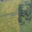
On-line Digital Images | DP 217555 | Oblique aerial view of the location of the ring ditch under crop but with no visible cropmarking, looking N. | 22/7/2015 | Item Level |
 |
On-line Digital Images | DP 217557 | Oblique aerial view of the fort, and the cropmarks of the pit-defined boundary system and enclosure, looking WSW. | 22/7/2015 | Item Level |
 |
On-line Digital Images | DP 217566 | Oblique aerial view of the cropmarks of the enclosure and the possible sunken-floored buildings, looking SSE. | 22/7/2015 | Item Level |
 |
On-line Digital Images | DP 217568 | Oblique aerial view of the cropmarks of the enclosure and the possible sunken-floored buildings with Drem village beyond, looking ENE. | 22/7/2015 | Item Level |
 |
On-line Digital Images | DP 217569 | Oblique aerial view of the cropmarks of the ring ditch, looking NNW. | 22/7/2015 | Item Level |
 |
On-line Digital Images | DP 217571 | Oblique aerial view of the cropmarks of the sunken floored buildings, looking N. | 22/7/2015 | Item Level |
 |
On-line Digital Images | DP 217574 | Oblique aerial view of the cropmarks of the rig on Gin Head, looking E. | 22/7/2015 | Item Level |
 |
On-line Digital Images | DP 217577 | Oblique aerial view of the cropmarks of the trackway and the possible enclosure, looking NNW. | 22/7/2015 | Item Level |
 |
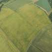
On-line Digital Images | DP 217578 | Oblique aerial view of the cropmarks of the trackway and the possible enclosure, looking NW. | 22/7/2015 | Item Level |
 |
On-line Digital Images | DP 217580 | Oblique aerial view of the cropmarks of the fort and pit-defined boundary, looking E. | 22/7/2015 | Item Level |
 |
On-line Digital Images | DP 217582 | Oblique aerial view of the cropmarks of the settlement enclosure, looking ENE. | 22/7/2015 | Item Level |
 |
On-line Digital Images | DP 217584 | Oblique aerial view of the cropmarks of the settlement enclosure, looking WSW. | 22/7/2015 | Item Level |
 |
On-line Digital Images | DP 217585 | Oblique aerial view of the cropmarks of the settlement enclosure, looking SW. | 22/7/2015 | Item Level |
 |
On-line Digital Images | DP 217587 | Oblique aerial view of the cropmarks of the ring ditch, looking S. | 22/7/2015 | Item Level |
 |
On-line Digital Images | DP 217595 | Oblique aerial view of the cropmarks of the fort, looking SSW. | 22/7/2015 | Item Level |
 |
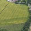
On-line Digital Images | DP 217597 | Oblique aerial view of the cropmarks of the fort, looking SE. | 22/7/2015 | Item Level |
 |
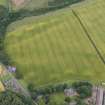
On-line Digital Images | DP 217599 | Oblique aerial view of the cropmarks of the pits and enclosure, looking SSE. | 22/7/2015 | Item Level |
 |
On-line Digital Images | DP 217600 | Oblique aerial view of the cropmarks of the pits, track and enclosure, looking NNE. | 22/7/2015 | Item Level |
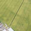 |
On-line Digital Images | DP 217602 | Oblique aerial view of the cropmarks of the pits, looking NNW. | 22/7/2015 | Item Level |
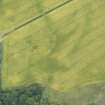 |
On-line Digital Images | DP 217604 | Oblique aerial view of the cropmarks of the pits and enclosure, looking NW. | 22/7/2015 | Item Level |
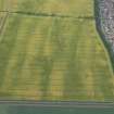 |
On-line Digital Images | DP 217529 | Oblique aerial view of the cropmarks of the settlement, enclosure and pits, looking WSW. | 22/7/2015 | Item Level |
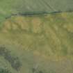 |
On-line Digital Images | DP 217606 | Oblique aerial view of the cropmarks of the forts, looking ESE. | 22/7/2015 | Item Level |
 |
On-line Digital Images | DP 217609 | Oblique aerial view of the cropmarks of the fort, looking NE. | 22/7/2015 | Item Level |
 |
On-line Digital Images | DP 217610 | Oblique aerial view of the cropmarks of the fort with Reedy Loch farmstead beyond, looking N. | 22/7/2015 | Item Level |

© Historic Environment Scotland. Scottish Charity No. SC045925