Sortie 2015/28
551 178/2019/25
Description Sortie 2015/28
Date 22/7/2015
Collection RCAHMS Aerial Photography Digital
Catalogue Number 551 178/2019/25
Category All Other
Permalink http://canmore.org.uk/collection/1483433
Description Sortie 2015/28
Date 22/7/2015
Collection RCAHMS Aerial Photography Digital
Catalogue Number 551 178/2019/25
Category All Other
Permalink http://canmore.org.uk/collection/1483433
Collection Level (551 178) RCAHMS Aerial Photography Digital
> Group Level (551 178/2019) 2015 Photographs
>> Sub-Group Level (551 178/2019/25) Sortie 2015/28
| Preview | Category | Catalogue Number | Title | Date | Level |
|---|---|---|---|---|---|
| Digital Files (Non-image) | TM 000740 | GPS recorded flight path and map for Sortie 2015/28 | 22/7/2015 | Item Level | |
 |
On-line Digital Images | DP 217608 | Oblique aerial view of the cropmarks of the settlement enclosure with West Flemington farmstead beyond, looking N. | 22/7/2015 | Item Level |
 |
On-line Digital Images | DP 217528 | Oblique aerial view of the cropmarks of the settlement, enclosure and pits, looking ENE. | 22/7/2015 | Item Level |
 |
On-line Digital Images | DP 217538 | Oblique aerial view of the cropmarks of the West Mains fort, looking NE. | 22/7/2015 | Item Level |
 |
On-line Digital Images | DP 217540 | Oblique aerial view of the cropmarks of the settlement enclosure, looking S. | 22/7/2015 | Item Level |
 |
On-line Digital Images | DP 217542 | Oblique aerial view of the cropmarks of the enclosure, looking NE. | 22/7/2015 | Item Level |
 |
On-line Digital Images | DP 217544 | Oblique aerial view of the cropmarks of the rectilinear enclosure, looking NE. | 22/7/2015 | Item Level |
 |
On-line Digital Images | DP 217546 | Oblique aerial view of the cropmarks of the rectilinear enclosure, looking NW. | 22/7/2015 | Item Level |
 |
On-line Digital Images | DP 217547 | Oblique aerial view of the cropmarks of the rectilinear enclosure, looking W. | 22/7/2015 | Item Level |
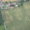 |
On-line Digital Images | DP 217550 | Oblique aerial view of the cropmarks of the field boundary, looking SE. | 22/7/2015 | Item Level |
 |
On-line Digital Images | DP 217552 | Oblique aerial view of the cropmarks of the settlement enclosure, looking NNW. | 22/7/2015 | Item Level |
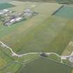 |
On-line Digital Images | DP 217516 | General oblique aerial view of Drem Airfield and the cropmarks of the palisaded enclosure and pit defined boundary, looking SSE. | 22/7/2015 | Item Level |
 |
On-line Digital Images | DP 217517 | Oblique aerial view of the cropmarks of the pit defined boundary, looking ENE. | 22/7/2015 | Item Level |
 |
On-line Digital Images | DP 217518 | Oblique aerial view of the cropmarks of the palisaded enclosure and pit defined boundary, looking NE. | 22/7/2015 | Item Level |
 |
On-line Digital Images | DP 217519 | Oblique aerial view of the cropmarks of the pit defined boundary, looking N. | 22/7/2015 | Item Level |
 |
On-line Digital Images | DP 217521 | Oblique aerial view of the cropmarks of the tree boles and field boundaries in the Gosford Park policies, looking NNE. | 22/7/2015 | Item Level |
 |
On-line Digital Images | DP 217522 | Oblique aerial view of the cropmarks of the tree boles and field boundaries in the Gosford Park policies, looking SSE. | 22/7/2015 | Item Level |
 |
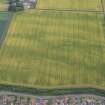
On-line Digital Images | DP 217524 | Oblique aerial view of the cropmarks of the enclosure, looking SE. | 22/7/2015 | Item Level |
 |
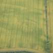
On-line Digital Images | DP 217525 | Oblique aerial view of the cropmarks of the enclosure, pits and settlement, looking SSE. | 22/7/2015 | Item Level |
 |
On-line Digital Images | DP 217526 | Oblique aerial view of the cropmarks of the settlement, looking SE. | 22/7/2015 | Item Level |
 |
On-line Digital Images | DP 217527 | Oblique aerial view of the cropmarks of the enclosure and pits, looking SE. | 22/7/2015 | Item Level |
 |
On-line Digital Images | DP 217520 | Oblique aerial view of the cropmarks of the tree boles and field boundaries in the Gosford Park policies, looking ESE. | 22/7/2015 | Item Level |
 |
On-line Digital Images | DP 217523 | Oblique aerial view of the cropmarks of the tree boles and field boundaries in the Gosford Park policies, looking S. | 22/7/2015 | Item Level |
 |
On-line Digital Images | DP 217554 | Oblique aerial view of the cropmarks of the settlement enclosure, looking W. | 22/7/2015 | Item Level |

© Historic Environment Scotland. Scottish Charity No. SC045925