Sortie 2014/34
551 178/2018/29
Description Sortie 2014/34
Collection RCAHMS Aerial Photography Digital
Catalogue Number 551 178/2018/29
Category All Other
Permalink http://canmore.org.uk/collection/1434142
Description Sortie 2014/34
Collection RCAHMS Aerial Photography Digital
Catalogue Number 551 178/2018/29
Category All Other
Permalink http://canmore.org.uk/collection/1434142
Collection Level (551 178) RCAHMS Aerial Photography Digital
> Sub-Group Level (551 178/2018) 2014 Photographs
>> Sub-Group Level (551 178/2018/29) Sortie 2014/34
| Preview | Category | Catalogue Number | Title | Date | Level |
|---|---|---|---|---|---|
 |
On-line Digital Images | DP 193546 | Oblique aerial view of the cropmarks of the quarries, looking N. | 7/7/2014 | Item Level |
 |
On-line Digital Images | DP 193547 | Oblique aerial view of the cropmarks of the ring ditch and field boundary, looking NNW. | 7/7/2014 | Item Level |
 |
On-line Digital Images | DP 193548 | Oblique aerial view of the cropmarks of the ring ditch and field boundary, looking W. | 7/7/2014 | Item Level |
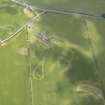 |
On-line Digital Images | DP 193549 | Oblique aerial view of the anti aircraft battery and the cropmarks of the track, looking WSW. | 7/7/2014 | Item Level |
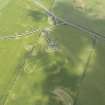 |
On-line Digital Images | DP 193550 | Oblique aerial view of the anti aircraft battery and the cropmarks of the track, looking SW. | 7/7/2014 | Item Level |
 |
On-line Digital Images | DP 193551 | Oblique aerial view of the Cairnryan ferry terminal and MS Stena Superfast VII, looking WSW. | 7/7/2014 | Item Level |
 |
On-line Digital Images | DP 193552 | Oblique aerial view of the field boundaries, looking SSW. | 7/7/2014 | Item Level |
 |
On-line Digital Images | DP 193553 | General oblique aerial view of the field boundaries, looking SSW. | 7/7/2014 | Item Level |
 |
On-line Digital Images | DP 193554 | Oblique aerial view of the circular features in the intertidal area on Fairlee sands, looking WSW. | 7/7/2014 | Item Level |
 |
On-line Digital Images | DP 193556 | Oblique aerial view of the circular features in the intertidal area on Fairlee Sands, looking WSW. | 7/7/2014 | Item Level |
 |
On-line Digital Images | DP 193557 | Oblique aerial view of the cropmarks of the enclosure, looking N. | 7/7/2014 | Item Level |
 |
On-line Digital Images | DP 193555 | Oblique aerial view of the circular features in the intertidal area on Fairlee Sands with the pier beyond, looking WSW. | 7/7/2014 | Item Level |
 |
On-line Digital Images | DP 193541 | Oblique aerial view of the cropmarks of the ring ditch, looking N. | 7/7/2014 | Item Level |
 |
On-line Digital Images | DP 193543 | Oblique aerial view of the cropmarks of the ring ditch, looking SSW. | 7/7/2014 | Item Level |
 |
On-line Digital Images | DP 193545 | Oblique aerial view of the cropmarks of the quarries, looking NNE. | 7/7/2014 | Item Level |
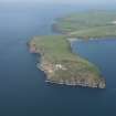 |
On-line Digital Images | DP 193529 | General oblique aerial view of the Mull of Galloway, looking WNW. | 7/7/2014 | Item Level |
 |
On-line Digital Images | DP 193534 | Oblique aerial view of the cropmarks of the curving ditch, looking ESE. | 7/7/2014 | Item Level |
 |
On-line Digital Images | DP 193536 | Oblique aerial view of the cropmarks of the curving ditch, looking WSW. | 7/7/2014 | Item Level |
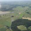 |
On-line Digital Images | DP 193538 | General oblique aerial view of the newly constructed A75 road line with Castle of Park in the foreground and the Piltanton Burn and Luce Sands in the distance, looking WSW. | 7/7/2014 | Item Level |
 |
On-line Digital Images | DP 193539 | General oblique aerial view of the newly constructed A75 road line with Castle of Park in the foreground, looking WSW. | 7/7/2014 | Item Level |

© Historic Environment Scotland. Scottish Charity No. SC045925