Sortie 2014/34
551 178/2018/29
Description Sortie 2014/34
Collection RCAHMS Aerial Photography Digital
Catalogue Number 551 178/2018/29
Category All Other
Permalink http://canmore.org.uk/collection/1434142
Description Sortie 2014/34
Collection RCAHMS Aerial Photography Digital
Catalogue Number 551 178/2018/29
Category All Other
Permalink http://canmore.org.uk/collection/1434142
Collection Level (551 178) RCAHMS Aerial Photography Digital
> Sub-Group Level (551 178/2018) 2014 Photographs
>> Sub-Group Level (551 178/2018/29) Sortie 2014/34
| Preview | Category | Catalogue Number | Title | Date | Level |
|---|---|---|---|---|---|
| Digital Files (Non-image) | TM 000791 | GPS recorded flight path and map for Sortie 2014/34 | 7/7/2014 | Item Level | |
 |
On-line Digital Images | DP 193515 | Oblique aerial view of the cropmarks of the fort at Wester Carmuirs, looking SSW. | 7/7/2014 | Item Level |
 |
On-line Digital Images | DP 193516 | Oblique aerial view of the cropmarks of the fort at Wester Carmuirs, looking S. | 7/7/2014 | Item Level |
 |
On-line Digital Images | DP 193517 | Oblique aerial view of the cropmarks of the fort at Wester Carmuirs, looking SSE. | 7/7/2014 | Item Level |
 |
On-line Digital Images | DP 193518 | Oblique aerial view of the cropmarks of the settlement enclosure, looking SE. | 7/7/2014 | Item Level |
 |
On-line Digital Images | DP 193519 | Oblique aerial view of the cropmarks of the fort, ring ditch and quarry at Girvan Mains, looking WSW. | 7/7/2014 | Item Level |
 |
On-line Digital Images | DP 193520 | Oblique aerial view of the cropmarks of the fort, ring ditch and quarry at Girvan Mains, looking ESE. | 7/7/2014 | Item Level |
 |
On-line Digital Images | DP 193521 | Oblique aerial view of the cropmarks of the fort, ring ditch and quarry at Girvan Mains, looking ENE. | 7/7/2014 | Item Level |
 |
On-line Digital Images | DP 193522 | Oblique aerial view of the cropmarks of the fort, ring ditch and quarry at Girvan Mains, looking SSW. | 7/7/2014 | Item Level |
 |
On-line Digital Images | DP 193523 | Oblique aerial view of the grassmarks of the settlement enclosure, looking ESE. | 7/7/2014 | Item Level |
 |
On-line Digital Images | DP 193524 | General oblique aerial view of the Craigenlee Fell wind farm with Loch Ryan in the distance, looking NNE. | 7/7/2014 | Item Level |
 |
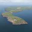
On-line Digital Images | DP 193525 | Oblique aerial view of the Mull of Galloway centred on the East and West Tarbet, looking N. | 7/7/2014 | Item Level |
 |
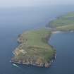
On-line Digital Images | DP 193526 | General oblique aerial view of the Mull of Galloway, looking NW. | 7/7/2014 | Item Level |
 |
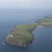
On-line Digital Images | DP 193527 | General oblique aerial view of the Mull of Galloway, looking WNW. | 7/7/2014 | Item Level |
 |
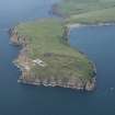
On-line Digital Images | DP 193528 | General oblique aerial view of the Mull of Galloway, looking WNW. | 7/7/2014 | Item Level |
 |
On-line Digital Images | DP 193530 | General oblique aerial view of the Mull of Galloway, looking NW. | 7/7/2014 | Item Level |
 |
On-line Digital Images | DP 193531 | Oblique aerial view of the Mull of Galloway centred on the East and West Tarbet, looking WSW. | 7/7/2014 | Item Level |
 |
On-line Digital Images | DP 193532 | Oblique aerial view of the Mull of Galloway centred on the East and West Tarbet, looking SW. | 7/7/2014 | Item Level |
 |
On-line Digital Images | DP 193533 | Oblique aerial view of the cropmarks of the curving ditch, looking SSE. | 7/7/2014 | Item Level |
 |
On-line Digital Images | DP 193535 | Oblique aerial view of the cropmarks of the curving ditch, looking WSW. | 7/7/2014 | Item Level |
 |
On-line Digital Images | DP 193537 | General oblique aerial view of the newly constructed A75 road line with Castle of Park in the foreground, looking W. | 7/7/2014 | Item Level |
 |
On-line Digital Images | DP 193540 | Oblique aerial view of the cropmarks of the ring ditch, looking E. | 7/7/2014 | Item Level |
 |
On-line Digital Images | DP 193542 | Oblique aerial view of the cropmarks of the ring ditch, looking WSW. | 7/7/2014 | Item Level |
 |
On-line Digital Images | DP 193544 | Oblique aerial view of the cropmarks of the quarries, looking ENE. | 7/7/2014 | Item Level |

© Historic Environment Scotland. Scottish Charity No. SC045925