Accessibility

Font Size

100% 150% 200%

Background Colour

Default Contrast
Close Reset

Scheduled Maintenance


Please be advised that this website will undergo scheduled maintenance on the following dates: •

Tuesday 3rd December 11:00-15:00

During these times, some services may be temporarily unavailable. We apologise for any inconvenience this may cause.


Archive relating to the RCAHMS Strath of Kildonan Survey

551 1/4/2/3

Description Archive relating to the RCAHMS Strath of Kildonan Survey

Date 1991 to 1992

Collection Records of the Royal Commission on the Ancient and Historical Monuments of Scotland (RCAHMS), Edinbu

Catalogue Number 551 1/4/2/3

Category All Other

Permalink http://canmore.org.uk/collection/1420012

Collection Hierarchy - Sub-Group Level

Preview Category Catalogue Number Title Date Level
All Other 551 1/4/2/3/1 Distribution maps Sub-Group Level
Digital Files (Non-image) DX 001419 RCAHMS Structures Database, Strath of Kildonan 1991 Item Level
On-line Digital Images On-line Digital Images SC 1019098 View of Dr Graham Ritchie carrying out an ALS survey. 6/1991 Item Level
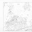
On-line Digital Images On-line Digital Images DP 054966 Publication drawing; plan of archaeological landscape at Learable 6/1991 Item Level
On-line Digital Images On-line Digital Images SC 1417789 Plan of Suisgill Broch 1991 Item Level
On-line Digital Images On-line Digital Images SC 2182539 RCAHMS Survey data plotted from several sources (Strath of Kildonan, map sheet NC82NE) 1992 Item Level
On-line Digital Images On-line Digital Images SC 2182540 RCAHMS Survey data plotted from several sources (Strath of Kildonan, map sheet NC82NW) 1992 Item Level
On-line Digital Images On-line Digital Images SC 2182541 RCAHMS Survey data plotted from several sources (Strath of Kildonan, map sheet NC82SE) 1992 Item Level
On-line Digital Images On-line Digital Images SC 2182542 RCAHMS Survey data plotted from several sources (Strath of Kildonan, map sheet NC92NW) 1992 Item Level
On-line Digital Images On-line Digital Images SC 2182543 RCAHMS Survey data plotted from several sources (Strath of Kildonan, map sheet NC92SW) 1992 Item Level
On-line Digital Images On-line Digital Images SC 2667818 Plan of archaeological landscape 1991 Item Level
Manuscripts MS 731/1 Printed and bound copies of the RCAHMSALS Field Survey Database entries (1-479), Strath of Kildonan 1991 Item Level
Prints and Drawings DC 26870/1 Plot of EDM survey data, Learable 1991 Item Level
Prints and Drawings DC 26870/4 EDM plot, Kinbrace Farm 1991 Item Level
Prints and Drawings DC 25715 PO Plan of hut-circles Item Level
Prints and Drawings DC 21601 Plan 1991 Item Level
Prints and Drawings DC 21603 Plan_of archaeological landscape 1991 Item Level
Prints and Drawings DC 21606 Plan of archaeological landscape 1991 Item Level
Prints and Drawings DC 21608 Plan of structure 'F' 1991 Item Level
Prints and Drawings DC 21611 Plan of structure 'F' 1991 Item Level
Prints and Drawings DC 21624 PO Plan of hut-circle 1991 Item Level
Prints and Drawings DC 25007 PO Plan of archaeological landscape 1992 Item Level
Prints and Drawings DC 21602 Plan of broch 1991 Item Level
Prints and Drawings DC 21609 Plan of broch 1991 Item Level

People and Organisations

Events