|
Digital Files (Non-image) |
GV 004309 |
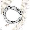
RCAHMS Plan of hut-circle at Lynebeg |
2007 |
Item Level |
|
Digital Files (Non-image) |
GV 004310 |
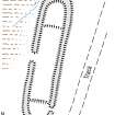
RCAHMS Plan of round-ended building on the E flank of Beinn Mhor. |
2007 |
Item Level |
|
Digital Files (Non-image) |
GV 004314 |
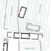
RCAHMS Plan of farmstead on the south-east flank of the Hill of Lethendry (NJ02NW 18). The farmstead, which was abandoned in the late 19th century, was surveyed because it displayed a depth of chronology that suggested a much earlier origin. |
2007 |
Item Level |
|
Digital Files (Non-image) |
GV 004315 |
RCAHMS Plan of Lethendry farmstead |
|
Item Level |
|
Digital Files (Non-image) |
GV 004316 |
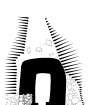
RCAHMS Fae, limekiln, Ground plan, scale 1:200 and West elevation, scale 1:100 |
2007 |
Item Level |
|
Digital Files (Non-image) |
GV 004317 |
RCAHMS Gaich Wood, cairn, plan |
2007 |
Item Level |
|
Digital Files (Non-image) |
GV 004318 |
RCAHMS Balnuick, Burnt Mound, plan |
2007 |
Item Level |
|
Digital Files (Non-image) |
GV 004319 |
RCAHMS Sliabhclachd, Kiln-barn, plan and section |
2007 |
Item Level |
|
Digital Files (Non-image) |
GV 004320 |
RCAHMS Laggandhu, Hut-circles, plan |
2007 |
Item Level |
|
Digital Files (Non-image) |
GV 004321 |
RCAHMS Lantachan, Hut-circle, plan |
2007 |
Item Level |
|
Digital Files (Non-image) |
GV 004323 |
RCAHMS Pityoulish, barrows, plan |
2007 |
Item Level |
|
Digital Files (Non-image) |
GV 004322 |
RCAHMS Laggandhu, Hut-circles and Farmstead, location map |
2007 |
Item Level |
|
Digital Files (Non-image) |
GV 004325 |
RCAHMS Plan of Pictish Barrow |
7/2007 |
Item Level |
|
Digital Files (Non-image) |
TM 000117 |
DXF file containing all Survey linework from the 2006 RCAHMS Braes of Abernethy survey |
1/2016 |
Item Level |
|
Digital Files (Non-image) |
TM 001101 |
Zip file containing all Survey files and linework from the RCAHMS Braes of Abernethy survey |
1/2016 |
Item Level |
 |
On-line Digital Images |
SC 1400261 |
RCAHMS illustration: Plan of hut-circle at Lynebeg |
2007 |
Item Level |
 |
On-line Digital Images |
SC 1400262 |
RCAHMS illustration: Plan of round-ended building on the E flank of Beinn Mhor |
2007 |
Item Level |
 |
On-line Digital Images |
SC 1400263 |
RCAHMS illustration: Hill of Lethendry, farmstead plan |
2007 |
Item Level |
 |
On-line Digital Images |
SC 1400264 |
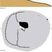
RCAHMS illustration: Fae, limekiln, Ground plan, scale 1:200 and West elevation |
2007 |
Item Level |
 |
On-line Digital Images |
SC 1400265 |
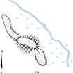
RCAHMS illustration: Gaich Wood, cairn, plan |
2007 |
Item Level |
 |
On-line Digital Images |
SC 1400266 |
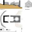
RCAHMS illustration: Balnuick, Burnt Mound, plan |
2007 |
Item Level |
 |
On-line Digital Images |
SC 1400267 |
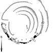
RCAHMS illustration: Sliabhclachd, Kiln-barn, plan and section |
2007 |
Item Level |
 |
On-line Digital Images |
SC 1400268 |
RCAHMS illustration: Laggandhu, Hut-circles, plan |
2007 |
Item Level |
 |
On-line Digital Images |
SC 1400269 |
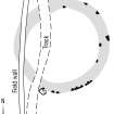
RCAHMS illustration: Lantachan, Hut-circle, plan |
2007 |
Item Level |


