Accessibility

Font Size

100% 150% 200%

Background Colour

Default Contrast
Close Reset

Selkirkshire Inventory (1957)

551 1/4/1/14

Description Selkirkshire Inventory (1957)

Collection Records of the Royal Commission on the Ancient and Historical Monuments of Scotland (RCAHMS), Edinbu

Catalogue Number 551 1/4/1/14

Category All Other

Permalink http://canmore.org.uk/collection/1336433

Collection Hierarchy - Sub-Group Level

Preview Category Catalogue Number Title Date Level
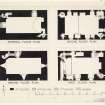
On-line Digital Images On-line Digital Images DP 157390 Publication plan of ground, first and second floors, Kirkhope Tower. c. 1934 Item Level
On-line Digital Images On-line Digital Images DP 157392 Publication drawing. Floor plans, Newark Castle. c. 1946 Item Level
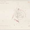
On-line Digital Images On-line Digital Images DP 157256 Plane table survey of Hangingshaw earthwork. 28/9/1949 Item Level
On-line Digital Images On-line Digital Images DP 157252 Publication plan of Hangingshaw earthwork. c. 1949 Item Level
On-line Digital Images On-line Digital Images DP 157298 Publication drawing. Plan and section of Howden Motte. c. 1950 Item Level
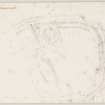
On-line Digital Images On-line Digital Images DP 157322 Publication plan of Leap Lin earthwork. c. 1950 Item Level
On-line Digital Images On-line Digital Images DP 157332 Plane table survey of Leap Lin earthwork. 25/5/1950 Item Level
On-line Digital Images On-line Digital Images DP 157355 Publication plan of Linglie Earthwork. c. 1949 Item Level
On-line Digital Images On-line Digital Images DP 157363 Plane table survey of Linglie Earthwork. 20/9/1949 Item Level
On-line Digital Images On-line Digital Images DP 157853 Publication plan of isolated building in old village at Over Kirkhope. c. 1950 Item Level
On-line Digital Images On-line Digital Images DP 157854 Publication plan of old village and chapel at Over Kirkhope. c. 1950 Item Level
On-line Digital Images On-line Digital Images DP 157860 Plane-table survey of old village at Over Kirkhope. 23/8/1950 Item Level
On-line Digital Images On-line Digital Images DP 157861 Plane-table survey of fort, NE of Rink Hill. 29/9/1949 Item Level
On-line Digital Images On-line Digital Images DP 157862 Plane-table survey of Rink Hill fort. 5/1950 Item Level
On-line Digital Images On-line Digital Images DP 157864 Plane-table survey of Torwoodlee Broch, sheet 1. 10/5/1950 Item Level
On-line Digital Images On-line Digital Images DP 157865 Plane table survey of Torwoodlee Broch, sheet 2. 5/1950 Item Level
On-line Digital Images On-line Digital Images DP 157866 Plane-table survey of Torwoodlee Broch, sheet 3. 5/1950 Item Level
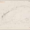
On-line Digital Images On-line Digital Images DP 157867 Publication plan of "Wallace's Trench" linear earthwork. c. 1950 Item Level
On-line Digital Images On-line Digital Images DP 158457 Publication drawing. Plan of Tushielaw Tower and associated buildings. c. 1934 Item Level
On-line Digital Images On-line Digital Images DP 158458 Plane-table survey of Tushielaw Tower. 27/8/1934 Item Level
On-line Digital Images On-line Digital Images DP 158459 Plane-table survey of 'Wallace's Trench' linear earthwork. 22/8/1950 Item Level
On-line Digital Images On-line Digital Images DP 158496 Publication plan of Wester Essenside fort. c. 1950 Item Level
On-line Digital Images On-line Digital Images DP 158497 Plane-table survey of Wester Eddenside fort. 1/6/1950 Item Level
On-line Digital Images On-line Digital Images DP 158498 Plane-table survey of Whytbank Tower. 29/5/1933 Item Level

People and Organisations

Events