Accessibility

Font Size

100% 150% 200%

Background Colour

Default Contrast
Close Reset

Pricing Change

New pricing for orders of material from this site will come into place shortly. Charges for supply of digital images, digitisation on demand, prints and licensing will be altered. 


Upcoming Maintenance

Please be advised that this website will undergo scheduled maintenance on the following dates:

Thursday, 9 January: 11:00 AM - 3:00 PM

Thursday, 23 January: 11:00 AM - 3:00 PM

Thursday, 30 January: 11:00 AM - 3:00 PM

During these times, some functionality such as image purchasing may be temporarily unavailable. We apologise for any inconvenience this may cause.


Kirkcudbright surveys

551 1/128/30/21

Description Kirkcudbright surveys

Collection Records of the Royal Commission on the Ancient and Historical Monuments of Scotland (RCAHMS), Edinbu

Catalogue Number 551 1/128/30/21

Category All Other

Permalink http://canmore.org.uk/collection/1307589

Collection Hierarchy - Batch Level

Preview Category Catalogue Number Title Date Level
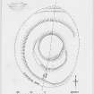
On-line Digital Images On-line Digital Images DP 148831 Inked plan: settlement at Auchenhay Bridge. c. 1953 Item Level
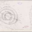
On-line Digital Images On-line Digital Images DP 148832 Plane-table survey: Auchenhay Bridge. 8/4/1953 Item Level
On-line Digital Images On-line Digital Images DP 148833 Inked plan (redrawn): Auchenhay Bridge. c. 1953 Item Level
On-line Digital Images On-line Digital Images DP 148834 Inked plan: Barr Hill fort. c. 1953 Item Level
On-line Digital Images On-line Digital Images DP 148835 Plane-table survey: Barr Hill fort. 9/4/1953 Item Level
On-line Digital Images On-line Digital Images DP 148836 Inked drawing: Castle Muir. c. 1959 Item Level
On-line Digital Images On-line Digital Images DP 148837 Plane-table survey: Castle Muir. 8/8/1953 Item Level
On-line Digital Images On-line Digital Images DP 148838 Inked drawing: Crofts Burn. c. 1953 Item Level
On-line Digital Images On-line Digital Images DP 148839 Plane-table survey: Crofts Burn. 9/4/1953 Item Level
On-line Digital Images On-line Digital Images DP 148840 Inked plan: The Doon, Twynholm. c. 1959 Item Level
On-line Digital Images On-line Digital Images DP 148841 Plane-table survey: The Doon, Twymholm. 30/9/1952 Item Level
On-line Digital Images On-line Digital Images DP 148842 Plane-table survey (sheet 1 of 2): Doon of Carsluith. 29/9/1952 Item Level
On-line Digital Images On-line Digital Images DP 148843 Plane-table survey (sheet 2 of 2): Doon of Carlsuith. 29/9/1952 Item Level
On-line Digital Images On-line Digital Images DP 148844 Plane-table survey: Dunguille Fort. 26/5/1954 Item Level
On-line Digital Images On-line Digital Images DP 148845 Plane-table survey (sheet 1 of 2): Giant's Dyke. 7/8/1953 Item Level
On-line Digital Images On-line Digital Images DP 148846 Plane-table survey (sheet 2 of 2): Giant's Dyke. 7/8/1953 Item Level
On-line Digital Images On-line Digital Images DP 148847 Inked drawing: Glenlair Burn. c. 1959 Item Level
On-line Digital Images On-line Digital Images DP 148848 Plane-table survey: Glenlair Burn. 9/4/1953 Item Level
On-line Digital Images On-line Digital Images DP 148849 Plane table survey: fort at Kerbers. 4/8/1953 Item Level
On-line Digital Images On-line Digital Images DP 148850 Inked plan: fort at Kerbers. c. 1953 Item Level
On-line Digital Images On-line Digital Images DP 148851 Inked plan: Kirkbride Settlement. c. 1952 Item Level
On-line Digital Images On-line Digital Images DP 148852 Plane-table survey: Kirkbride Settlement. 3/10/1952 Item Level
On-line Digital Images On-line Digital Images DP 148853 Plane-table survey (sheet 2 of 2): fort at Little Airds Hill. 5/8/1953 Item Level
On-line Digital Images On-line Digital Images DP 148854 Plane-table survey (sheet 1 of 2): Little Aird's Hill Fort. 5/8/1953 Item Level

People and Organisations

Events