 |
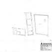
On-line Digital Images |
SC 1251044 |
Survey drawing; Osties Hill farmstead |
26/5/2004 |
Item Level |
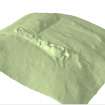 |
On-line Digital Images |
SC 1361901 |
Image showing a 3D model of South Yarrows South Long Cairn and the surrounding area. Note - this is a low resolution image. |
2004 |
Item Level |
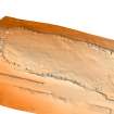 |
On-line Digital Images |
SC 1360954 |
Image of Achkinloch stone setting 3d model created in arcscene |
11/2013 |
Item Level |
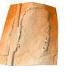 |
On-line Digital Images |
SC 1361158 |
Image of Achkinloch stone setting 3d model created in arcscene |
11/2013 |
Item Level |
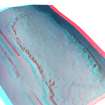 |
On-line Digital Images |
SC 1361160 |
3D anaglyph image of Achkinloch stone setting 3d model created in arcscene. (To be viewed with red/blue 3d glasses) |
11/2013 |
Item Level |
 |
On-line Digital Images |
SC 1361231 |
Rectified 1946 Aerial photograph showing the decoy airfield at Thrumster, Sarclet, Wick. There is a .tfw file to position this tif file. |
1946 |
Item Level |
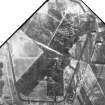 |
On-line Digital Images |
SC 1361329 |
Rectified 1947 Aerial photograph showing the decoy airfield at Thrumster, Sarclet, Wick. There is a .tfw file to position this tif file. |
1947 |
Item Level |
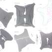 |
On-line Digital Images |
SC 1361809 |
Comparative page of short horned cairns from Caithness |
10/2004 |
Item Level |
 |
On-line Digital Images |
SC 1503185 |
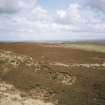
Garrywhin Fort: view from SW |
1995 |
Item Level |
 |
On-line Digital Images |
SC 1537452 |
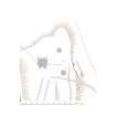
Adobe Illustrator site plan showing the Cairn of Get and surrounding features |
10/2011 |
Item Level |
 |
On-line Digital Images |
SC 1537454 |
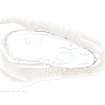
Adobe Illustrator plan of Garrywhin fort |
10/2011 |
Item Level |
 |
On-line Digital Images |
SC 1537456 |
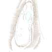
Adobe Illustrator plan of Garrywhin Fort |
10/2011 |
Item Level |
 |
On-line Digital Images |
SC 1537458 |
Adobe Illustrator plan of Garrywhin stone rows and cairn |
10/2011 |
Item Level |
 |
On-line Digital Images |
SC 1537461 |
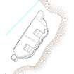
Adobe Illustrator plan of the Sarclet gun emplacement |
10/2011 |
Item Level |
 |
On-line Digital Images |
SC 1537463 |
Adobe Illustrator plan of the building at Groat's Loch |
10/2011 |
Item Level |
 |
On-line Digital Images |
SC 1537464 |
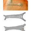
Adobe Illustrator comparative page showing 2 plans and a digital terrain model of South Yarrows South long cairn |
10/2011 |
Item Level |
 |
On-line Digital Images |
SC 1537472 |
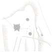
Site plan showing the Cairn of Get and surrounding features. |
10/2011 |
Item Level |
 |
On-line Digital Images |
SC 1537478 |
Adobe Illustrator plan of Garrywhin stone rows and cairn |
10/2011 |
Item Level |
|
Manuscripts |
MS 731/26 |
RCAHMS archaeological field survey database: Yarrows 2004. Held as an attribute table in GIS. See DX 001416 |
2005 |
Item Level |
|
Prints and Drawings |
DC 44691 |
RCAHMS survey drawing; Plan of standing stones at Broubster. |
7/7/2005 |
Item Level |
|
Prints and Drawings |
DC 44690 |
RCAHMS survey drawing; Plan of chambered cairn (ND34SW 4), cists and cairns (ND34SW 16), and limekiln and quarries (ND34SW 397). |
10/8/2004 |
Item Level |
|
Prints and Drawings |
DC 44689 |
RCAHMS survey drawing: Plan of fort at Garrywhin. |
30/6/2004 |
Item Level |
|
Prints and Drawings |
DC 44686 |
RCAHMS survey drawing; Plan of South Yarrows South long cairn. |
30/9/2004 |
Item Level |
|
Prints and Drawings |
DC 44687 |
Plan (additional detail to DC 44686) |
30/9/2004 |
Item Level |


