 |
On-line Digital Images |
SC 1346681 |
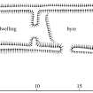
Plan of byre-house at Cadger Knowes. Fig 24 in "Well shelterd & watered" Menstrie Glen, a farming landscape near Stirling. |
2001 |
Item Level |
 |
On-line Digital Images |
SC 1346682 |
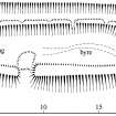
Plan of byre-house north of Quarterside of Lipney. Fig 25 in "Well shelterd & watered" Menstrie Glen, a farming landscape near Stirling. |
2001 |
Item Level |
 |
On-line Digital Images |
SC 1346683 |
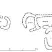
Publication drawing; plan of possible byre-house and earlier huts, Loss Hill. |
2001 |
Item Level |
 |
On-line Digital Images |
SC 1346653 |
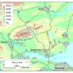
Map showing location of Menstrie Glen in eastern Scotland. Fig 2 in "Well shelterd & watered" Menstrie Glen, a farming landscape near Stirling. |
2001 |
Item Level |
 |
On-line Digital Images |
SC 1346654 |
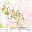
Map showing distribution of settlements in Menstrie Glen before the 1760s with head-dykes and cultivated ground. Fig 11 in "Well shelterd & watered" Menstrie Glen, a farming landscape near Stirling. |
2001 |
Item Level |
 |
On-line Digital Images |
SC 1346655 |
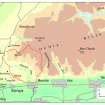
Map of the western end of the Ochils showing the location of Menstrie Glen. Fig 12 in "Well shelterd & watered" Menstrie Glen, a farming landscape near Stirling. |
2001 |
Item Level |
 |
On-line Digital Images |
SC 1346656 |
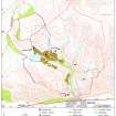
Map depicting arable land and settlement in the early 19th century. Fig 21 in "Well shelterd & watered" Menstrie Glen, a farming landscape near Stirling. |
2001 |
Item Level |
 |
On-line Digital Images |
SC 1440960 |
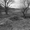
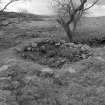
View of southern farmstead from north; detail of corn-drying kiln bowl. |
1998 |
Item Level |
 |
On-line Digital Images |
SC 1440961 |
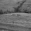
View of southern farmstead from north; detail of corn-drying kiln bowl from north. |
1998 |
Item Level |
 |
On-line Digital Images |
SC 1440962 |
View of hut near farmstead. |
1998 |
Item Level |
 |
On-line Digital Images |
SC 1440963 |
View of hut near farmstead. |
1998 |
Item Level |
 |
On-line Digital Images |
SC 1440964 |
View of farmstead from north. |
1998 |
Item Level |
 |
On-line Digital Images |
SC 1440965 |
View of farmstead from south. |
1998 |
Item Level |
 |
On-line Digital Images |
SC 1440966 |
View of farmstead from south. |
1998 |
Item Level |
 |
On-line Digital Images |
SC 1440967 |
View of farmstead from south. |
1998 |
Item Level |
 |
On-line Digital Images |
SC 1440968 |
General view of Menstrie Glen from Backside of Lipney looking north-west across the glen. |
1998 |
Item Level |
 |
On-line Digital Images |
SC 1440969 |
General view of Menstrie Glen from Ashentrool (NS89NW 56.00) looking south-east. |
1998 |
Item Level |
 |
On-line Digital Images |
SC 1440970 |
General view of Menstrie Glen from Ashentrool (NS89NW 56.00) looking south-east. |
1998 |
Item Level |
 |
On-line Digital Images |
SC 1440971 |
General view of Menstrie Glen from Ashentrool (NS89NW 56.00) looking south-east. |
1998 |
Item Level |
 |
On-line Digital Images |
SC 1440972 |
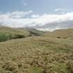
View of Menstrie Glen from Ashentool |
1998 |
Item Level |
 |
On-line Digital Images |
SC 1440973 |
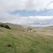
General view of Menstrie Glen from Loss. |
1998 |
Item Level |
 |
On-line Digital Images |
SC 1440974 |
General view of Menstrie Glen from Ashentrool towards Loss. |
1998 |
Item Level |
 |
On-line Digital Images |
SC 1440975 |
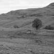
View of farmstead and country house from north. |
1998 |
Item Level |
 |
On-line Digital Images |
SC 1440976 |
View of farmstead and country house from north. |
1998 |
Item Level |


