Sortie 2015/25
551 178/2019/22
Description Sortie 2015/25
Date 9/7/2015
Collection RCAHMS Aerial Photography Digital
Catalogue Number 551 178/2019/22
Category All Other
Permalink http://canmore.org.uk/collection/1482382
Description Sortie 2015/25
Date 9/7/2015
Collection RCAHMS Aerial Photography Digital
Catalogue Number 551 178/2019/22
Category All Other
Permalink http://canmore.org.uk/collection/1482382
Collection Level (551 178) RCAHMS Aerial Photography Digital
> Group Level (551 178/2019) 2015 Photographs
>> Sub-Group Level (551 178/2019/22) Sortie 2015/25
| Preview | Category | Catalogue Number | Title | Date | Level |
|---|---|---|---|---|---|
 |
On-line Digital Images | DP 216786 | Oblique aerial view of the cropmarks, looking SSE. | 9/7/2015 | Item Level |
 |
On-line Digital Images | DP 216787 | Oblique aerial view of the cropmarks, looking SE. | 9/7/2015 | Item Level |
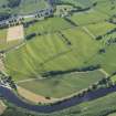 |
On-line Digital Images | DP 216788 | General oblique aerial view of the cropmarks of the Roman Temporary Camps, looking S. | 9/7/2015 | Item Level |
 |
On-line Digital Images | DP 216789 | General oblique aerial view of the cropmarks of the Roman Temporary Camps, looking SSE. | 9/7/2015 | Item Level |
 |
On-line Digital Images | DP 216792 | Oblique aerial view of the cropmarks of the enclosure, looking ENE. | 9/7/2015 | Item Level |
 |
On-line Digital Images | DP 216793 | Oblique aerial view of the cropmarks of the enclosure, pits and the possible enclosure, looking NE. | 9/7/2015 | Item Level |
 |
On-line Digital Images | DP 216796 | Oblique aerial view of the cropmarks of the enclosure, looking NW. | 9/7/2015 | Item Level |
 |
On-line Digital Images | DP 216798 | Oblique aerial view of the cropmarks of the fort, looking WSW. | 9/7/2015 | Item Level |
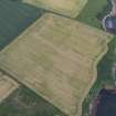 |
On-line Digital Images | DP 216722 | Oblique aerial view of the cropmarks of the enclosure and the site of Seacliff Tower, looking NW. | 9/7/2015 | Item Level |
 |
On-line Digital Images | DP 216724 | Oblique aerial view of the cropmarks, looking ENE. | 9/7/2015 | Item Level |
 |
On-line Digital Images | DP 216726 | Oblique aerial view of Traprain Law, looking ENE. | 9/7/2015 | Item Level |
 |
On-line Digital Images | DP 216728 | Oblique aerial view of the cropmarks of the possible pits and field boundary, looking N. | 9/7/2015 | Item Level |
 |
On-line Digital Images | DP 216729 | Oblique aerial view of the cropmarks of the possible field boundary, looking SE. | 9/7/2015 | Item Level |
 |
On-line Digital Images | DP 216731 | Oblique aerial view of the cropmarks of the fort, looking SSE. | 9/7/2015 | Item Level |
 |
On-line Digital Images | DP 216733 | Oblique aerial view of the cropmarks of the fort, looking ENE. | 9/7/2015 | Item Level |
 |
On-line Digital Images | DP 216735 | Oblique aerial view of the cropmarks of the possible field boundary, looking NNW. | 9/7/2015 | Item Level |
 |
On-line Digital Images | DP 216746 | Oblique aerial view of the cropmarks of the settlement, looking NE. | 9/7/2015 | Item Level |
 |
On-line Digital Images | DP 216747 | Oblique aerial view of the cropmarks of the settlement, looking NNE. | 9/7/2015 | Item Level |
 |
On-line Digital Images | DP 216750 | Oblique aerial view of the cropmarks of the fort and settlement, looking SW. | 9/7/2015 | Item Level |
 |
On-line Digital Images | DP 216749 | Oblique aerial view of the cropmarks of the settlement, looking NW. | 9/7/2015 | Item Level |
 |
On-line Digital Images | DP 216754 | Oblique aerial view of the cropmarks of the possible ring ditches and the geological features, looking NNE. | 9/7/2015 | Item Level |
 |
On-line Digital Images | DP 216755 | Oblique aerial view of the cropmarks of the possible ring ditches and the geological features, looking NNW. | 9/7/2015 | Item Level |
 |
On-line Digital Images | DP 216757 | Oblique aerial view of the cropmarks of the possible pits, looking NW. | 9/7/2015 | Item Level |
 |
On-line Digital Images | DP 216759 | Oblique aerial view of the cropmarks of the possible pits, looking WSW. | 9/7/2015 | Item Level |

© Historic Environment Scotland. Scottish Charity No. SC045925