Sortie 2015/06
551 178/2019/1
Description Sortie 2015/06
Date 17/4/2015
Collection RCAHMS Aerial Photography Digital
Catalogue Number 551 178/2019/1
Category All Other
Permalink http://canmore.org.uk/collection/1472658
Description Sortie 2015/06
Date 17/4/2015
Collection RCAHMS Aerial Photography Digital
Catalogue Number 551 178/2019/1
Category All Other
Permalink http://canmore.org.uk/collection/1472658
Collection Level (551 178) RCAHMS Aerial Photography Digital
> Group Level (551 178/2019) 2015 Photographs
>> Sub-Group Level (551 178/2019/1) Sortie 2015/06
| Preview | Category | Catalogue Number | Title | Date | Level |
|---|---|---|---|---|---|
| Digital Files (Non-image) | TM 000721 | GPS recorded flight path and map for Sortie 2015/06 | 17/4/2015 | Item Level | |
 |
On-line Digital Images | DP 209593 | Oblique aerial view of the soilmarks of the oval feature, looking WSW. | 17/4/2015 | Item Level |
 |
On-line Digital Images | DP 209594 | Oblique aerial view of the soilmarks of the Roman Temporary Camp ditch and entrance, looking NNW. | 17/4/2015 | Item Level |
 |
On-line Digital Images | DP 209595 | Oblique aerial view of the soilmarks of the Roman Temporary Camp ditch and entrance, looking NW. | 17/4/2015 | Item Level |
 |
On-line Digital Images | DP 209596 | Oblique aerial view of the soilmarks of the Roman Temporary Camp ditch and entrance, looking WNW. | 17/4/2015 | Item Level |
 |
On-line Digital Images | DP 209597 | Oblique aerial view with the soilmarks of the Roman Temporary Camp ditch and entrance in the distance, looking NW. | 17/4/2015 | Item Level |
 |
On-line Digital Images | DP 209598 | Oblique aerial view with the soilmarks of the Roman Temporary Camp ditch and entrance at the centre left, looking SE. | 17/4/2015 | Item Level |
 |
On-line Digital Images | DP 209599 | Oblique aerial view of the fort at Dow Hill after tree clearance, looking SSE. | 17/4/2015 | Item Level |
 |
On-line Digital Images | DP 209600 | Oblique aerial view of the fort at Dow Hill after tree clearance, looking S. | 17/4/2015 | Item Level |
 |
On-line Digital Images | DP 209601 | Oblique aerial view of the fort at Dow Hill after tree clearance, looking SSE. | 17/4/2015 | Item Level |
 |
On-line Digital Images | DP 209602 | Oblique aerial view of the soilmarks of the rig, looking NW. | 17/4/2015 | Item Level |
 |
On-line Digital Images | DP 209606 | General oblique aerial view of the policies at Rossie Priory, looking NNW. | 17/4/2015 | Item Level |
 |
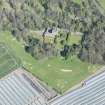
On-line Digital Images | DP 209611 | Oblique aerial view of Kellie Castle and the golf course, looking N. | 17/4/2015 | Item Level |
 |
On-line Digital Images | DP 209613 | Oblique aerial view of the soilmarks of the plantation banks, looking S. | 17/4/2015 | Item Level |
 |
On-line Digital Images | DP 209618 | Oblique aerial view of the cairn after tree clearance, looking NW. | 17/4/2015 | Item Level |
 |
On-line Digital Images | DP 209622 | Oblique aerial view of the fort at Dunmore, looking N. | 17/4/2015 | Item Level |
 |
On-line Digital Images | DP 209614 | Oblique aerial view of the soilmarks of the plantation banks, looking NE. | 17/4/2015 | Item Level |
 |
On-line Digital Images | DP 209615 | Oblique aerial view of the soilmarks of the fort at The Welton, looking S. | 17/4/2015 | Item Level |
 |
On-line Digital Images | DP 209616 | Oblique aerial view of the soilmarks of the fort at The Welton with the farm adjacent, looking WSW. | 17/4/2015 | Item Level |
 |
On-line Digital Images | DP 209617 | Oblique aerial view of the soilmarks of the fort at The Welton, looking SSW. | 17/4/2015 | Item Level |
 |
On-line Digital Images | DP 209619 | Oblique aerial view of the cairn after tree clearance, looking WSW. | 17/4/2015 | Item Level |
 |
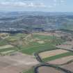
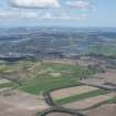
On-line Digital Images | DP 209620 | General oblique aerial view with Perth and the Friarton Bridge in the middle distance, Strathmore beyond and the Tay extending to the right, looking NE. | 17/4/2015 | Item Level |
 |
On-line Digital Images | DP 209621 | General oblique aerial view with Perth and the Friarton Bridge in the middle distance, Strathmore beyond and the Tay extending to the right, looking NE. | 17/4/2015 | Item Level |
 |
On-line Digital Images | DP 209604 | Oblique aerial view of the reed beds on the River Tay between Seaside House and Powgavie, looking NE. | 17/4/2015 | Item Level |

© Historic Environment Scotland. Scottish Charity No. SC045925