Sortie 2014/01
551 178/2018/1
Description Sortie 2014/01
Collection RCAHMS Aerial Photography Digital
Catalogue Number 551 178/2018/1
Category All Other
Permalink http://canmore.org.uk/collection/1407682
Description Sortie 2014/01
Collection RCAHMS Aerial Photography Digital
Catalogue Number 551 178/2018/1
Category All Other
Permalink http://canmore.org.uk/collection/1407682
Collection Level (551 178) RCAHMS Aerial Photography Digital
> Sub-Group Level (551 178/2018) 2014 Photographs
>> Sub-Group Level (551 178/2018/1) Sortie 2014/01
| Preview | Category | Catalogue Number | Title | Date | Level |
|---|---|---|---|---|---|
| Digital Files (Non-image) | TM 000760 | GPS recorded flight path and map for Sortie 2014/01 | 30/1/2014 | Item Level | |
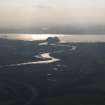 |
On-line Digital Images | DP 175430 | General oblique aerial view of the Firth of Clyde and Dumbarton Castle, looking to the SSW. | 30/1/2014 | Item Level |
 |
On-line Digital Images | DP 175431 | Oblique aerial view of the Lurg Moor Roman fortlet, looking to the S. | 30/1/2014 | Item Level |
 |
On-line Digital Images | DP 175432 | Oblique aerial view of the Lurg Moor Roman fortlet, looking to the NW. | 30/1/2014 | Item Level |
 |
On-line Digital Images | DP 175433 | Oblique aerial view of the Lurg Moor Roman fortlet, looking to the W. | 30/1/2014 | Item Level |
 |
On-line Digital Images | DP 175434 | Oblique aerial view of the Lurg Moor Roman fortlet, looking to the WSW. | 30/1/2014 | Item Level |
 |
On-line Digital Images | DP 175435 | Oblique aerial view of the remains of the farmstead and rig, looking to the NE. | 30/1/2014 | Item Level |
 |
On-line Digital Images | DP 175436 | General oblique aerial view of the remains of the field boundaries, looking to the NNW. | 30/1/2014 | Item Level |
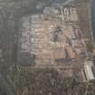 |
On-line Digital Images | DP 175437 | Oblique aerial view of the remains of Inverkip power station during post-demolition clearance, looking to the WSW. | 30/1/2014 | Item Level |
 |
On-line Digital Images | DP 175438 | Oblique aerial view of the remains of Inverkip power station during post-demolition clearance, looking to the SW. | 30/1/2014 | Item Level |
 |
On-line Digital Images | DP 175441 | Oblique aerial view of the remains of Inverkip power station during post-demolition clearance, looking to the ENE. | 30/1/2014 | Item Level |
 |
On-line Digital Images | DP 175443 | Oblique aerial view of the remains of Inverkip power station during post-demolition clearance, looking to the WNW. | 30/1/2014 | Item Level |
 |
On-line Digital Images | DP 175446 | Oblique aerial view of the remains of Inverkip power station during post-demolition clearance, looking to the NNE. | 30/1/2014 | Item Level |
 |
On-line Digital Images | DP 175448 | Oblique aerial view of the remains of Inverkip power station during post-demolition clearance, looking to the NNE. | 30/1/2014 | Item Level |
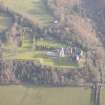 |
On-line Digital Images | DP 175450 | General oblique aerial view of Skelmorlie Castle, lookingt o the E. | 30/1/2014 | Item Level |
 |
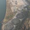
On-line Digital Images | DP 175439 | General oblique aerial view of the remains of Inverkip power station during post-demolition clearance, looking to the NE. | 30/1/2014 | Item Level |
 |
On-line Digital Images | DP 175440 | General oblique aerial view of the remains of Inverkip power station during post-demolition clearance, looking to the NNE. | 30/1/2014 | Item Level |
 |
On-line Digital Images | DP 175442 | General oblique aerial view of the remains of Inverkip power station during post-demolition clearance, looking to the NNE. | 30/1/2014 | Item Level |
 |
On-line Digital Images | DP 175444 | Oblique aerial view of the remains of Inverkip power station during post-demolition clearance, looking to the W. | 30/1/2014 | Item Level |
 |
On-line Digital Images | DP 175445 | Oblique aerial view of the remains of Inverkip power station during post-demolition clearance, looking to the SSW. | 30/1/2014 | Item Level |
 |
On-line Digital Images | DP 175447 | Oblique aerial view of the remains of Inverkip power station during post-demolition clearance, looking to the NE. | 30/1/2014 | Item Level |
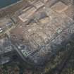 |
On-line Digital Images | DP 175449 | Oblique aerial view of the remains of Inverkip power station during post-demolition clearance, looking to the NNW. | 30/1/2014 | Item Level |
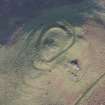 |
On-line Digital Images | DP 175451 | Oblique aerial view of The Knock fort, looking to the NNW. | 30/1/2014 | Item Level |
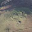 |
On-line Digital Images | DP 175452 | Oblique aerial view of The Knock fort, looking to the NW. | 30/1/2014 | Item Level |

© Historic Environment Scotland. Scottish Charity No. SC045925