Sortie 2013/26
551 178/2017/36
Description Sortie 2013/26
Collection RCAHMS Aerial Photography Digital
Catalogue Number 551 178/2017/36
Category All Other
Permalink http://canmore.org.uk/collection/1355878
Description Sortie 2013/26
Collection RCAHMS Aerial Photography Digital
Catalogue Number 551 178/2017/36
Category All Other
Permalink http://canmore.org.uk/collection/1355878
Collection Level (551 178) RCAHMS Aerial Photography Digital
> Sub-Group Level (551 178/2017) 2013 Photographs
>> Sub-Group Level (551 178/2017/36) Sortie 2013/26
| Preview | Category | Catalogue Number | Title | Date | Level |
|---|---|---|---|---|---|
| Digital Files (Non-image) | TM 000829 | GPS recorded flight path and map for Sortie 2013/26 | 14/7/2013 | Item Level | |
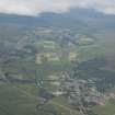 |
On-line Digital Images | DP 163919 | General oblique aerial view of Kingussie with Newtonmore beyond, looking WSW. | 17/7/2013 | Item Level |
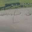 |
On-line Digital Images | DP 163920 | Oblique aerial view of the fish traps at Whinbrae, looking S. | 17/7/2013 | Item Level |
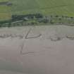 |
On-line Digital Images | DP 163921 | Oblique aerial view of the fish traps at Whinbrae, looking S. | 17/7/2013 | Item Level |
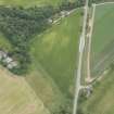 |
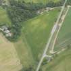
On-line Digital Images | DP 163922 | Oblique aerial view of the cropmarks of the ring ditch, looking ESE. | 17/7/2013 | Item Level |
 |
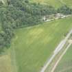
On-line Digital Images | DP 163923 | Oblique aerial view of the cropmarks of the ring ditch, looking E. | 17/7/2013 | Item Level |
 |
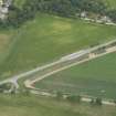
On-line Digital Images | DP 163924 | Oblique aerial view of the cropmarks of the ring ditch, looking ENE. | 17/7/2013 | Item Level |
 |
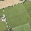
On-line Digital Images | DP 163925 | Oblique aerial view of the cropmarks of the ring ditch, looking NE. | 17/7/2013 | Item Level |
 |
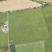
On-line Digital Images | DP 163926 | Oblique aerial view of the cropmarks of the enclosure at Easter Moniack, looking NNW. | 17/7/2013 | Item Level |
 |
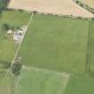
On-line Digital Images | DP 163927 | Oblique aerial view of the cropmarks of the enclosure at Easter Moniack, looking NW. | 17/7/2013 | Item Level |
 |
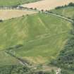
On-line Digital Images | DP 163928 | Oblique aerial view of the cropmarks of the enclosure at Easter Moniack, looking WNW. | 17/7/2013 | Item Level |
 |
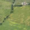
On-line Digital Images | DP 163929 | Oblique aerial view of a cropmarks of the enclosure, field boundary and pits, looking SSE. | 17/7/2013 | Item Level |
 |
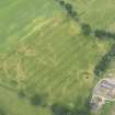
On-line Digital Images | DP 163931 | Oblique aerial view of the cropmarks of the pits and possible round house at Moniack Castle, looking NE. | 17/7/2013 | Item Level |
 |
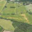
On-line Digital Images | DP 163934 | Oblique aerial view of the cropmarks of the pits and possible round house at Moniack Castle, looking WNW. | 17/7/2013 | Item Level |
 |
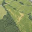
On-line Digital Images | DP 163936 | Oblique aerial view of cropmarks of the rig and furrow, looking E. | 17/7/2013 | Item Level |
 |
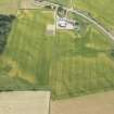
On-line Digital Images | DP 163938 | Oblique aerial view of cropmarks of the rig and furrow, looking NE. | 17/7/2013 | Item Level |
 |
On-line Digital Images | DP 163940 | Oblique aerial view of the cropmarks of the ring ditch, looking SE. | 17/7/2013 | Item Level |
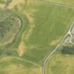 |
On-line Digital Images | DP 163943 | Oblique aerial view of the cropmarks of the enclosure, possible round house and pits, looking NNE. | 17/7/2013 | Item Level |
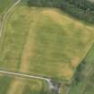 |
On-line Digital Images | DP 163944 | Oblique aerial view of the cropmarks of the enclosure, looking NNE. | 17/7/2013 | Item Level |
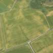 |
On-line Digital Images | DP 163945 | Oblique aerial view of the cropmarks of the possible road and the possible round houses, looking N. | 17/7/2013 | Item Level |
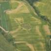 |
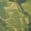
On-line Digital Images | DP 163946 | Oblique aerial view of the cropmarks of the barrow cemetery, enclosure, track and pits at Tarradale House, looking NNW. | 17/7/2013 | Item Level |
 |
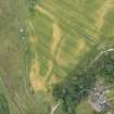
On-line Digital Images | DP 163947 | Oblique aerial view of the cropmarks of the barrow cemetery, enclosure, track and pits at Tarradale House, looking NNW. | 17/7/2013 | Item Level |
 |
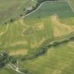
On-line Digital Images | DP 163948 | Oblique aerial view of the cropmarks of the track and pits at Tarradale House, looking WNW. | 17/7/2013 | Item Level |
 |
On-line Digital Images | DP 163949 | Oblique aerial view of the cropmarks of the barrow cemetery, enclosure, track and pits at Tarradale House, looking WSW. | 17/7/2013 | Item Level |

© Historic Environment Scotland. Scottish Charity No. SC045925