Sortie 2013/25
551 178/2017/35
Description Sortie 2013/25
Collection RCAHMS Aerial Photography Digital
Catalogue Number 551 178/2017/35
Category All Other
Permalink http://canmore.org.uk/collection/1355658
Description Sortie 2013/25
Collection RCAHMS Aerial Photography Digital
Catalogue Number 551 178/2017/35
Category All Other
Permalink http://canmore.org.uk/collection/1355658
Collection Level (551 178) RCAHMS Aerial Photography Digital
> Sub-Group Level (551 178/2017) 2013 Photographs
>> Sub-Group Level (551 178/2017/35) Sortie 2013/25
| Preview | Category | Catalogue Number | Title | Date | Level |
|---|---|---|---|---|---|
 |
On-line Digital Images | DP 163901 | Oblique aerial view of the cromarks of the enclosures and settlement at Luffness Mains, looking W. | 8/7/2013 | Item Level |
 |
On-line Digital Images | DP 163904 | Oblique aerial view of the cropmarks of the enclosure on Rigley Hill, looking SW. | 8/7/2013 | Item Level |
 |
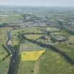
On-line Digital Images | DP 163903 | General oblique aerial view of poppy field close to Easter Pentcaitland, looking SW. | 8/7/2013 | Item Level |
 |
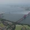
On-line Digital Images | DP 163907 | General oblique aerial view of the Forth Bridge, looking NW. | 8/7/2013 | Item Level |
 |
On-line Digital Images | DP 163909 | General oblique aerial view of the Forth Bridge centred on Inchgarvie, looking W. | 8/7/2013 | Item Level |
 |
On-line Digital Images | DP 163912 | General oblique aerial view of the Forth Bridge and the road bridge, looking W. | 8/7/2013 | Item Level |
 |
On-line Digital Images | DP 163914 | General oblique aerial view of the Forth Bridge and the road bridge, looking SW. | 8/7/2013 | Item Level |
 |
On-line Digital Images | DP 163815 | Oblique aerial view of the cropmarks of the settlement enclosure at Pathhead, looking W. | 8/7/2013 | Item Level |
 |
On-line Digital Images | DP 163817 | Oblique aerial view of the cropmarks of the settlement enclosure at Pathhead, looking N. | 8/7/2013 | Item Level |
 |
On-line Digital Images | DP 163819 | Oblique aerial view of the cropmarks of the ring ditches, settlement and pit alignment at Victoria Jubilee Bridge, looking E. | 8/7/2013 | Item Level |
 |
On-line Digital Images | DP 163820 | Oblique aerial view of the cropmarks of the ring ditches, settlement and pit alignment at Victoria Jubilee Bridge, looking E. | 8/7/2013 | Item Level |
 |
On-line Digital Images | DP 163822 | Oblique aerial view of the cropmarks of the ring ditches, settlement and pit alignment at Victoria Jubilee Bridge, looking N. | 8/7/2013 | Item Level |
 |
On-line Digital Images | DP 163824 | Oblique aerial view of the cropmarks of the drain and possible ring ditches at Horn Burn, looking N. | 8/7/2013 | Item Level |
 |
On-line Digital Images | DP 163825 | Oblique aerial view of the cropmarks of the ring ditches, settlement and pit alignment at Victoria Jubilee Bridge, looking SSW. | 8/7/2013 | Item Level |
 |
On-line Digital Images | DP 163827 | Oblique aerial view of the cropmarks of the ring ditches, settlement and pit alignment at Victoria Jubilee Bridge, looking SE. | 8/7/2013 | Item Level |
 |
On-line Digital Images | DP 163829 | Oblique aerial view of cropmarks of the field boundary at Blackburn, looking N. | 8/7/2013 | Item Level |
 |
On-line Digital Images | DP 163840 | General oblique aerial view of Roxburgh, looking NE. | 8/7/2013 | Item Level |
 |
On-line Digital Images | DP 163842 | Oblique aerial view of the cropmarks of the Roman fort at Newstead, looking N. | 8/7/2013 | Item Level |
 |
On-line Digital Images | DP 163844 | Oblique aerial view of the cropmarks of the enclosure at East Morrison, looking W. | 8/7/2013 | Item Level |
 |
On-line Digital Images | DP 163846 | Oblique aerial view of the cropmarks of the enclosures at East Morrison, looking N. | 8/7/2013 | Item Level |
 |
On-line Digital Images | DP 163847 | Oblique aerial view of the cropmarks of the enclosures at East Morrison, looking SW. | 8/7/2013 | Item Level |
 |
On-line Digital Images | DP 163849 | Oblique aerial view of the cropmarks of the enclosures at East Morrison, looking E. | 8/7/2013 | Item Level |
 |
On-line Digital Images | DP 163851 | Oblique aerial view of Berwickshire High School at Duns, Langtongate, looking NW. | 8/7/2013 | Item Level |
 |
On-line Digital Images | DP 163853 | Oblique aerial view of the grass cutting pattern and part of the road close to Monashee Farm, looking SW. | 8/7/2013 | Item Level |

© Historic Environment Scotland. Scottish Charity No. SC045925