Sortie 2013/36
551 178/2017/20
Description Sortie 2013/36
Collection RCAHMS Aerial Photography Digital
Catalogue Number 551 178/2017/20
Category All Other
Permalink http://canmore.org.uk/collection/1348923
Description Sortie 2013/36
Collection RCAHMS Aerial Photography Digital
Catalogue Number 551 178/2017/20
Category All Other
Permalink http://canmore.org.uk/collection/1348923
Collection Level (551 178) RCAHMS Aerial Photography Digital
> Sub-Group Level (551 178/2017) 2013 Photographs
>> Sub-Group Level (551 178/2017/20) Sortie 2013/36
| Preview | Category | Catalogue Number | Title | Date | Level |
|---|---|---|---|---|---|
 |
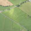
On-line Digital Images | DP 160708 | Oblique aerial view of the cropmarks of the Roman Temporary Camp at Lochrutton, looking SE. | 6/8/2013 | Item Level |
 |
On-line Digital Images | DP 160709 | Oblique aerial view of the cropmarks of the Roman Temporary Camp at Lochrutton, looking E. | 6/8/2013 | Item Level |
 |
On-line Digital Images | DP 160711 | Oblique aerial view of the cropmarks of the settlement and possible enclosure at Heatheryhall, looking W. | 6/8/2013 | Item Level |
 |
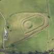
On-line Digital Images | DP 160712 | Oblique aerial view of the cropmarks of the possible enclosure at Heatheryhall, looking WSW. | 6/8/2013 | Item Level |
 |
On-line Digital Images | DP 160713 | Oblique aerial view of the cropmarks of the settlement and possible enclosure at Heatheryhall, looking E. | 6/8/2013 | Item Level |
 |
On-line Digital Images | DP 160714 | Oblique aerial view of the cropmarks of the settlement and possible enclosure at Heatheryhall, looking E. | 6/8/2013 | Item Level |
 |
On-line Digital Images | DP 160715 | Oblique aerial view of the cropmarks of the settlement at Heatheryhall, looking E. | 6/8/2013 | Item Level |
 |
On-line Digital Images | DP 160717 | Oblique aerial view of the cropmarks of the settlement and possible enclosure at Heatheryhall, looking N. | 6/8/2013 | Item Level |
 |
On-line Digital Images | DP 160718 | General oblique aerial view of the cropmarks of the settlements and field boundaries at Cragie Burn, looking N. | 6/8/2013 | Item Level |
 |
On-line Digital Images | DP 160719 | Oblique aerial view of the cropmarks of the settlements and field boundaries at Cragie Burn, looking W. | 6/8/2013 | Item Level |
 |
On-line Digital Images | DP 160721 | Oblique aerial view of the cropmarks of the settlements and field boundaries at Cragie Burn, looking W. | 6/8/2013 | Item Level |
 |
On-line Digital Images | DP 160723 | Oblique aerial view of the cropmarks of the settlement at Heatheryhall, looking E. | 6/8/2013 | Item Level |
 |
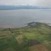
On-line Digital Images | DP 160727 | Oblique aerial view of the roadworks on the A75 near Carrutherstown with the Solway in the distance, looking SE. | 6/8/2013 | Item Level |
 |
On-line Digital Images | DP 160728 | Oblique aerial view of the Twelve Apostles stone circle, looking NNE. | 6/8/2013 | Item Level |
 |
On-line Digital Images | DP 160730 | General oblique aerial view of Southerness, looking S. | 6/8/2013 | Item Level |
 |
On-line Digital Images | DP 160732 | Oblique aerial view of the Mote of Urr, looking W. | 6/8/2013 | Item Level |
 |
On-line Digital Images | DP 160734 | Oblique aerial view of the Mote of Urr, looking N. | 6/8/2013 | Item Level |
 |
On-line Digital Images | DP 160736 | Oblique aerial view of the Mote of Urr, looking W. | 6/8/2013 | Item Level |
 |
On-line Digital Images | DP 160738 | Oblique aerial view of the Mote of Urr, looking SW. | 6/8/2013 | Item Level |
 |
On-line Digital Images | DP 160741 | General oblique aerial view of Sandgreen farm and coastline, looking SE. | 6/8/2013 | Item Level |
 |
On-line Digital Images | DP 160743 | Oblique aerial view of the M74 and Thirstone Quarry, looking WNW. | 6/8/2013 | Item Level |
 |
On-line Digital Images | DP 160745 | Oblique aerial view of the dockyard at Rosyth, looking W. | 6/8/2013 | Item Level |
 |
On-line Digital Images | DP 160749 | Oblique aerial view of the works at Cowdenbeath, looking W. | 6/8/2013 | Item Level |
 |
On-line Digital Images | DP 160704 | Oblique aerial view of the cairn at Carlochan Hill, looking W. | 6/8/2013 | Item Level |

© Historic Environment Scotland. Scottish Charity No. SC045925