551 177/14
Description 1989 Photographs
Collection RCAHMS Aerial Photography
Catalogue Number 551 177/14
Category All Other
Permalink http://canmore.org.uk/collection/1346479
Collection Hierarchy - Sub-Group Level
Collection Level (551 177) RCAHMS Aerial Photography
> Sub-Group Level (551 177/14) 1989 Photographs
| Preview | Category | Catalogue Number | Title | Date | Level |
|---|---|---|---|---|---|
 |
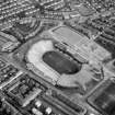
On-line Digital Images | SC 1078527 | Glasgow, Mount Florida, Hampden Park Stadium. Digital copy of photograph of general aerial view. | 1989 | Item Level |
 |
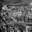
On-line Digital Images | SC 1075689 | Aerial view. | 1989 | Item Level |
| Photographs and Off-line Digital Images | H 92130 PO | Oblique aerial view centred on the cropmarks of the enclosures, taken from the SE. | 5/7/1989 | Item Level | |
| Photographs and Off-line Digital Images | H 92131 PO | Oblique aerial view centred on the cropmarks of the enclosure, taken from the NW. | 5/7/1989 | Item Level | |
| Photographs and Off-line Digital Images | H 92132 PO | Oblique aerial view centred on the cropmarks of the enclosure, taken from the SE. | 5/7/1989 | Item Level | |
| Photographs and Off-line Digital Images | H 92133 PO | Oblique aerial view centred on the cropmarks of the enclosure, ring-ditches, pits and barrows, taken from the NE. | 5/7/1989 | Item Level | |
| Photographs and Off-line Digital Images | H 92134 PO | General oblique aerial view centred on the cropmarks of the rig and field boundary with the farmhouse and farmsteading in the distance, taken from the SW. | 5/7/1989 | Item Level | |
| Photographs and Off-line Digital Images | H 92135 PO | Oblique aerial view centred on the cropmarks of the ring-ditch, pits, field boundary and possible pit-alignment, taken from the W. | 5/7/1989 | Item Level | |
| Photographs and Off-line Digital Images | H 92136 PO | Oblique aerial view centred on the cropmarks of the ring-ditch, pits, field boundary and possible pit-alignment, taken from the WSW. | 5/7/1989 | Item Level | |
| Photographs and Off-line Digital Images | H 92137 PO | General oblique aerial view centred on the cropmarks of the ring-ditch, pits, field boundaries and possible pit-alignment, taken from the SSE. | 5/7/1989 | Item Level | |
| Photographs and Off-line Digital Images | H 92138 PO | Oblique aerial view centred on the cropmarks of the field boundaries and pits, taken from the SW. | 5/7/1989 | Item Level | |
| Photographs and Off-line Digital Images | H 92139 PO | Oblique aerial view centred on the cropmarks of the pits and possible souterrian with the farmsteading adjacent, taken from the SE. | 5/7/1989 | Item Level | |
| Photographs and Off-line Digital Images | H 92140 PO | Oblique aerial centred on the cropmarks of the plantation bank, taken from the N. | 5/7/1989 | Item Level | |
| Photographs and Off-line Digital Images | H 92141 PO | Oblique aerial centred on the cropmarks of the plantation bank, taken from the NW. | 5/7/1989 | Item Level | |
| Photographs and Off-line Digital Images | H 92125 PO | Oblique aerial view centred on the cropmarks of the enclosure, pit and possible quarry, taken from the WSW. | 6/7/1989 | Item Level | |
| Photographs and Off-line Digital Images | H 92126 PO | Oblique aerial view centred on the cropmarks of the enclosure, pit and possible quarry, taken from the NW. | 6/7/1989 | Item Level | |
| Photographs and Off-line Digital Images | H 92142 PO | Oblique aerial view centred on the cropmarks of the pits, field boundary and unenclosed settlement and the linear cropmark, taken from the NNW. | 5/7/1989 | Item Level | |
| Photographs and Off-line Digital Images | H 92122 PO | Oblique aerial view centred on the remains of the feed bin stances, taken from the ENE. | 5/7/1989 | Item Level | |
| Photographs and Off-line Digital Images | H 92123 PO | General oblique aerial view looking towards Banff with the hospital and cropmarks of the enclosure, pit and possible quarry in the foreground, taken from the WSW. | 6/7/1989 | Item Level | |
| Photographs and Off-line Digital Images | H 92124 PO | General oblique aerial view centred on the cropmarks of the enclosure, pit and possible quarry, taken from the NW. | 6/7/1989 | Item Level | |
| Photographs and Off-line Digital Images | H 92128 PO | Oblique aerial view centred on the cropmarks of the enclosure, pit and possible quarry, taken from the SSE. | 6/7/1989 | Item Level | |
| Photographs and Off-line Digital Images | H 92129 PO | Oblique aerial view centred on the cropmarks of the enclosures, taken from the SE. | 5/7/1989 | Item Level | |
 |
On-line Digital Images | SC 1110455 | Oblique aerial view showing Lawers country house, chapel and garden. | 1989 | Item Level |
 |
On-line Digital Images | SC 1111140 | Oblique aerial view of Lauriston Place, showing Edinburgh College of Art and 3, Lady Lawson Street, Argyle House. | 1989 | Item Level |


