Sortie 2013/11
551 178/2017/10
Description Sortie 2013/11
Collection RCAHMS Aerial Photography Digital
Catalogue Number 551 178/2017/10
Category All Other
Permalink http://canmore.org.uk/collection/1339527
Description Sortie 2013/11
Collection RCAHMS Aerial Photography Digital
Catalogue Number 551 178/2017/10
Category All Other
Permalink http://canmore.org.uk/collection/1339527
Collection Level (551 178) RCAHMS Aerial Photography Digital
> Sub-Group Level (551 178/2017) 2013 Photographs
>> Sub-Group Level (551 178/2017/10) Sortie 2013/11
| Preview | Category | Catalogue Number | Title | Date | Level |
|---|---|---|---|---|---|
| Digital Files (Non-image) | TM 000814 | GPS recorded flight path and map for Sortie 2013/11 | 30/4/2013 | Item Level | |
 |
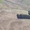
On-line Digital Images | DP 156911 | Oblique aerial view of Middleknowes, looking NE. | 30/4/2013 | Item Level |
 |
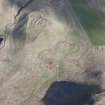
On-line Digital Images | DP 156913 | Oblique aerial view of Pennymuir, looking E. | 30/4/2013 | Item Level |
 |
On-line Digital Images | DP 156914 | Oblique aerial view of Moat Knowe, looking N. | 30/4/2013 | Item Level |
 |
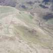
On-line Digital Images | DP 156915 | Oblique aerial view of Stanshiel Hill, looking NE. | 30/4/2013 | Item Level |
 |
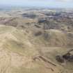
On-line Digital Images | DP 156917 | Oblique aerial view of Peelinick with the linear earthwork in the foreground, looking NE. | 30/4/2013 | Item Level |
 |
On-line Digital Images | DP 156918 | General oblique aerial view of Peelinick with the linear earthwork in the foreground, looking NE. | 30/4/2013 | Item Level |
 |
On-line Digital Images | DP 156919 | General oblique aerial view of Broad Law, Cheviot Hills, looking N. | 30/4/2013 | Item Level |
 |
On-line Digital Images | DP 156920 | Oblique aerial view of Yearning Saddle Refuge, looking SW. | 30/4/2013 | Item Level |
 |
On-line Digital Images | DP 156921 | Oblique aerial view of Yearning Saddle Refuge, looking SSW. | 30/4/2013 | Item Level |
 |
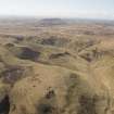
On-line Digital Images | DP 156923 | Oblique aerial view of Yearning Saddle Refuge, looking S. | 30/4/2013 | Item Level |
 |
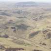
On-line Digital Images | DP 156925 | General oblique aerial view of Peelinick, Cheviot Hills, looking SSE. | 30/4/2013 | Item Level |
 |
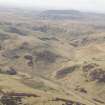
On-line Digital Images | DP 156928 | General oblique aerial view of Huntford Hill, Cheviot Hills, looking SSE. | 30/4/2013 | Item Level |
 |
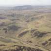
On-line Digital Images | DP 156929 | General oblique aerial view of Huntford Hill, Cheviot Hills, looking SSE. | 30/4/2013 | Item Level |
 |
On-line Digital Images | DP 156930 | General oblique aerial view of Huntford Hill, Cheviot Hills, looking SSE. | 30/4/2013 | Item Level |
 |
On-line Digital Images | DP 156931 | Oblique aerial view of Upper Chatto, looking S. | 30/4/2013 | Item Level |
 |
On-line Digital Images | DP 156934 | Oblique aerial view of Upper Chatto, looking SSE. | 30/4/2013 | Item Level |
 |
On-line Digital Images | DP 156681 | Oblique aerial view of Corsehope Rings, looking SE. | 30/4/2013 | Item Level |
 |
On-line Digital Images | DP 156811 | Oblique aerial view of the hollow trackways beside Largo Law, looking NE. | 30/4/2013 | Item Level |
 |
On-line Digital Images | DP 156812 | Oblique aerial view of the wind-blown sand at Drumbarnie, looking NNE. | 30/4/2013 | Item Level |
 |
On-line Digital Images | DP 156813 | General oblique aerial view of Elie, looking ENE. | 30/4/2013 | Item Level |
 |
On-line Digital Images | DP 156815 | Oblique aerial view of Fountainhall showing construction of the Borders Railway Line, looking N. | 30/4/2013 | Item Level |
 |
On-line Digital Images | DP 156817 | Oblique aerial view of Fountainhall showing construction of the Borders Railway Line, looking NW. | 30/4/2013 | Item Level |
 |
On-line Digital Images | DP 156818 | Oblique aerial view of Stow centred on Old Stow Kirk, looking ENE. | 30/4/2013 | Item Level |

© Historic Environment Scotland. Scottish Charity No. SC045925