Sortie 2012/18
551 2012/24
Description Sortie 2012/18
Collection RCAHMS Aerial Photography Digital
Catalogue Number 551 2012/24
Category All Other
Permalink http://canmore.org.uk/collection/1310792
Description Sortie 2012/18
Collection RCAHMS Aerial Photography Digital
Catalogue Number 551 2012/24
Category All Other
Permalink http://canmore.org.uk/collection/1310792
Collection Level (551 178) RCAHMS Aerial Photography Digital
> Sub-Group Level (551 2012) 2012 Photographs
>> Sub-Group Level (551 2012/24) Sortie 2012/18
| Preview | Category | Catalogue Number | Title | Date | Level |
|---|---|---|---|---|---|
| Digital Files (Non-image) | TM 000863 | GPS recorded flight path and map for Sortie 2012/18 | 18/7/2012 | Item Level | |
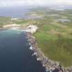 |
On-line Digital Images | DP 143395 | General oblique aerial view centred on the Links of Noltland, looking SE. | 18/7/2012 | Item Level |
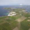 |
On-line Digital Images | DP 143396 | General oblique aerial view centred on the Links of Noltland, looking NE. | 18/7/2012 | Item Level |
 |
On-line Digital Images | DP 143397 | General oblique aerial view centred on the Links of Noltland, looking NE. | 18/7/2012 | Item Level |
 |
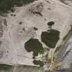
On-line Digital Images | DP 143398 | General oblique aerial view centred on the Point of Ness golf course, looking N. | 18/7/2012 | Item Level |
 |
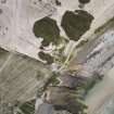
On-line Digital Images | DP 143179 | Oblique aerial view of the Links of Noltland excavation area, looking SW. | 18/7/2012 | Item Level |
 |
On-line Digital Images | DP 143180 | Oblique aerial view of the Links of Noltland excavation area, looking SW. | 18/7/2012 | Item Level |
 |
On-line Digital Images | DP 143181 | Oblique aerial view of the Links of Noltland excavation area, looking S. | 18/7/2012 | Item Level |
 |
On-line Digital Images | DP 143182 | Oblique aerial view of the Links of Noltland excavation area, looking SE. | 18/7/2012 | Item Level |
 |
On-line Digital Images | DP 143183 | Oblique aerial view of the Links of Noltland excavation area, looking ESE. | 18/7/2012 | Item Level |
 |
On-line Digital Images | DP 143184 | Oblique aerial view of the Links of Noltland excavation area, looking E. | 18/7/2012 | Item Level |
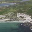 |
On-line Digital Images | DP 143185 | General oblique aerial view of the Links of Noltland excavation area, looking SSE. | 18/7/2012 | Item Level |
 |
On-line Digital Images | DP 143186 | Oblique aerial view centred on the enclosure at Noup, looking NE. | 18/7/2012 | Item Level |
 |
On-line Digital Images | DP 143187 | Oblique aerial view centred on the enclosure at Noup, looking NNE. | 18/7/2012 | Item Level |
 |
On-line Digital Images | DP 143188 | Oblique aerial view centred on Queena Howe, looking north west. | 18/7/2012 | Item Level |
 |
On-line Digital Images | DP 143189 | Oblique aerial view centred on Queena Howe, looking WNW. | 18/7/2012 | Item Level |
 |
On-line Digital Images | DP 143190 | Oblique aerial view centred on Queena Howe, looking WNW. | 18/7/2012 | Item Level |
 |
On-line Digital Images | DP 143191 | Oblique aerial view centred on Queena Howe, looking SSW. | 18/7/2012 | Item Level |
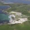 |
On-line Digital Images | DP 143192 | General oblique aerial view of Westray, centred on the Links of Noltland, looking NE. | 18/7/2012 | Item Level |
 |
On-line Digital Images | DP 143193 | Oblique aerial view of the cliffs and erosion at Flag Ber on the west coast of Westray, looking NE. | 18/7/2012 | Item Level |
 |
On-line Digital Images | DP 143194 | Oblique aerial view of the Loch of Wasbister, centred on the Burrian, looking N. | 18/7/2012 | Item Level |
 |
On-line Digital Images | DP 143195 | Oblique aerial view of the excavations at Hallbreck Farm, looking NW. | 18/7/2012 | Item Level |
 |
On-line Digital Images | DP 143196 | Oblique aerial view of the excavations at Hallbreck Farm, looking WNW. | 18/7/2012 | Item Level |
 |
On-line Digital Images | DP 143197 | Oblique aerial view of the excavations at Hallbreck Farm, looking SW. | 18/7/2012 | Item Level |

© Historic Environment Scotland. Scottish Charity No. SC045925