551 2012/20
Description Sortie 2012/06
Date 20/5/2012
Collection RCAHMS Aerial Photography Digital
Catalogue Number 551 2012/20
Category All Other
Permalink http://canmore.org.uk/collection/1310393
Collection Hierarchy - Sub-Group Level
Collection Level (551 178) RCAHMS Aerial Photography Digital
> Sub-Group Level (551 2012) 2012 Photographs
>> Sub-Group Level (551 2012/20) Sortie 2012/06
| Preview | Category | Catalogue Number | Title | Date | Level |
|---|---|---|---|---|---|
| Digital Files (Non-image) | TM 000852 | GPS recorded flight path and map for Sortie 2012/06 | 20/5/2012 | Item Level | |
 |
On-line Digital Images | DP 142661 | General oblique aerial view of John Muir Country Park, Peffer Sands and Ravensheugh Sands, looking NE. | 20/5/2012 | Item Level |
 |
On-line Digital Images | DP 142662 | General oblique aerial view of John Muir Country Park, Peffer Sands and Ravensheugh Sands, looking NE. | 20/5/2012 | Item Level |
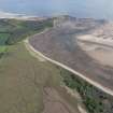 |
On-line Digital Images | DP 142663 | General oblique aerial view of John Muir Country Park, Tyne Sands and St Baldreds Cradle, looking NE. | 20/5/2012 | Item Level |
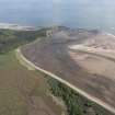 |
On-line Digital Images | DP 142664 | General oblique aerial view of John Muir Country Park, Tyne Sands and St Baldreds Cradle, looking NE. | 20/5/2012 | Item Level |
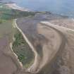 |
On-line Digital Images | DP 142665 | General oblique aerial view of John Muir Country Park, Tyne Sands,St Baldreds Cradle, looking NE. | 20/5/2012 | Item Level |
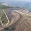 |
On-line Digital Images | DP 142666 | General oblique aerial view of John Muir Country Park, Tyne Sands,St Baldreds Cradle, looking NE. | 20/5/2012 | Item Level |
 |
On-line Digital Images | DP 142667 | General oblique aerial view of John Muir Country Park, Tyne Sands,Hedderwick Hill Plantation, looking NE. | 20/5/2012 | Item Level |
 |
On-line Digital Images | DP 142668 | General oblique aerial view of John Muir Country Park, Tyne Sands,Hedderwick Hill Plantation, looking NE. | 20/5/2012 | Item Level |
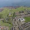 |
On-line Digital Images | DP 142670 | General oblique aerial view of Belhaven, Dunbar and Winterfield Golf Club, looking N. | 20/5/2012 | Item Level |
 |
On-line Digital Images | DP 142673 | General oblique aerial view of Branxton, Torness Nuclear Generating Station, Skateraw Harbour and Harp Law, looking NE. | 20/5/2012 | Item Level |
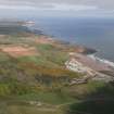 |
On-line Digital Images | DP 142674 | General oblique aerial view of Cockburnspath, Torness Nuclear Generating Station and Pease Bay Caravan Park, looking NNE. | 20/5/2012 | Item Level |
 |
On-line Digital Images | DP 142677 | Oblique aerial view of Red Heugh, looking E. | 20/5/2012 | Item Level |
 |
On-line Digital Images | DP 142678 | Oblique aerial view of Red Heugh, looking NW. | 20/5/2012 | Item Level |
 |
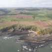
On-line Digital Images | DP 142680 | Oblique aerial view of Red Heugh and Red Heugh Shore, looking W. | 20/5/2012 | Item Level |
 |
On-line Digital Images | DP 142683 | General oblique aerial view of Cove Harbour, Heathery Heugh looking S. | 20/5/2012 | Item Level |
 |
On-line Digital Images | DP 142684 | General oblique aerial view of Cove Harbour, Heathery Heugh, centred on Siccar Point, looking SSW. | 20/5/2012 | Item Level |
 |
On-line Digital Images | DP 142685 | General oblique aerial view of Pressmennan Wood, Pressmennan Loch and Ruchlaw West Mains, looking S. | 20/5/2012 | Item Level |
 |
On-line Digital Images | DP 142686 | General oblique aerial view of Newhailes House, Newhailes Estate and Newhailes Industrial Estate, looking S. | 20/5/2012 | Item Level |
 |
On-line Digital Images | DP 142687 | General oblique aerial view of Holyrood Park, Arthurs Seat and Palace of Holyroodhouse, looking S. | 20/5/2012 | Item Level |
 |
On-line Digital Images | DP 142688 | General oblique aerial view of Holyrood Park, Arthurs Seat, Calton Hill, Canongate and Royal Terrace Gardens, looking S. | 20/5/2012 | Item Level |
 |
On-line Digital Images | DP 142689 | General oblique aerial view of Forth Rail Bridge, Forth Road Bridge, North Queensferry and construction of Queensferry Crossing, looking SW. | 20/5/2012 | Item Level |
 |
On-line Digital Images | DP 142690 | General oblique aerial view of Forth Rail Bridge, Forth Road Bridge, North Queensferry and construction of Queensferry Crossing, looking SW. | 20/5/2012 | Item Level |
 |
On-line Digital Images | DP 142691 | General oblique aerial view of Forth Rail Bridge, Forth Road Bridge, North Queensferry and construction of Queensferry Crossing, looking SW. | 20/5/2012 | Item Level |


