551 178/1/37
Description Sortie 2011/37
Collection RCAHMS Aerial Photography Digital
Catalogue Number 551 178/1/37
Category All Other
Permalink http://canmore.org.uk/collection/1255341
Collection Hierarchy - Sub-Group Level
Collection Level (551 178) RCAHMS Aerial Photography Digital
> Sub-Group Level (551 178/1) 2011 Photographs
>> Sub-Group Level (551 178/1/37) Sortie 2011/37
| Preview | Category | Catalogue Number | Title | Date | Level |
|---|---|---|---|---|---|
| Digital Files (Non-image) | TM 000913 | GPS recorded flight path and map for Sortie 2011/37 | 16/11/2011 | Item Level | |
 |
On-line Digital Images | DP 109586 | Oblique aerial view of the remains of Dun Thomaidh and its causeway, the remains of fish traps at Moronish and the remains of an enclosure and lazy beds at Gearraidh Mhartainnan, Vallay, North Uist, taken from the WSW. | 16/11/2011 | Item Level |
 |
On-line Digital Images | DP 109587 | Oblique aerial view of the remains of Dun Thomaidh and its causeway, the remains of fish traps at Moronish and the remains of an enclosure and lazy beds at Gearraidh Mhartainnan, Vallay, North Uist, taken from the SW. | 16/11/2011 | Item Level |
 |
On-line Digital Images | DP 109588 | Oblique aerial view of the remains of a system of fish traps at Oronsay, North Uist, taken from the SW. | 16/11/2011 | Item Level |
 |
On-line Digital Images | DP 109589 | Oblique aerial view of the remains of a system of fish traps at Oronsay, North Uist, taken from the SSW. | 16/11/2011 | Item Level |
 |
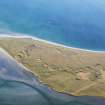
On-line Digital Images | DP 109590 | General oblique aerial view of the remains of a causeway and possible fish trap at Oronsay and the nearby remains of a farmstead, Oronsay, North Uist, taken from the WSW. | 16/11/2011 | Item Level |
 |
On-line Digital Images | DP 109591 | General oblique aerial view of Machair Robach and Vallaquie, North Uist, taken from the SSE. | 16/11/2011 | Item Level |
 |
On-line Digital Images | DP 109592 | General oblique aerial view of the NE end of Loch Lochy, Laggan Locks, the Caledonian Canal and the Great Glen, taken from the SW. | 16/11/2011 | Item Level |
 |
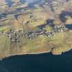
On-line Digital Images | DP 111374 | General oblique aerial view of Coire nan Crogachan, looking across the ridge of A' Mhuing, towards the Five Sisters of Kintail, taken from the W. | 16/11/2011 | Item Level |
 |
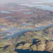
On-line Digital Images | DP 111270 | Oblique aerial view of the remains of the township, head dyke and lazy beds at Crosbost, Lochs, Lewis, taken from the SSW. | 16/11/2011 | Item Level |
 |
On-line Digital Images | DP 111271 | General oblique aerial view of the townships of Crosbost, Ranish and Grimshader, looking towards Stornoway, Lewis, taken from the SSE. | 16/11/2011 | Item Level |
 |
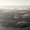
On-line Digital Images | DP 111269 | General oblique aerial view of the remains of the township, head dyke and lazy beds at Grimshader, Lochs, Lewis, taken from the W. | 16/11/2011 | Item Level |
 |
On-line Digital Images | DP 111264 | General oblique aerial view of Rubh' a' Bhaig Uaine, Loch Buaile Bhig, Loch Nan Deareag and the Lochs area, south of Stornoway, Lewis, taken from the NNE. | 16/11/2011 | Item Level |
 |
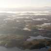
On-line Digital Images | DP 111266 | General oblique aerial view of the Lochs wind farm at Loch a' Bhlar Bhuidhe and the remains of peat cutting at Loch Lobhair, Lochs, Lewis, taken from the SSE. | 16/11/2011 | Item Level |
 |
On-line Digital Images | DP 111265 | General oblique aerial view of Rubh' a' Bhaig Uaine, Loch Buaile Bhig, Loch Nan Deareag and the Lochs area, south of Stornoway, Lewis, taken from the NNE. | 16/11/2011 | Item Level |
 |
On-line Digital Images | DP 111267 | General oblique aerial view of the Lochs wind farm at Loch a' Bhlar Bhuidhe and the remains of peat cutting at Loch Lobhair, Lochs, Lewis, taken from the SSE. | 16/11/2011 | Item Level |
 |
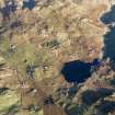
On-line Digital Images | DP 111268 | General oblique aerial view of the remains of the township, head dyke and lazy beds at Grimshader, Lochs, Lewis, taken from the W. | 16/11/2011 | Item Level |
 |
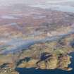
On-line Digital Images | DP 111274 | Oblique aerial view of the remains of the township, head dyke and lazy beds at Calbost, Loch Dubh, Lewis, taken from the SW. | 16/11/2011 | Item Level |
 |
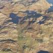
On-line Digital Images | DP 111272 | General oblique aerial view of the townships of Crosbost, Ranish and Grimshader, looking towards Stornoway, Lewis, taken from the SSE. | 16/11/2011 | Item Level |
 |
On-line Digital Images | DP 111275 | General oblique aerial view of the remains of the township, head dyke and lazy beds at Calbost, looking towards the township of Marvig, Lochs, Lewis, taken from the S. | 16/11/2011 | Item Level |
 |
On-line Digital Images | DP 111273 | Oblique aerial view of the remains of the township, head dyke and lazy beds at Calbost, Loch Dubh, Lewis, taken from the SW. | 16/11/2011 | Item Level |
 |
On-line Digital Images | DP 111281 | Oblique aerial view of the remains of a causeway and possible island dwelling on Loch Crois Ailean, near Gravir, Lewis, taken from the NNE. | 16/11/2011 | Item Level |
 |
On-line Digital Images | DP 111277 | Oblique aerial view of the remains of the township, head dyke and lazy beds at Calbost, Loch Dubh, Lewis, taken from the NE. | 16/11/2011 | Item Level |
 |
On-line Digital Images | DP 111282 | General oblique aerial view of the remains of the township, head dyke, field system and lazy beds at Gravir, Lewis, taken from the W. | 16/11/2011 | Item Level |


