|
Digital Files (Non-image) |
TM 000978 |
GPS recorded flight path and map for Sortie 2009/21 |
30/5/2009 |
Item Level |
 |
On-line Digital Images |
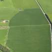
DP 075565 |
Oblique aerial view centred on the cropmarks of the possible enclosure on Doo Hill, taken from the WSW. |
30/5/2009 |
Item Level |
 |
On-line Digital Images |
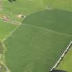
DP 075566 |
Oblique aerial view centred on the cropmarks of the possible enclosure on Doo Hill, taken from the SW. |
30/5/2009 |
Item Level |
 |
On-line Digital Images |
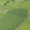
DP 075567 |
Oblique aerial view centred on the cropmarks of the possible enclosure on Doo Hill, taken from the SW. |
30/5/2009 |
Item Level |
 |
On-line Digital Images |
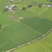
DP 075568 |
Oblique aerial view centred on the cropmarks of the possible enclosure on Doo Hill, taken from the S. |
30/5/2009 |
Item Level |
 |
On-line Digital Images |
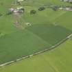
DP 075569 |
Oblique aerial view centred on the cropmarks of the possible enclosure on Doo Hill, taken from the SSE. |
30/5/2009 |
Item Level |
 |
On-line Digital Images |
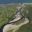
DP 075570 |
General oblique aerial view of the mouth of the River Spey centred on the Spey viaduct with the Garmouth and Kingston Golf Course beyond, taken from the S. |
30/5/2009 |
Item Level |
 |
On-line Digital Images |
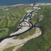
DP 075571 |
General oblique aerial view of the mouth of the River Spey centred on the Spey viaduct with the Garmouth and Kingston Golf Course beyond, taken from the S. |
30/5/2009 |
Item Level |
 |
On-line Digital Images |
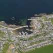
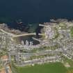
DP 075572 |
Oblique aerial view of the village of Findochty, taken from the SSE. |
30/5/2009 |
Item Level |
 |
On-line Digital Images |
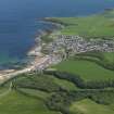
DP 075573 |
Oblique aerial view of the village of Findochty, taken from the SSE. |
30/5/2009 |
Item Level |
 |
On-line Digital Images |
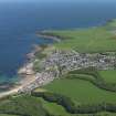
DP 075574 |
General oblique aerial view centred on the town of Cullen, taken from the WSW. |
30/5/2009 |
Item Level |
 |
On-line Digital Images |
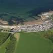
DP 075575 |
General oblique aerial view centred on the town of Cullen, taken from the WSW. |
30/5/2009 |
Item Level |
 |
On-line Digital Images |
DP 075576 |
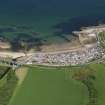
General oblique aerial view centred on the Seatown part of the town of Cullen, taken from the SSW. |
30/5/2009 |
Item Level |
 |
On-line Digital Images |
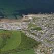
DP 075577 |
General oblique aerial view centred on the Seatown part of the town of Cullen, taken from the S. |
30/5/2009 |
Item Level |
 |
On-line Digital Images |
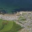
DP 075578 |
General oblique aerial view centred on the town of Cullen, taken from the S. |
30/5/2009 |
Item Level |
 |
On-line Digital Images |
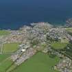
DP 075579 |
General oblique aerial view centred on the town of Cullen, taken from the S. |
30/5/2009 |
Item Level |
 |
On-line Digital Images |
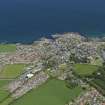
DP 075580 |
General oblique aerial view centred on the village of Portsoy, taken from the S. |
30/5/2009 |
Item Level |
 |
On-line Digital Images |
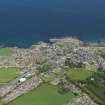
DP 075581 |
General oblique aerial view centred on the village of Portsoy, taken from the S. |
30/5/2009 |
Item Level |
 |
On-line Digital Images |
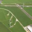
DP 075582 |
General oblique aerial view centred on the village of Portsoy, taken from the S. |
30/5/2009 |
Item Level |
 |
On-line Digital Images |
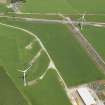
DP 075583 |
Oblique aerial view of two turbines of the Boyndie Windfarm Electricity Generating Station and the remains of the runways of Boyndie airfield, taken from the SSW. |
30/5/2009 |
Item Level |
 |
On-line Digital Images |
DP 075584 |
Oblique aerial view of two turbines of the Boyndie Windfarm Electricity Generating Station and the remains of the runways of Boyndie airfield, taken from the SSW. |
30/5/2009 |
Item Level |
 |
On-line Digital Images |
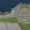
DP 075585 |
Oblique aerial view centred on the village of Whitehills, taken from the SSW. |
30/5/2009 |
Item Level |
 |
On-line Digital Images |
DP 075586 |
Oblique aerial view centred on the village of Whitehills, taken from the S. |
30/5/2009 |
Item Level |
 |
On-line Digital Images |
DP 075587 |
Oblique aerial view centred on the village of Whitehills, taken from the S. |
30/5/2009 |
Item Level |


