Sortie 2009/20
551 178/2/20
Description Sortie 2009/20
Collection RCAHMS Aerial Photography Digital
Catalogue Number 551 178/2/20
Category All Other
Permalink http://canmore.org.uk/collection/1237286
Description Sortie 2009/20
Collection RCAHMS Aerial Photography Digital
Catalogue Number 551 178/2/20
Category All Other
Permalink http://canmore.org.uk/collection/1237286
Collection Level (551 178) RCAHMS Aerial Photography Digital
> Sub-Group Level (551 178/2) 2009 Photographs
>> Sub-Group Level (551 178/2/20) Sortie 2009/20
| Preview | Category | Catalogue Number | Title | Date | Level |
|---|---|---|---|---|---|
| Digital Files (Non-image) | TM 000977 | GPS recorded flight path and map for Sortie 2009/20 | 30/5/2009 | Item Level | |
 |
On-line Digital Images | DP 074787 | Oblique aerial view of the field systems, centred NG 984 900, in Glenarigolach, taken from the NW. | 30/5/2009 | Item Level |
 |
On-line Digital Images | DP 074788 | Oblique aerial view of the field systems, centred NG 984 900, in Glenarigolach, taken from the NW. | 30/5/2009 | Item Level |
 |
On-line Digital Images | DP 074789 | Oblique aerial view of the township and field systems in Glenarigolach, centred NG 982 898. Taken from the NW. | 30/5/2009 | Item Level |
 |
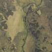
On-line Digital Images | DP 074790 | Oblique aerial view of a field systems in lower Glenarigolach, centred NG 981 894, taken from the SSW. | 30/5/2009 | Item Level |
 |
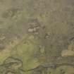
On-line Digital Images | DP 074791 | Oblique aerial view of a field systems in lower Glenarigolach, centred NG 982 894, taken from the SSW. | 30/5/2009 | Item Level |
 |
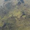
On-line Digital Images | DP 280492 | Oblique aerial view of the township buildings in Glenarigolach, centred NG 982 898, taken from the SE. | 30/5/2009 | Item Level |
 |
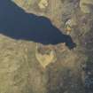
On-line Digital Images | DP 074793 | Oblique aerial view of the field system, centred NG 986 892, taken from the N. | 30/5/2009 | Item Level |
 |
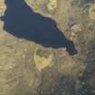
On-line Digital Images | DP 074794 | Oblique aerial view of the enclosure at Lochan An Cairill, taken from the SE. | 30/5/2009 | Item Level |
 |
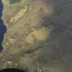
On-line Digital Images | DP 074795 | Oblique aerial view of the enclosure at Lochan An Cairill, taken from the SE. | 30/5/2009 | Item Level |
 |
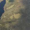
On-line Digital Images | DP 074796 | General oblique aerial view of the buildings and enclosures at Lochan Na Cairill, taken from the E. | 30/5/2009 | Item Level |
 |
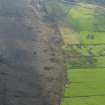
On-line Digital Images | DP 074797 | General oblique aerial view of the buildings and enclosures at Lochan Na Cairill, taken from the E. | 30/5/2009 | Item Level |
 |
On-line Digital Images | DP 074798 | General oblique aerial view centred on the location of the township at Bagh Mhungasdail, taken from the NW. | 30/5/2009 | Item Level |
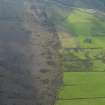 |
On-line Digital Images | DP 074799 | General oblique aerial view centred on the location of the township at Bagh Mhungasdail, taken from the NW. | 30/5/2009 | Item Level |
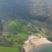 |
On-line Digital Images | DP 074800 | General oblique aerial view of the settlement and bay at Mungasdale, taken from the NW. | 30/5/2009 | Item Level |
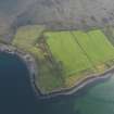 |
On-line Digital Images | DP 074801 | Oblique aerial view centred on the lazy beds and fields at Rubha na Moine, taken from the WSW. | 30/5/2009 | Item Level |
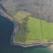 |
On-line Digital Images | DP 074802 | Oblique aerial view centred on the lazy beds and fields at Rubha na Moine, taken from the SW. | 30/5/2009 | Item Level |
 |
On-line Digital Images | DP 074803 | Oblique aerial view centred on the township at Mungasdale, taken from the SE. | 30/5/2009 | Item Level |
 |
On-line Digital Images | DP 074804 | Oblique aerial view centred on the township at Mungasdale, taken from the SE. | 30/5/2009 | Item Level |
 |
On-line Digital Images | DP 074805 | General oblique aerial view of Mungasdale, taken from the ESE. | 30/5/2009 | Item Level |
 |
On-line Digital Images | DP 074806 | General oblique aerial view of Mungasdale, taken from the E. | 30/5/2009 | Item Level |
 |
On-line Digital Images | DP 074807 | Oblique aerial view centred on the hut circles, taken from the NW. | 30/5/2009 | Item Level |
 |
On-line Digital Images | DP 074808 | Oblique aerial view centred on the hut circles, taken from the NW. | 30/5/2009 | Item Level |
 |
On-line Digital Images | DP 074809 | Oblique aerial view centred on the remains of the farmstead and enclosure at Fisherfield, taken from the WSW. | 30/5/2009 | Item Level |

© Historic Environment Scotland. Scottish Charity No. SC045925