|
Digital Files (Non-image) |
TM 000972 |
GPS recorded flight path and map for Sortie 2009/15 |
13/5/2009 |
Item Level |
 |
On-line Digital Images |
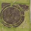
DP 058594 |
Oblique aerial view centred on the remains of the henge and stone circle at Ring of Brodgar, taken from the SW. |
13/5/2009 |
Item Level |
 |
On-line Digital Images |
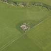
DP 060110 |
Oblique aerial view centred on the excavation at the Cairns o' the Bu settlement at Windwick, taken from the SSE. |
13/5/2009 |
Item Level |
 |
On-line Digital Images |
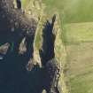
DP 060111 |
Oblique aerial view centred on the Brough of Windwick promontory fort, taken from the NE. |
13/5/2009 |
Item Level |
 |
On-line Digital Images |
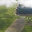
DP 060112 |
Oblique aerial view centred on Windwick and the site of St Andrew's Chapel, taken from the S. |
13/5/2009 |
Item Level |
 |
On-line Digital Images |
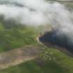
DP 060113 |
General oblique aerial view of Windwick, South Ronaldsay, taken from the SE. |
13/5/2009 |
Item Level |
 |
On-line Digital Images |
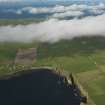
DP 060114 |
General oblique aerial view of Windwick, South Ronaldsay, taken from the NE. |
13/5/2009 |
Item Level |
 |
On-line Digital Images |
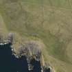
DP 060115 |
Oblique aerial view centred on The Tomb of the Eagles, Isbister, taken from the NE. |
13/5/2009 |
Item Level |
 |
On-line Digital Images |
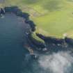
DP 060116 |
Oblique aerial view centred on Castle of Burwick promontory fort and possible monastic settlement, taken from the SW. |
13/5/2009 |
Item Level |
 |
On-line Digital Images |
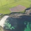
DP 060117 |
Oblique aerial view centred on Weems Castle broch, taken from the NW. |
13/5/2009 |
Item Level |
 |
On-line Digital Images |
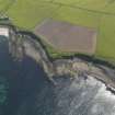
DP 060118 |
Oblique aerial view centred on Weems Castle broch, taken from the WNW. |
13/5/2009 |
Item Level |
 |
On-line Digital Images |
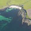
DP 060119 |
Oblique aerial view centred on Weems Castle broch, taken from the WSW. |
13/5/2009 |
Item Level |
 |
On-line Digital Images |
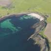
DP 060120 |
Oblique aerial view centred on Weems Castle broch, taken from the SSW. |
13/5/2009 |
Item Level |
 |
On-line Digital Images |
DP 060121 |
Oblique aerial view centred on a possible fish trap at the Ayre of Banks, taken from the NE. |
13/5/2009 |
Item Level |
 |
On-line Digital Images |
DP 060122 |
Oblique aerial view centred on the anti aircraft battery and military camp at Herston Hill, South Ronaldsay, taken from the W. |
13/5/2009 |
Item Level |
 |
On-line Digital Images |
DP 060123 |
Oblique aerial view centred on the anti aircraft battery and military camp at Herston Hill, South Ronaldsay, taken from the W. |
13/5/2009 |
Item Level |
 |
On-line Digital Images |
DP 060124 |
General oblique aerial view centred on the Hoxa Head Battery, taken from the NW. |
13/5/2009 |
Item Level |
 |
On-line Digital Images |
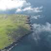
DP 060125 |
General oblique aerial view centred on the Hoxa Head Battery, taken from the NNW. |
13/5/2009 |
Item Level |
 |
On-line Digital Images |
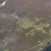
DP 060126 |
Oblique aerial view centred on the 'Z' Battery and ancilliary buildings at Golta, Flotta, taken from the NE. |
13/5/2009 |
Item Level |
 |
On-line Digital Images |
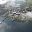
DP 060127 |
General oblique aerial view of Flotta Oil Terminal, taken from the NNW. |
13/5/2009 |
Item Level |
 |
On-line Digital Images |
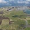
DP 060128 |
General oblique aerial view of Flotta Oil Terminal, taken from the S. |
13/5/2009 |
Item Level |
 |
On-line Digital Images |
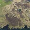
DP 060129 |
Oblique aerial view centred on the naval signal station at Stanger Head with the ruins of a farmstead adjacent, taken from the S. |
13/5/2009 |
Item Level |
 |
On-line Digital Images |
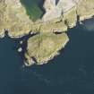
DP 060130 |
Oblique aerial view centred on the searchlight battery at Stanger Head, taken from the SE. |
13/5/2009 |
Item Level |
 |
On-line Digital Images |
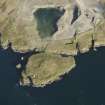
DP 060131 |
Oblique aerial view centred on the searchlight battery at Stanger Head, taken from the SE. |
13/5/2009 |
Item Level |


