Sortie 2010/39
551 178/3/39
Description Sortie 2010/39
Collection RCAHMS Aerial Photography Digital
Catalogue Number 551 178/3/39
Category All Other
Permalink http://canmore.org.uk/collection/1237051
Description Sortie 2010/39
Collection RCAHMS Aerial Photography Digital
Catalogue Number 551 178/3/39
Category All Other
Permalink http://canmore.org.uk/collection/1237051
Collection Level (551 178) RCAHMS Aerial Photography Digital
> Sub-Group Level (551 178/3) 2010 Photographs
>> Sub-Group Level (551 178/3/39) Sortie 2010/39
| Preview | Category | Catalogue Number | Title | Date | Level |
|---|---|---|---|---|---|
| Digital Files (Non-image) | TM 000953 | GPS recorded flight path and map for Sortie 2010/39 | 13/8/2010 | Item Level | |
 |
On-line Digital Images | DP 093263 | Oblique aerial view of Kirknewton Airfield, looking SE. | 13/8/2010 | Item Level |
 |
On-line Digital Images | DP 093267 | General oblique aerial view of Thistlemark Hill with Margmony Hill, the Shinnel Water and the Cairn Water beyond, looking SSE. | 13/8/2010 | Item Level |
 |
On-line Digital Images | DP 093268 | General oblique aerial view of Margmony Hill and the Shinnel Water with the Cairn Water beyond, looking SSE. | 13/8/2010 | Item Level |
 |
On-line Digital Images | DP 093269 | General oblique aerial view of Luce Bay, looking W. | 13/8/2010 | Item Level |
 |
On-line Digital Images | DP 093270 | General oblique aerial view of Luce Bay, looking W. | 13/8/2010 | Item Level |
 |
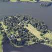
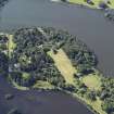
On-line Digital Images | DP 093271 | General oblique aerial view of Castle Kennedy House and policies, looking WSW. | 13/8/2010 | Item Level |
 |
On-line Digital Images | DP 093273 | General oblique aerial view of Castle Kennedy House and policies, looking SSW. | 13/8/2010 | Item Level |
 |
On-line Digital Images | DP 093275 | Oblique aerial view of the cropmarks of the possible enclosure and pits, looking NNE. | 13/8/2010 | Item Level |
 |
On-line Digital Images | DP 093276 | Oblique aerial view of the cropmarks of the possible enclosure and pits, looking WSW. | 13/8/2010 | Item Level |
 |
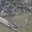
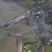
On-line Digital Images | DP 093277 | Oblique aerial view of Stranraer harbour, looking SSW. | 13/8/2010 | Item Level |
 |
On-line Digital Images | DP 093278 | Oblique aerial view of Stranraer harbour, looking E. | 13/8/2010 | Item Level |
 |
On-line Digital Images | DP 093279 | Oblique aerial view of the cropmarks of the palisaded settlement, looking NE. | 13/8/2010 | Item Level |
 |
On-line Digital Images | DP 093281 | Oblique aerial view of the cropmarks of the field boundaries and pit alignment, looking NNW. | 13/8/2010 | Item Level |
 |
On-line Digital Images | DP 093285 | General oblique aerial view with West Freugh Airfield in the foreground and Loch Ryan in the distance, looking NNW. | 13/8/2010 | Item Level |
 |
On-line Digital Images | DP 093287 | Oblique aerial view of the target base, looking N. | 13/8/2010 | Item Level |
 |
On-line Digital Images | DP 093288 | Oblique aerial view of Stoneykirk village, looking ENE. | 13/8/2010 | Item Level |
 |
On-line Digital Images | DP 093289 | Oblique aerial view of the cropmarks of the barrow and palisaded enclosure, looking N. | 13/8/2010 | Item Level |
 |
On-line Digital Images | DP 093291 | Oblique aerial view of the cropmarks of the barrow, looking SSW. | 13/8/2010 | Item Level |
 |
On-line Digital Images | DP 093293 | Oblique aerial view of the cropmarks of the barrow, looking SSE. | 13/8/2010 | Item Level |
 |
On-line Digital Images | DP 093294 | Oblique aerial view of the cropmarks of the barrow, looking SE. | 13/8/2010 | Item Level |
 |
On-line Digital Images | DP 093295 | Oblique aerial view of the cropmarks of the palisaded enclosure and of Low Culgroat, looking ESE. | 13/8/2010 | Item Level |
 |
On-line Digital Images | DP 093296 | General oblique aerial view of Luce Bay with Sandhead in the foreground, looking E. | 13/8/2010 | Item Level |
 |
On-line Digital Images | DP 093297 | Oblique aerial view of the cropmarks of the palisaded settlement, looking NE. | 13/8/2010 | Item Level |

© Historic Environment Scotland. Scottish Charity No. SC045925