Sortie 2010/35
551 178/3/35
Description Sortie 2010/35
Collection RCAHMS Aerial Photography Digital
Catalogue Number 551 178/3/35
Category All Other
Permalink http://canmore.org.uk/collection/1237047
Description Sortie 2010/35
Collection RCAHMS Aerial Photography Digital
Catalogue Number 551 178/3/35
Category All Other
Permalink http://canmore.org.uk/collection/1237047
Collection Level (551 178) RCAHMS Aerial Photography Digital
> Sub-Group Level (551 178/3) 2010 Photographs
>> Sub-Group Level (551 178/3/35) Sortie 2010/35
| Preview | Category | Catalogue Number | Title | Date | Level |
|---|---|---|---|---|---|
| Digital Files (Non-image) | TM 000949 | GPS recorded flight path and map for Sortie 2010/35 | 23/7/2010 | Item Level | |
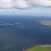 |
On-line Digital Images | DP 092288 | General oblique aerial view looking up Papa Sound with Papa Westray to the right and Wsetray to the left, taken from the SSW. | 23/7/2010 | Item Level |
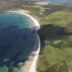 |
On-line Digital Images | DP 092289 | General oblique aerial view looking along the beach of Fersness Bay towards London Airport, Eday, taken fromthe WSW. | 23/7/2010 | Item Level |
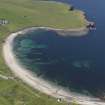 |
On-line Digital Images | DP 092260 | General oblique aerial view of the Bay of Skaill centred on Skara Brae, taken from the NE. | 23/7/2010 | Item Level |
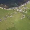 |
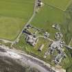
On-line Digital Images | DP 092264 | Oblique aerial view of Birsay village, taken from the SE. | 23/7/2010 | Item Level |
 |
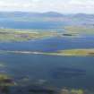
On-line Digital Images | DP 092265 | Oblique aerial view of of the Earl's Palace at Birsay, taken from the WSW. | 23/7/2010 | Item Level |
 |
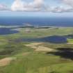
On-line Digital Images | DP 092276 | General oblique aerial view looking across the Lochs of Harray and Stenness with Hoy in the distance, taken from the NNE. | 23/7/2010 | Item Level |
 |
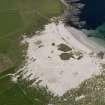
On-line Digital Images | DP 092277 | General aerial view of the Loch of Hundland and Loch of Board House centred on Kirkbuster, taken from the SSE. | 23/7/2010 | Item Level |
 |
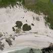
On-line Digital Images | DP 092280 | Oblique aerial view of the excavations at the Links of Noltland, taken from the SE. | 23/7/2010 | Item Level |
 |
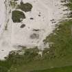
On-line Digital Images | DP 092281 | Oblique aerial view of the excavations at the Links of Noltland, taken from the N. | 23/7/2010 | Item Level |
 |
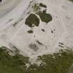
On-line Digital Images | DP 092282 | Oblique aerial view of the excavations at the Links of Noltland, taken from the W. | 23/7/2010 | Item Level |
 |
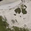
On-line Digital Images | DP 092283 | Oblique aerial view of the excavations at the Links of Noltland, taken from the WSW. | 23/7/2010 | Item Level |
 |
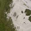
On-line Digital Images | DP 092284 | Oblique aerial view of the excavations at the Links of Noltland, taken from the SSW. | 23/7/2010 | Item Level |
 |
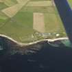
On-line Digital Images | DP 092285 | Oblique aerial view of the excavations at the Links of Noltland, taken from the SSE. | 23/7/2010 | Item Level |
 |
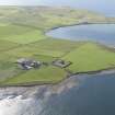
On-line Digital Images | DP 092232 | General oblique aerial view of St Ninian's Church, Skail, taken from the ESE. | 23/7/2010 | Item Level |
 |
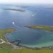
On-line Digital Images | DP 092233 | General oblique aerial view of Braebuster, taken from the NW. | 23/7/2010 | Item Level |
 |
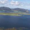
On-line Digital Images | DP 092234 | General oblique aerial view of Houton Bay looking towards Scapa Flow and Cava, taken from the N. | 23/7/2010 | Item Level |
 |
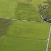
On-line Digital Images | DP 092236 | General oblique aerial view looking across Graemsay towards Hoy, taken from the NE. | 23/7/2010 | Item Level |
 |
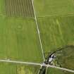
On-line Digital Images | DP 092237 | Oblique aerial view of the Hall of Ireland with a vegetation mark showing the ditch and the Mill of Ireland adjacent, taken from the WNW. | 23/7/2010 | Item Level |
 |
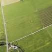
On-line Digital Images | DP 092238 | Oblique aerial view of the Hall of Ireland with a vegetation mark showing the ditch and the Mill of Ireland adjacent, taken from the SSW. | 23/7/2010 | Item Level |
 |
On-line Digital Images | DP 092240 | Oblique aerial view of the Hall of Ireland with a vegetation mark showing the ditch and the Mill of Ireland adjacent, taken from the SE. | 23/7/2010 | Item Level |
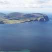 |
On-line Digital Images | DP 092241 | General oblique aerial view of the north end of Hoy, taken from the NW. | 23/7/2010 | Item Level |
 |
On-line Digital Images | DP 092243 | Oblique aerial view of the cropmark of the field boundary with Northbreck farmstead adjacent, taken from the ESE. | 23/7/2010 | Item Level |
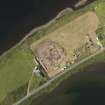 |
On-line Digital Images | DP 092245 | Oblique aerial view of the excavations at the Ness of Brodgar, taken from the ENE. | 23/7/2010 | Item Level |

© Historic Environment Scotland. Scottish Charity No. SC045925