Sortie 2010/28
551 178/3/28
Description Sortie 2010/28
Collection RCAHMS Aerial Photography Digital
Catalogue Number 551 178/3/28
Category All Other
Permalink http://canmore.org.uk/collection/1237040
Description Sortie 2010/28
Collection RCAHMS Aerial Photography Digital
Catalogue Number 551 178/3/28
Category All Other
Permalink http://canmore.org.uk/collection/1237040
Collection Level (551 178) RCAHMS Aerial Photography Digital
> Sub-Group Level (551 178/3) 2010 Photographs
>> Sub-Group Level (551 178/3/28) Sortie 2010/28
| Preview | Category | Catalogue Number | Title | Date | Level |
|---|---|---|---|---|---|
 |
On-line Digital Images | DP 090720 | Oblique aerial view of the cropmarks of the possible ring ditch, taken from the W. | 6/7/2010 | Item Level |
 |
On-line Digital Images | DP 090721 | Oblique aerial view of the cropmarks of the quarry pits along the Roman Road at NY 1110 9640, taken from the W. | 6/7/2010 | Item Level |
 |
On-line Digital Images | DP 090722 | Oblique aerial view of the cropmarks of the quarry pits along the Roman Road at NY 1113 9580 and Annaholm Cottage, taken from the W. | 6/7/2010 | Item Level |
 |
On-line Digital Images | DP 090723 | Oblique aerial view of Newton and the cropmarks of the quarry pits along the Roman Road at NY 1112 9497, taken from the ESE. | 6/7/2010 | Item Level |
 |
On-line Digital Images | DP 090724 | Oblique aerial view of the cropmarks of the quarry pits along the Roman Road at NY 1113 9580 and Annaholm Cottage, taken from the N. | 6/7/2010 | Item Level |
 |
On-line Digital Images | DP 090799 | Oblique aerial view of the cropmarks of the rectilinear settlement and the ditch of the Roman Temporary Camp at Torwood, taken from the SSW. | 6/7/2010 | Item Level |
 |
On-line Digital Images | DP 090800 | Oblique aerial view of the cropmarks of the rectilinear settlement and the ditch of the Roman Temporary Camp at Torwood, taken from the SSE. | 6/7/2010 | Item Level |
 |
On-line Digital Images | DP 090801 | Oblique aerial view of the cropmarks of the rectilinear settlement and the ditch of the Roman Temporary Camp at Torwood with Lochside farmstead in the foregound, taken from the S. | 6/7/2010 | Item Level |
 |
On-line Digital Images | DP 090802 | Oblique aerial view of the cropmarks of the rectilinear settlement and the ditch of the Roman Temporary Camp at Torwood with Lochside farmstead adjacent, taken from the S. | 6/7/2010 | Item Level |
 |
On-line Digital Images | DP 090805 | Oblique aerial view of the cropmarks of the rectilinear settlement and the ditch of the Roman Temporary Camp at Torwood with Lochside farmstead beyond, taken from the NNE. | 6/7/2010 | Item Level |
 |
On-line Digital Images | DP 090806 | Oblique aerial view of the cropmarks of the sunken floored buildings, pits and field boundaries at the possible village site, taken from the E. | 6/7/2010 | Item Level |
 |
On-line Digital Images | DP 090807 | buildings, pits and field boundaries at the possible village site, taken from the E. | 6/7/2010 | Item Level |
 |
On-line Digital Images | DP 090808 | buildings, pits and field boundaries at the possible village site, taken from the WNW. | 6/7/2010 | Item Level |
 |
On-line Digital Images | DP 090809 | Oblique aerial view of the remains of the fort at Nutholm Hill with the grassmarks of the ditch showing, taken from the W. | 6/7/2010 | Item Level |
 |
On-line Digital Images | DP 090811 | Oblique aerial view of the remains of the fort at Nutholm Hill with the grassmarks of the ditch showing, taken from the SW. | 6/7/2010 | Item Level |
 |
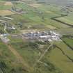
On-line Digital Images | DP 090812 | General oblique aerial view of Chapel Cross nuclear power station and the remains of Annan airfield, taken from the WSW. | 6/7/2010 | Item Level |
 |
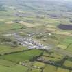
On-line Digital Images | DP 090813 | General oblique aerial view of Chapel Cross nuclear power station and the remains of Annan airfield, taken from the S. | 6/7/2010 | Item Level |

© Historic Environment Scotland. Scottish Charity No. SC045925