Sortie 2010/26
551 178/3/26
Description Sortie 2010/26
Collection RCAHMS Aerial Photography Digital
Catalogue Number 551 178/3/26
Category All Other
Permalink http://canmore.org.uk/collection/1237038
Description Sortie 2010/26
Collection RCAHMS Aerial Photography Digital
Catalogue Number 551 178/3/26
Category All Other
Permalink http://canmore.org.uk/collection/1237038
Collection Level (551 178) RCAHMS Aerial Photography Digital
> Sub-Group Level (551 178/3) 2010 Photographs
>> Sub-Group Level (551 178/3/26) Sortie 2010/26
| Preview | Category | Catalogue Number | Title | Date | Level |
|---|---|---|---|---|---|
| Digital Files (Non-image) | TM 000940 | GPS recorded flight path and map for Sortie 2010/26 | 29/6/2010 | Item Level | |
 |
On-line Digital Images | DP 090163 | General oblique aerial view looking across the M9 towards Bonnytoun House and Sun Microsystems, taken from the NW. | 29/6/2010 | Item Level |
 |
On-line Digital Images | DP 090164 | Oblique aerial view of the cropamrks of the possible coal pits and other pits, taken from the ENE. | 29/6/2010 | Item Level |
 |
On-line Digital Images | DP 090165 | Oblique aerial view of the cropamrks of the possible coal pits and other pits, taken from the NE. | 29/6/2010 | Item Level |
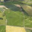 |
On-line Digital Images | DP 090166 | Oblique aerial view of the cropmarks of the rig and furrow and pits with Plean Tower in the background, taken from the NNE. | 29/6/2010 | Item Level |
 |
On-line Digital Images | DP 090167 | Oblique aerial view of the cropmarks of the rig and furrow and pits, taken from the NNE. | 29/6/2010 | Item Level |
 |
On-line Digital Images | DP 090168 | Oblique aerial view of the cropmarks of the rig and furrow and pits, taken from the NE. | 29/6/2010 | Item Level |
 |
On-line Digital Images | DP 090169 | Oblique aerial view of the cropmarks of the pits, taken from the NNE. | 29/6/2010 | Item Level |
 |
On-line Digital Images | DP 090170 | Oblique aerial view of the parchmarks of the rig and furrow, taken from the NNE. | 29/6/2010 | Item Level |
 |
On-line Digital Images | DP 090171 | Oblique aerial view of the roofless shells of the buildings of Dalnahsaig and the meander in the River Add, taken from the N. | 29/6/2010 | Item Level |
 |
On-line Digital Images | DP 090172 | Oblique aerial view of the grassmarks of the enclosure and possible barrows with the farmstead of Killinochonoch adjacent, taken from the ESE. | 29/6/2010 | Item Level |
 |
On-line Digital Images | DP 090173 | Oblique aerial view of the grassmarks of the enclosure and possible barrows, taken from the NNE. | 29/6/2010 | Item Level |
 |
On-line Digital Images | DP 090174 | General oblique aerial view looking across Crinan village along the Crinan canal, taken from the NW. | 29/6/2010 | Item Level |
 |
On-line Digital Images | DP 090175 | General oblique aerial view looking across Crinan village along the Crinan canal, taken from the NW. | 29/6/2010 | Item Level |
 |
On-line Digital Images | DP 090176 | Oblique aerial view of the grassmarks of the possible barrow at Cnocbreac, Jura, taken from the NW. | 29/6/2010 | Item Level |
 |
On-line Digital Images | DP 090177 | Oblique aerial view of the grassmarks of the possible barrow at Cnocbreac, Jura, taken from the NW. | 29/6/2010 | Item Level |
 |
On-line Digital Images | DP 090180 | Oblique aerial view of Inver Cottage, Jura, looking across Whitefarland Bay, taken from the WNW. | 29/6/2010 | Item Level |
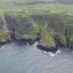 |
On-line Digital Images | DP 090181 | Oblique aerial view of Beinn a'Chaisteal and Alt nan Ba on Islay, taken from the NNW. | 29/6/2010 | Item Level |
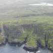 |
On-line Digital Images | DP 090182 | Oblique aerial view of Beinn a'Chaisteal and Alt nan Ba on Islay, taken from the NNW. | 29/6/2010 | Item Level |
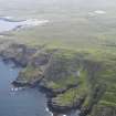 |
On-line Digital Images | DP 090183 | Oblique aerial view of Beinn a'Chaisteal and Alt nan Ba on Islay, taken from the WNW. | 29/6/2010 | Item Level |
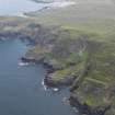 |
On-line Digital Images | DP 090184 | Oblique aerial view of Beinn a'Chaisteal and Alt nan Ba on Islay, taken from the NNW. | 29/6/2010 | Item Level |
 |
On-line Digital Images | DP 090185 | Oblique aerial view of the remains of the field system and rig and furrow, taken from the W. | 29/6/2010 | Item Level |

© Historic Environment Scotland. Scottish Charity No. SC045925