| Preview |
Category |
Catalogue Number |
Title |
Date |
Level |
 |
On-line Digital Images |
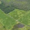
DP 082446 |
Oblique aerial view of the cropmarks of the pits and field boundaries, taken from the NE. |
21/6/2010 |
Item Level |
 |
On-line Digital Images |
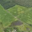
DP 082447 |
Oblique aerial view of the cropmarks of the pits and field boundaries, taken from the NNE. |
21/6/2010 |
Item Level |
 |
On-line Digital Images |
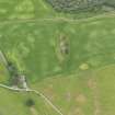
DP 082448 |
Oblique aerial view of the cropmarks of the pits and field boundaries, taken from the N. |
21/6/2010 |
Item Level |
 |
On-line Digital Images |
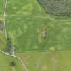
DP 082449 |
Oblique aerial view of the cropmarks of the pits and field boundaries, taken from the NNW. |
21/6/2010 |
Item Level |
 |
On-line Digital Images |
DP 082450 |
Oblique aerial view of the cropmarks of the pits with Brommhill farmhouse adjacent, taken from the WSW. |
21/6/2010 |
Item Level |
 |
On-line Digital Images |
DP 082451 |
Oblique aerial view of the cropmarks of the pits with Brommhill farmhouse adjacent, taken from the SW. |
21/6/2010 |
Item Level |
 |
On-line Digital Images |
DP 082452 |
Oblique aerial view of the cropmarks of the pits, taken from the SSW. |
21/6/2010 |
Item Level |
 |
On-line Digital Images |
DP 082453 |
Oblique aerial view of the cropmarks of the pits and ditches, taken from the ESE. |
21/6/2010 |
Item Level |
 |
On-line Digital Images |
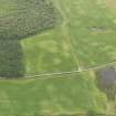
DP 082454 |
Oblique aerial view of the cropmarks of the pits and field boundaries, taken from the E. |
21/6/2010 |
Item Level |
 |
On-line Digital Images |
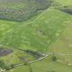
DP 082455 |
Oblique aerial view of the cropmarks of the pits and field boundaries, taken from the NE. |
21/6/2010 |
Item Level |
 |
On-line Digital Images |
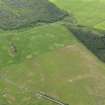
DP 082456 |
Oblique aerial view of the cropmarks of the pits and field boundaries, taken from the NNW. |
21/6/2010 |
Item Level |
 |
On-line Digital Images |
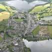
DP 082457 |
General oblique aerial view of Lochmaben with the Mill Loch in the foreground and the Castle Loch beyond, taken from the NNW. |
21/6/2010 |
Item Level |
 |
On-line Digital Images |
DP 082458 |
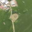
Oblique aerial view of Trailflat Church and burial ground, taken from the NNW. |
21/6/2010 |
Item Level |
 |
On-line Digital Images |
DP 082459 |
Oblique aerial view centred on the grassmarks of the Roman Temporary Camp at Lochrutton, taken from the SE. |
21/6/2010 |
Item Level |
 |
On-line Digital Images |
DP 082460 |
Oblique aerial view centred on the grassmarks of the Roman Temporary Camp at Lochrutton, taken from the ESE. |
21/6/2010 |
Item Level |
