Sortie 2010/19
551 178/3/19
Description Sortie 2010/19
Collection RCAHMS Aerial Photography Digital
Catalogue Number 551 178/3/19
Category All Other
Permalink http://canmore.org.uk/collection/1237031
Description Sortie 2010/19
Collection RCAHMS Aerial Photography Digital
Catalogue Number 551 178/3/19
Category All Other
Permalink http://canmore.org.uk/collection/1237031
Collection Level (551 178) RCAHMS Aerial Photography Digital
> Sub-Group Level (551 178/3) 2010 Photographs
>> Sub-Group Level (551 178/3/19) Sortie 2010/19
| Preview | Category | Catalogue Number | Title | Date | Level |
|---|---|---|---|---|---|
 |
On-line Digital Images | DP 081972 | General oblique aerial view of The Haa, Unst, looking SSE. | 15/6/2010 | Item Level |
 |
On-line Digital Images | DP 081973 | General oblique aerial view of Hevda and Rittenhamar at the north end of Unst, looking S. | 15/6/2010 | Item Level |
 |
On-line Digital Images | DP 081974 | Oblique aerial view of the northern part of the Saxa Vord radar station, looking SSE. | 15/6/2010 | Item Level |
 |
On-line Digital Images | DP 081975 | Oblique aerial view of the northern part of the Saxa Vord radar station, looking ENE. | 15/6/2010 | Item Level |
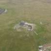 |
On-line Digital Images | DP 081976 | Oblique aerial view of the Saxa Vord radar station and the cairns, looking E. | 15/6/2010 | Item Level |
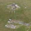 |
On-line Digital Images | DP 081978 | Oblique aerial view of the Saxa Vord radar station and the cairns, looking ENE. | 15/6/2010 | Item Level |
 |
On-line Digital Images | DP 081981 | Oblique aerial view of part of the Saxa Vord radar station and the cairns at Ward of Norwick, looking NE. | 15/6/2010 | Item Level |
 |
On-line Digital Images | DP 081983 | General oblique aerial view of Burrafirth with the Loch of Cliff beyond, looking SW. | 15/6/2010 | Item Level |
 |
On-line Digital Images | DP 081985 | Oblique aerial view of North Unst Lighthouse, Muckle Flugga, looking SSW. | 15/6/2010 | Item Level |
 |
On-line Digital Images | DP 081988 | Oblique aerial view of the gannetry at Neap on the NW coast of Unst, looking E. | 15/6/2010 | Item Level |
 |
On-line Digital Images | DP 081990 | Oblique aerial view of the farmsteads, enclosures and fields at Woodwick, Unst, looking ENE. | 15/6/2010 | Item Level |
 |
On-line Digital Images | DP 081992 | Oblique aerial view of the farmsteads, enclosures and fields at Southerhouse, Unst, looking NE. | 15/6/2010 | Item Level |
 |
On-line Digital Images | DP 081993 | Oblique aerial view of the farmsteads, enclosures and fields at Southerhouse and Collaster, Unst, looking N. | 15/6/2010 | Item Level |
 |
On-line Digital Images | DP 081994 | Oblique aerial view of the farmsteads, enclosures and fields at Scarpa and Collaster, Unst, looking W. | 15/6/2010 | Item Level |
 |
On-line Digital Images | DP 081995 | Oblique aerial view of the farmsteads, enclosures and fields at Scarpa and Collaster, Unst, looking WSW. | 15/6/2010 | Item Level |
 |
On-line Digital Images | DP 081996 | Oblique aerial view of the farmsteads, enclosures and fields at Westing, Unst, looking SE. | 15/6/2010 | Item Level |
 |
On-line Digital Images | DP 081997 | Oblique aerial view of the farmstead at Quoy, Unst, looking SE. | 15/6/2010 | Item Level |
 |
On-line Digital Images | DP 081998 | Oblique aerial view of the farmstead at Quoy, Unst, looking E. | 15/6/2010 | Item Level |
 |
On-line Digital Images | DP 081999 | Oblique aerial view of the buildings and fields at Westing, Unst, looking ESE. | 15/6/2010 | Item Level |
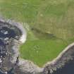 |
On-line Digital Images | DP 082000 | Oblique aerial view of Kirkaby Church, Unst, looking E. | 15/6/2010 | Item Level |
 |
On-line Digital Images | DP 082001 | Oblique aerial view of the farmsteads and field systems and the Gossa Water, looking NE. | 15/6/2010 | Item Level |
 |
On-line Digital Images | DP 081938 | Oblique aerial view of the remains of Clibberswick and the field systems, looking SSW. | 15/6/2010 | Item Level |
 |
On-line Digital Images | DP 081959 | Oblique aerial view of The Taing and Norwick, looking NW. | 15/6/2010 | Item Level |
 |
On-line Digital Images | DP 082014 | Oblique aerial view of the Broch of Underhoull and the field systems, looking SSW. | 15/6/2010 | Item Level |

© Historic Environment Scotland. Scottish Charity No. SC045925