Sortie 2011/15
551 178/1/15
Description Sortie 2011/15
Collection RCAHMS Aerial Photography Digital
Catalogue Number 551 178/1/15
Category All Other
Permalink http://canmore.org.uk/collection/1236934
Description Sortie 2011/15
Collection RCAHMS Aerial Photography Digital
Catalogue Number 551 178/1/15
Category All Other
Permalink http://canmore.org.uk/collection/1236934
Collection Level (551 178) RCAHMS Aerial Photography Digital
> Sub-Group Level (551 178/1) 2011 Photographs
>> Sub-Group Level (551 178/1/15) Sortie 2011/15
| Preview | Category | Catalogue Number | Title | Date | Level |
|---|---|---|---|---|---|
| Digital Files (Non-image) | TM 000895 | GPS recorded flight path and map for Sortie 2011/15 | 3/5/2011 | Item Level | |
 |
On-line Digital Images | DP 112380 | General oblique aerial view of Machrie Hotel with the golf course adjacent, taken from the N. | 3/5/2011 | Item Level |
 |
On-line Digital Images | DP 112393 | General oblique aerial view of the fort at Dun Athad, Islay, taken from the S. | 3/5/2011 | Item Level |
 |
On-line Digital Images | DP 112317 | General oblique aerial view of the whirlpool at Gulf of Corryvreckan, taken from the NNE. | 3/5/2011 | Item Level |
 |
On-line Digital Images | DP 112318 | General oblique aerial view of the whirlpool at Gulf of Corryvreckan, taken from the NNE. | 3/5/2011 | Item Level |
 |
On-line Digital Images | DP 112364 | General oblique aerial view of the soilmarks ofthe enclosure at Newton, Islay, taken from the SE. | 3/5/2011 | Item Level |
 |
On-line Digital Images | DP 112382 | General oblique aerial view of the remains of the field systems and farmsteads at Sruthan Poll Nan Gamhna, Islay, taken from the ESE. | 3/5/2011 | Item Level |
 |
On-line Digital Images | DP 112319 | General oblique aerial view of whirlpool at Gulf of Corryvreckan, taken from the NNE. | 3/5/2011 | Item Level |
 |
On-line Digital Images | DP 112348 | General oblique aerial view of the crannog on Loch Laingeadail, taken from the ESE. | 3/5/2011 | Item Level |
 |
On-line Digital Images | DP 112349 | General oblique aerial view of the crannog on Loch Laingeadail, taken from the NNW. | 3/5/2011 | Item Level |
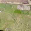 |
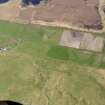
On-line Digital Images | DP 112350 | General oblique aerial view centred on the remains of the farmstead, field boundaries and rig at Toranore, taken from the NNW. | 3/5/2011 | Item Level |
 |
On-line Digital Images | DP 112351 | General oblique aerial view centred on the remains of the farmstead, field boundaries and rig at Toranore, taken from the NW. | 3/5/2011 | Item Level |
 |
On-line Digital Images | DP 112361 | General oblique aerial view of chapel and burial ground at Nereabolls, Islay, taken from the SE. | 3/5/2011 | Item Level |
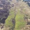 |
On-line Digital Images | DP 112383 | General oblique aerial view of the remains of the field systems and farmsteads at Sruthan Poll Nan Gamhna, Islay, taken from the ESE. | 3/5/2011 | Item Level |
 |
On-line Digital Images | DP 112321 | General oblique aerial view of Lagg Harbour, Jura, taken from the ESE. | 3/5/2011 | Item Level |
 |
On-line Digital Images | DP 112352 | General oblique aerial view of Coull Farm, Islay, taken from the NW. | 3/5/2011 | Item Level |
 |
On-line Digital Images | DP 112353 | General oblique aerial view of Coull Farm and Machir Bay, Islay, taken from the NW. | 3/5/2011 | Item Level |
 |
On-line Digital Images | DP 112322 | General oblique aerial view of Lagg, Jura, taken from the NE. | 3/5/2011 | Item Level |
 |
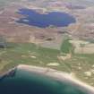
On-line Digital Images | DP 112323 | General oblique aerial view of the field system at Goirtean Fada, Jura, taken from the NW. | 3/5/2011 | Item Level |
 |
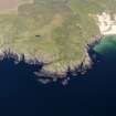
On-line Digital Images | DP 112354 | General oblique aerial view of Machir Bay and Loch Gorm, taken from the SW. | 3/5/2011 | Item Level |
 |
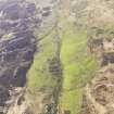
On-line Digital Images | DP 112355 | General oblique aerial view of fort at Dun Na Faing, Lossit Point, Islay, taken from the WSW. | 3/5/2011 | Item Level |
 |
On-line Digital Images | DP 112384 | General oblique aerial view of the remains of the field systems and famsteads at Sruthan Poll Nan Gamhna, Islay, taken from the ESE. | 3/5/2011 | Item Level |
 |
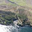
On-line Digital Images | DP 112324 | General oblique aerial view of field system at Goirtean Fada, Jura, taken from the WNW. | 3/5/2011 | Item Level |
 |
On-line Digital Images | DP 112325 | General oblique aerial view of Port Askaig, Islay, with the ferry at the jetty, taken from the ENE. | 3/5/2011 | Item Level |

© Historic Environment Scotland. Scottish Charity No. SC045925