551 178/1/10
Description Sortie 2011/10
Collection RCAHMS Aerial Photography Digital
Catalogue Number 551 178/1/10
Category All Other
Permalink http://canmore.org.uk/collection/1236924
Collection Hierarchy - Sub-Group Level
Collection Level (551 178) RCAHMS Aerial Photography Digital
> Sub-Group Level (551 178/1) 2011 Photographs
>> Sub-Group Level (551 178/1/10) Sortie 2011/10
| Preview | Category | Catalogue Number | Title | Date | Level |
|---|---|---|---|---|---|
| Digital Files (Non-image) | TM 000892 | GPS recorded flight path and map for Sortie 2011/10 | 1/5/2011 | Item Level | |
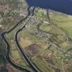 |
On-line Digital Images | DP 111927 | General oblique aerial view of the Caledonian Canal and remains of the military road, field systems and hut circles at Fort Augustus golf course, taken from the SW. | 1/5/2011 | Item Level |
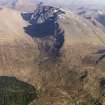 |
On-line Digital Images | DP 111939 | General oblique aerial view of Allt a Mhuillin and Ben Nevis, taken from the NW. | 1/5/2011 | Item Level |
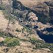 |
On-line Digital Images | DP 111847 | General oblique aerial view of the Glenfinnan Viaduct and Monument, taken from the NW. | 1/5/2011 | Item Level |
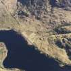 |
On-line Digital Images | DP 111849 | Oblique aerial view of the remains of Essan farmstead on the S side of Loch Eilt, taken from the NNW. | 1/5/2011 | Item Level |
 |
On-line Digital Images | DP 111845 | General oblique aerial view of Fassfern House and the remains of the fish trap, taken from the NNE. | 1/5/2011 | Item Level |
 |
On-line Digital Images | DP 111850 | General oblique aerial view of the remains of field systems and lazy beds at Rudha nam Fasaichean on the S side of Loch Morar, taken from the NNE. | 1/5/2011 | Item Level |
 |
On-line Digital Images | DP 111846 | General oblique aerial view of Fassfern House and the remains of the fish trap, taken from the NNW. | 1/5/2011 | Item Level |
 |
On-line Digital Images | DP 111848 | Oblique aerial view of the remains of Essan farmstead on the S side of Loch Eilt, taken from the N. | 1/5/2011 | Item Level |
 |
On-line Digital Images | DP 111853 | General oblique aerial view of the remains of a sheep fold, field boundaries and lazy beds at Rubha Nam Fasaichean, on the S side of Loch Morar, taken from the SE. | 1/5/2011 | Item Level |
 |
On-line Digital Images | DP 111854 | General oblique aerial view of the remains of a sheep fold, field boundaries and lazy beds at Rubha Nam Fasaichean and Lettermorar on the S side of Loch Morar, taken from the SE. | 1/5/2011 | Item Level |
 |
On-line Digital Images | DP 111851 | General oblique aerial view of the remains of field boundaries and lazy beds at Rubh' Aird Cumnaich, on the S side of Loch Morar, taken from the N. | 1/5/2011 | Item Level |
 |
On-line Digital Images | DP 111852 | General oblique aerial view of the remains of a sheep fold, field boundaries and lazy beds at Lettermorar on the S side of Loch Morar, taken from the S. | 1/5/2011 | Item Level |
 |
On-line Digital Images | DP 111867 | Oblique aerial view of the remains of a fishtrap, township, field system and head dyke at Niag Ard, near Inverguseran on the Knoydart Peninsula, taken from the SSW. | 1/5/2011 | Item Level |
 |
On-line Digital Images | DP 111870 | Oblique aerial view of the remains of a fish trap at Eilean Choinnich near Camas Liathach on the S side of Loch Hourn, taken from the SW. | 1/5/2011 | Item Level |
 |
On-line Digital Images | DP 111875 | Oblique aerial view of the remains of Skiary township and head dyke, on the S side of Loch Hourn, taken from the N. | 1/5/2011 | Item Level |
 |
On-line Digital Images | DP 111902 | General oblique aerial view of the Five Sisters of Kintail, centred on NG 9782 1668, taken from the NNW. | 1/5/2011 | Item Level |
 |
On-line Digital Images | DP 111903 | General oblique aerial view of the Five Sisters of Kintail, centred on NG 9782 1668, taken from the NNW. | 1/5/2011 | Item Level |
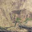 |
On-line Digital Images | DP 111906 | Oblique aerial view of the remains of the breastworks at the site of the Battle of Glen Shiel, taken from the SW. | 1/5/2011 | Item Level |
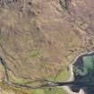 |
On-line Digital Images | DP 111863 | Oblique aerial view of the remains of a fish trap, township, field system and head dyke at Niag Ard, near Inverguseran on the Knoydart Peninsula, taken from the N. | 1/5/2011 | Item Level |
 |
On-line Digital Images | DP 111871 | Oblique aerial view of the remains of a fish trap at Eilean Choinnich near Camas Liathach on the S side of Loch Hourn, taken from the SSW. | 1/5/2011 | Item Level |
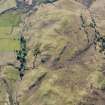 |
On-line Digital Images | DP 111884 | General oblique aerial view of the remains of Am Baghan Burblach fort and the old military road in Glen More, E of Glenelg, taken from the ENE. | 1/5/2011 | Item Level |
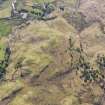 |
On-line Digital Images | DP 111885 | General oblique aerial view of the remains of Am Baghan Burblach fort and the old military road in Glen More, E of Glenelg, taken from the ENE. | 1/5/2011 | Item Level |
 |
On-line Digital Images | DP 111886 | General oblique aerial view of the remains of Am Baghan Galldair and Caisteal Mhicleod Duns in Glen More, E of Glenelg, taken from the NNE. | 1/5/2011 | Item Level |


