551 178/1/8
Description Sortie 2011/08
Collection RCAHMS Aerial Photography Digital
Catalogue Number 551 178/1/8
Category All Other
Permalink http://canmore.org.uk/collection/1236921
Collection Hierarchy - Sub-Group Level
Collection Level (551 178) RCAHMS Aerial Photography Digital
> Sub-Group Level (551 178/1) 2011 Photographs
>> Sub-Group Level (551 178/1/8) Sortie 2011/08
| Preview | Category | Catalogue Number | Title | Date | Level |
|---|---|---|---|---|---|
| Digital Files (Non-image) | TM 000890 | GPS recorded flight path and map for Sortie 2011/08 | 30/4/2011 | Item Level | |
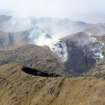 |
On-line Digital Images | DP 109255 | General oblique aerial view of the wild fire looking over Sgurr Ghuibhsachain towards the eastern flank of Beinn Odhar Bheag, taken from the SE. | 30/4/2011 | Item Level |
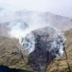 |
On-line Digital Images | DP 109256 | General oblique aerial view of the wild fire on the eastern flank of Beinn Odhar Bheag, taken from the SE. | 30/4/2011 | Item Level |
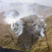 |
On-line Digital Images | DP 109257 | General oblique aerial view of the wild fire on the eastern flank of Beinn Odhar Bheag with Loch Shiel in the foreground, taken from the SE. | 30/4/2011 | Item Level |
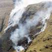 |
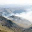
On-line Digital Images | DP 109258 | Oblique aerial view of the wild fire on the eastern flank of Beinn Odhar Bheag, taken from the E. | 30/4/2011 | Item Level |
 |
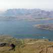
On-line Digital Images | DP 109259 | General oblique aerial view of the wild fire on the eastern flank of Beinn Odhar Bheag, taken from the NE. | 30/4/2011 | Item Level |
 |
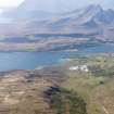
On-line Digital Images | DP 109260 | General oblique aerial view of the township of Ord, looking across Loch Eishort to the remains of the township of Suisnish and further across Loch Slappin to Kilmarie, Strathaird and Blabheinn, Skye, taken from the ESE. | 30/4/2011 | Item Level |
 |
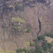
On-line Digital Images | DP 109261 | General oblique aerial view of the remains of the township of Kilbride, the marble quarry and township at Torrin and beyond to Strathaird and Blabheinn, Strath Suardal, Skye, taken from the E. | 30/4/2011 | Item Level |
 |
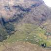
On-line Digital Images | DP 109262 | Oblique aerial view of the remains of the townships of Kilchrist and Strath Suardal, showing the remains of nearby enclosures, head dykes, rig and furrow and the remains of a disused marble quarry, Strath Suardal, Skye, taken from the N. | 30/4/2011 | Item Level |
 |
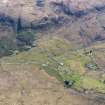
On-line Digital Images | DP 109263 | Oblique aerial view of the remains of the township, field system and cultivation remains at Kilbride, also showing the location of High Pasture Cave, Strath Suardal, Skye, taken from the NNE. | 30/4/2011 | Item Level |
 |
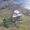
On-line Digital Images | DP 109264 | Oblique aerial view of the remains of the township of Kilbride and the nearby field system and cultivation remains, also showing the location of High Pasture Cave, Strath Suardal, Skye, taken from the N. | 30/4/2011 | Item Level |
 |
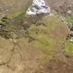
On-line Digital Images | DP 109265 | Oblique aerial view of the Cnoc Dubh marble quarry at Torrin, also showing the nearby remains of field systems, head dykes and lazy beds at Torrin and Kilbride, Skye, taken from the NNE. | 30/4/2011 | Item Level |
 |
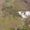
On-line Digital Images | DP 109266 | Oblique aerial view of the Cnoc Dubh marble quarry at Torrin, also showing the nearby remains of field systems, head dykes and lazy beds at Torrin and Kilbride, Skye, taken from the N. | 30/4/2011 | Item Level |
 |
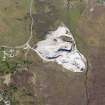
On-line Digital Images | DP 109267 | Oblique aerial view of the Cnoc Dubh marble quarry at Torrin, also showing the nearby remains of field systems, head dykes and lazy beds at Torrin and Kilbride, Skye, taken from the NW. | 30/4/2011 | Item Level |
 |
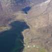
On-line Digital Images | DP 109268 | Oblique aerial view of the Cnoc Dubh marble quarry at Torrin, also showing the nearby remains of field systems and lazy beds at Torrin, Skye, taken from the SW. | 30/4/2011 | Item Level |
 |
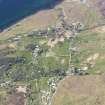
On-line Digital Images | DP 109270 | General oblique aerial view of the remains of fish traps at the head of Loch Slapin, Skye, taken from the SSW. | 30/4/2011 | Item Level |
 |
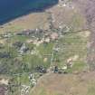
On-line Digital Images | DP 109271 | Oblique aerial view of the township of Torrin and the nearby remains of a field system, head dykes and cultivation remains, Skye, taken from the SE. | 30/4/2011 | Item Level |
 |
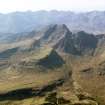
On-line Digital Images | DP 109273 | Oblique aerial view of the township of Torrin and the nearby remains of a field system, head dykes and cultivation remains, Skye, taken from the SE. | 30/4/2011 | Item Level |
 |
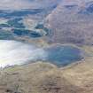
On-line Digital Images | DP 109274 | General oblique aerial view of An Stac, Blabheinn and the Cuillin Hills on Skye, taken from the W. | 30/4/2011 | Item Level |
 |
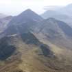
On-line Digital Images | DP 109275 | General oblique aerial view of the remains of fish traps at the head of Loch Slapin, Skye, taken from the W. | 30/4/2011 | Item Level |
 |
On-line Digital Images | DP 109276 | General oblique aerial view of Glas Bheinn Mhor, Belig and Blabheinn on Skye, taken from the NNE. | 30/4/2011 | Item Level |
 |
On-line Digital Images | DP 109277 | Oblique aerial view of the township of Sconser and the nearby remains of a field system, head dykes and lazy beds, Skye, taken from the N. | 30/4/2011 | Item Level |
 |
On-line Digital Images | DP 109278 | Oblique aerial view of the remains of a possible fish trap at Corran Glas on the NW shore of Loch Sligachan, opposite Sconser, Skye, taken from the NNW. | 30/4/2011 | Item Level |
 |
On-line Digital Images | DP 109279 | Oblique aerial view of the remains of a possible fish trap at Corran Glas on the NW shore of Loch Sligachan, with the township of Sconser and its associated field system opposite, Skye, taken from the NNW. | 30/4/2011 | Item Level |


